Related Research Articles
Spuzzum is an unincorporated settlement in British Columbia, Canada. Because it is on the Trans-Canada Highway, approximately 50 kilometres (31 mi) north of the community of Hope, it is often referred to as being "beyond dope". Spuzzum was immortalized in the early 1980s by the band "Six Cylinder" in a song with the refrain "If you haven't been to Spuzzum, you ain't been anywhere."
Boundary Creek Provincial Park is a provincial park in British Columbia, Canada located south of Greenwood BC in that province's Boundary Country, adjacent to BC Highway 3. The eponymous Boundary Creek flows through the park.

Cathedral Provincial Park and Protected Area, usually known as Cathedral Provincial Park and also as Cathedral Park, is a provincial park in British Columbia, Canada. It is located east of E.C. Manning Provincial Park, south of BC Highway 3, and southeast of the town of Princeton and southwest of Keremeos. Its southern boundary is the border with the United States. Much of the park is the basin of the Ashnola River.
Jewel Lake Provincial Park is a provincial park in British Columbia, Canada, located at the northeast end of Jewel Lake, which lies north of Greenwood and northwest of Grand Forks in that province's Boundary Country.
Shuswap Lake Marine Provincial Park is an 896-hectare provincial park in British Columbia, Canada, comprising 991 ha. The Park has a variety of amenities including boat launch ramps, picnic areas, and 27 campsites around the perimeter of Shuswap Lake. The lake's name and that of the surrounding Shuswap Country is from the Shuswap people (Secwepemc), the most northern of the Salishan speaking people.

Greenwood is a city in south central British Columbia. It was incorporated in 1897 and was formerly one of the principal cities of the Boundary Country smelting and mining district. It was incorporated as a city originally and has retained that title despite the population decline following the closure of the area's industries.
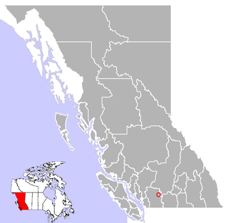
The Rock Creek Gold Rush was a gold rush in the Boundary Country region of the Colony of British Columbia. The rush was touched off in 1859 when two US soldiers were driven across the border to escape pursuing Indians and chanced on gold only three miles into British territory, on the banks of the Kettle River where it is met by Rock Creek, and both streams turn east to where in times since developed the city of Grand Forks. The first claim was filed by an Adam Beam in 1860, and the rush was on, composed mostly of Americans and some Chinese, all of whom had come overland from other workings, either at Colville or Oregon or all the way from California.

The Kettle River Range, often called the Kettle Range, is the southernmost range of the Monashee Mountains, located in far southeastern British Columbia, Canada and Ferry County, Washington, in the United States. Most of the northern half of the range is protected by the Colville National Forest and the southern half of the range is located on the Colville Indian Reservation. The highest peak is Copper Butte, which reaches 2,177 metres (7,142 ft). The range is crossed by Washington State Route 20 at Sherman Pass.
The Wild Horse River, formerly known as Wild Horse Creek, is a tributary of the Kootenay River, joining it near the town of Fort Steele, British Columbia, Canada. The river's canyon was the setting for the Wild Horse Creek Gold Rush and associated "war" during the gold rush of the mid-1860s.

Fort Pelly was a Hudson's Bay Company fur trading post located in the Canadian province of Saskatchewan. The fort was named after Sir John Pelly, governor of the Hudson's Bay Company. The current village of Pelly, Saskatchewan, takes its name from the fort, and is located approximately 8 miles north of the site of the fort.

The Ashnola River is a tributary of the Similkameen River, rising in the northeastern part of the North Cascades in Washington, United States, and flowing north into British Columbia, Canada, to join the Similkameen River about halfway along that river's course between the towns of Princeton and Keremeos. The river crosses the international boundary at 49°00′00″N120°19′37″W and transits Cathedral Provincial Park. It has one main tributary, Ewart Creek, which is about 25 kilometres (16 mi) long and begins virtually at the border and is entirely within Cathedral Park.
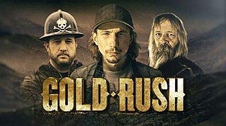
Gold Rush is a reality television series that airs on Discovery and its affiliates worldwide. The series follows the placer gold mining efforts of various family-run mining companies, mostly in the Klondike region of Dawson City, Yukon, Canada. In its 10th season as of early 2020, prior seasons also included mining efforts in South America and western North America.
CKGF-2-FM is a Canadian radio station that broadcasts an English language commercial FM radio active rock format at 102.3 MHz (FM) in Grand Forks, British Columbia. The station is currently owned by Vista Broadcast Group.
Boundary Creek is a creek located in the Boundary Country region of British Columbia. The creek is a tributary of the Kettle River. Boundary Creek flows into the Kettle River from the northeast and was the first creek found to be gold bearing in the Boundary Country. It was discovered in 1859 by American prospectors. Boundary Creek was heavily mined in the first decade after its discovery. It has been mined by many since then including Chinese miners. Gold nuggets worth $50 have been recovered from Boundary Creek.
July Creek is a creek which is located in the Boundary Country region of British Columbia. The creek is west of Grand Forks and flows into the Kettle River. It was discovered around 1860. The creek was panned for gold.
Jolly Creek is a creek located in the Boundary Country region of British Columbia. The creek is south of Conkle Lake. Jolly Creek flows into Rock Creek. It was discovered in 1860 and has been mined for gold. The Creek was named after local prospector Jolly Jack Thornton.
May Creek is a creek located in the Boundary Country of British Columbia. The creek is a tributary of July Creek. May Creek flows into July Creek about five miles west of Grand Forks, British Columbia. The creek has been mined for gold.
McKinney Creek is located in the Boundary Country region of British Columbia. The creek is one of the main tributaries of Rock Creek. McKinney Creek flows into Rock Creek from the west. The creek has been mined by Europeans and Chinese miners.
Pass Creek is a creek located in the Boundary Country region of British Columbia. This creek flows into the Granby River 11 miles north of Grand Forks, British Columbia. Pass Creek has been mined for gold.

Jolly Jack's Lost Mine is a legend about a hidden placer mine supposed to be located in the Boundary Country of British Columbia. The mine has been written about by local historians and various magazines. Many have searched for the lost placer mine of Jolly Jack. It is a local legend in the Boundary Country.
References
- ↑ N.L. Barlee (1973), Gold Creeks and Ghost Towns. Canada West Publications.