Merseyside is a metropolitan and ceremonial county in North West England. It borders Lancashire to the north, Greater Manchester to the east, Cheshire to the south, the Welsh county of Flintshire across the Dee Estuary to the southwest, and the Irish Sea to the west. The largest settlement is Liverpool.

Birkenhead is a town in the Metropolitan Borough of Wirral, Merseyside, England; historically, it was part of Cheshire until 1974. The town is on the Wirral Peninsula, along the south bank of the River Mersey, opposite Liverpool. At the 2011 census, it had a population of 88,818.

Bebington is a town and unparished area within the Metropolitan Borough of Wirral, in Merseyside, England. Historically part of Cheshire, it lies 5 miles (8 km) south of Liverpool, close to the River Mersey on the eastern side of the Wirral Peninsula. Nearby towns include Birkenhead and Wallasey to the north-northwest, and Heswall to the west-southwest. Bebington railway station opened in 1838 and is situated on the Wirral line of the Merseyrail network.

Bidston is a village and civil parish in the Metropolitan Borough of Wirral in Merseyside, England.

New Ferry is an urban area on the Metropolitan Borough of Wirral, Merseyside, England. It is located on the Wirral Peninsula, with the River Mersey to the east and the town of Bebington to the west. Within the boundaries of the historic county of Cheshire, the area was developed from the early nineteenth century.

Oxton is a suburb of Birkenhead, Merseyside, England. Administratively it is a ward of the Metropolitan Borough of Wirral. Originally a village in its own right, it became part of the Municipal Borough of Birkenhead upon its creation in 1877. Before local government reorganisation on 1 April 1974, it was part of the County Borough of Birkenhead, within the county of Cheshire.

Tranmere is a suburb of Birkenhead, on the Wirral Peninsula, England. Administratively, it is within the Birkenhead and Tranmere Ward of the Metropolitan Borough of Wirral, in Merseyside. Before local government reorganisation on 1 April 1974, it was part of the County Borough of Birkenhead, within the geographical county of Cheshire.

Wallasey is a town in the Metropolitan Borough of Wirral, Merseyside, England. Within the boundaries of the historic county of Cheshire, it is at the mouth of the River Mersey, on the north-eastern corner of the Wirral Peninsula. At the 2011 Census, the population was 60,284.

New Brighton is a seaside resort and suburb of Wallasey, in the Metropolitan Borough of Wirral in Merseyside, England, at the northeastern tip of the Wirral peninsula. It has sandy beaches which line the Irish Sea and mouth of the Mersey, and the UK's longest promenade.

The Wirral Peninsula, known locally as The Wirral, is a peninsula in North West England. The roughly rectangular peninsula is about 15 miles (24 km) long and 7 miles (11 km) wide, and is bounded by the Dee Estuary to the west, the Mersey Estuary to the east, and Liverpool Bay to the north.
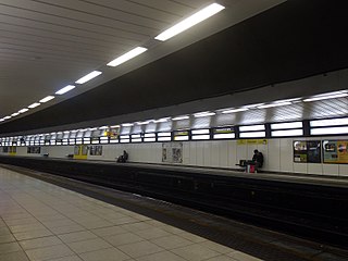
Birkenhead Hamilton Square railway station serves the town of Birkenhead, in Merseyside, England, on the Wirral Line of the Merseyrail network. The station is close to Hamilton Square in Birkenhead.

Birkenhead Woodside was a railway station at Woodside, in Birkenhead, on the Wirral Peninsula, Cheshire. It was served by local services in Cheshire as well as long-distance services to southern England, including London.

Woodside is an area of Birkenhead in the Metropolitan Borough of Wirral in Merseyside, England. It is situated opposite Liverpool Pier Head across the River Mersey.

Rock Ferry is an area of Birkenhead on the Wirral Peninsula, England. Administratively it is a ward of the Metropolitan Borough of Wirral. Before local government reorganisation on 1 April 1974, it was part of the county of Cheshire. At the 2011 Census, the population was 14,298.
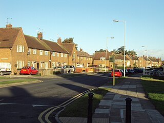
Woodchurch is an area of Birkenhead on the Wirral Peninsula, in England. Administratively, Woodchurch is within the Metropolitan Borough of Wirral, its parliamentary constituency is Wirral West, and its local council ward is Upton. At the 2001 Census, it had a population of 8,400. Woodchurch is dominated by a large housing development, known as the Woodchurch Estate. The district is served by several schools and has the major Arrowe Park Hospital just outside its boundary, which was built on 15 acres (61,000 m2) of the park itself and opened in 1982.

Wirral Waters is a large scale £4.5bn development currently being built by the Peel Group for Birkenhead, on the Wirral Peninsula, England. It is the sister programme of the Liverpool Waters project. Since 2012 the two projects have enjoyed enterprise zone status, together forming the Mersey Waters Enterprise Zone.

Birkenhead Park School is a co-educational 11–16 secondary school with academy status near Birkenhead Park, in Birkenhead on the Wirral Peninsula in England. It was renamed University Academy Birkenhead in 2011 from the merger of Park High School and Rock Ferry High School and was based at the former Park High School site. It was a Grammar School from 1926 to 1971, then went Co Educational in 1971 and was then just called Park High School.

Wirral Met College is a Further and Higher Education College situated on the Wirral Peninsula, in the north-west of England.

Ridgeway High School is a co-educational, comprehensive school in Noctorum, Birkenhead, on the Wirral Peninsula in England. The school caters for pupils between the ages of 11 and 16, from within the Local Authority area of the Metropolitan Borough of Wirral, primarily Noctorum, Prenton, and Oxton.

The 2019 Wirral Metropolitan Borough Council election took place on 2 May 2019 to elect members of Wirral Metropolitan Borough Council in England. This election was held on the same day as other local elections.

