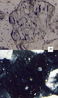
Rodriguez Seamount

Last updated
Rodriguez Seamount
Rodriguez seamount.jpg
A perspective bathymetric mapping of Rodriguez Seamount
Summit depth 650 m (2,133 ft) [1]
Height 1,675 m (5,495 ft) [1]
Summit area >205 km3 (49 cu mi) [1]
Location
Coordinates 34°01.20′N121°04.80′W / 34.02000°N 121.08000°W / 34.02000; -121.08000 Coordinates: 34°01.20′N121°04.80′W / 34.02000°N 121.08000°W / 34.02000; -121.08000 [2]
Country Central California, United States
Geology
Type Seamount (Guyot)
Age of rock 10–12 million years [1]

Rodriguez Seamount is a seamount and guyot located about 150 km (93 mi) off the coast of Central California. It is structurally similar to the nearby Guide, Pioneer, Gumdrop, and Davidson seamounts, all located roughly between 37.5° and 34.0° degrees of latitude. This group of seamounts is morphologically unique, and the mounts are very similar to one another. The seamount structures run parallel to an ancient spreading center which has since been replaced in its role by the San Andreas Fault system. [3]

Seamount A mountain rising from the ocean seafloor that does not reach to the waters surface

A seamount is a mountain rising from the ocean seafloor that does not reach to the water's surface, and thus is not an island, islet or cliff-rock. Seamounts are typically formed from extinct volcanoes that rise abruptly and are usually found rising from the seafloor to 1,000–4,000 m (3,300–13,100 ft) in height. They are defined by oceanographers as independent features that rise to at least 1,000 m (3,281 ft) above the seafloor, characteristically of conical form. The peaks are often found hundreds to thousands of meters below the surface, and are therefore considered to be within the deep sea. During their evolution over geologic time, the largest seamounts may reach the sea surface where wave action erodes the summit to form a flat surface. After they have subsided and sunk below the sea surface such flat-top seamounts are called "guyots" or "tablemounts"

Guyot An isolated over water volcanic mountain with a flat top

In marine geology, a guyot, also known as a tablemount, is an isolated underwater volcanic mountain (seamount) with a flat top more than 200 m (660 ft) below the surface of the sea. The diameters of these flat summits can exceed 10 km (6.2 mi). Guyots are most commonly found in the Pacific Ocean, but they have been identified in all the oceans except the Arctic Ocean.

Central California Place in California, United States

Central California is a subregion of Northern California, generally thought of as the middle third of the state, north of Southern California. It includes the northern portion of the San Joaquin Valley, the Central Coast, the central hills of the California Coast Ranges, and the foothills and mountain areas of the central Sierra Nevada.

Geology

Magnetic anomalies at Rodriguez indicate that it is located on a 19-million-year-old crustal surface. Rocks recovered from Rodriguez Seamount are largely composed of alkaline basalt and Hawaiite. Ar-Ar dating techniques indicate that the volcano is between 10 and 12 million years of age. [1]

Magnetism class of physical phenomena

Magnetism is a class of physical phenomena that are mediated by magnetic fields. Electric currents and the magnetic moments of elementary particles give rise to a magnetic field, which acts on other currents and magnetic moments. The most familiar effects occur in ferromagnetic materials, which are strongly attracted by magnetic fields and can be magnetized to become permanent magnets, producing magnetic fields themselves. Only a few substances are ferromagnetic; the most common ones are iron, nickel and cobalt and their alloys. The prefix ferro- refers to iron, because permanent magnetism was first observed in lodestone, a form of natural iron ore called magnetite, Fe3O4.

Basalt A magnesium- and iron-rich extrusive igneous rock

Basalt is a mafic extrusive igneous rock formed from the rapid cooling of magnesium-rich and iron-rich lava exposed at or very near the surface of a terrestrial planet or a moon. More than 90% of all volcanic rock on Earth is basalt. Basalt lava has a low viscosity, due to its low silica content, resulting in rapid lava flows that can spread over great areas before cooling and solidification. Flood basalt describes the formation in a series of lava basalt flows.

Hawaiite is an olivine basalt with a composition between alkali basalt and mugearite. It was first used as a name for some lavas found on the island of Hawaii.

Rodriguez Seamount rises about 1,675 m (5,495 ft) above the surrounding seafloor, to a minimum depth of 650 m (2,133 ft). Its calculated volume is greater than 205 km3 (49 cu mi); however this is likely an understatement because the survey did not include its lowermost slope. [1]

The slope is composed mostly of layered volcanic rock, mostly coarse sandstone, with a few scattered large lava boulders. They were likely formed from fragments of volcanic glass formed in the steam explosions of lava touching down against water, similar to the process that is happening today on Kilauea. This would have built a black sand beach over time; however, following millions of years of alterations, most of the sand has since been converted into clay. Small hills, constructed of jagged lava flows, are thought to have resulted from subaerial 'a'a flows. [4]

Volcanic rock rocks composing or associated with volcanoes, volcanic activity or volcanism

Volcanic rock is a rock formed from magma erupted from a volcano. In other words, it differs from other igneous rock by being of volcanic origin. Like all rock types, the concept of volcanic rock is artificial, and in nature volcanic rocks grade into hypabyssal and metamorphic rocks and constitute an important element of some sediments and sedimentary rocks. For these reasons, in geology, volcanics and shallow hypabyssal rocks are not always treated as distinct. In the context of Precambrian shield geology, the term "volcanic" is often applied to what are strictly metavolcanic rocks.

Sandstone A clastic sedimentary rock composed mostly of sand-sized particles

Sandstone is a clastic sedimentary rock composed mainly of sand-sized mineral particles or rock fragments.

Volcanic glass material

Volcanic glass is the amorphous (uncrystallized) product of rapidly cooling magma. Like all types of glass, it is a state of matter intermediate between the close-packed, highly ordered array of a crystal and the highly disordered array of gas. Volcanic glass can refer to the interstitial, or matrix, material in an aphanitic (fine grained) volcanic rock or can refer to any of several types of vitreous igneous rocks. Most commonly, it refers to obsidian, a rhyolitic glass with high silica (SiO2) content.

The northeast-trending ridges, which are common to the group that Rodriquez Seamount is in, are less distinct on Rodriguez than on the other seamounts in the group. In addition, the seamount is propagated by several large volcanic cones, the largest of which is 700 m (2,297 ft) tall and 2.2 km (1.4 mi) at the base, with a volume of about 2.6 km3 (1 cu mi). The lower flanks of the volcano have slumped and are covered in a thick layer of sediment, particularly the southwest flank. Another slump area to the west flank has blocky debris on it, suggesting that the base of the volcano has also started collapsing into itself. [1]

Rodriguez Seamount once extended above sea level, resulting in a flat, sediment-covered summit that is coated with beach sands of ancient origin. This flat top earns it the distinction of being a guyot. These sands have been colonized by, among others, sea cucumbers. [5]

Sea level Average level for the surface of the ocean at any given geographical position on the planetary surface

Mean sea level (MSL) is an average level of the surface of one or more of Earth's oceans from which heights such as elevation may be measured. MSL is a type of vertical datum – a standardised geodetic datum – that is used, for example, as a chart datum in cartography and marine navigation, or, in aviation, as the standard sea level at which atmospheric pressure is measured to calibrate altitude and, consequently, aircraft flight levels. A common and relatively straightforward mean sea-level standard is the midpoint between a mean low and mean high tide at a particular location.

Sea cucumber class of echinoderms

Sea cucumbers are echinoderms from the class Holothuroidea. They are marine animals with a leathery skin and an elongated body containing a single, branched gonad. Sea cucumbers are found on the sea floor worldwide. The number of holothurian species worldwide is about 1,717 with the greatest number being in the Asia Pacific region. Many of these are gathered for human consumption and some species are cultivated in aquaculture systems. The harvested product is variously referred to as trepang, namako, bêche-de-mer or balate. Sea cucumbers serve a useful role in the marine ecosystem as they help recycle nutrients, breaking down detritus and other organic matter after which bacteria can continue the degradation process.

An expedition in 2003 included Rodriguez Seamount as one of its destinations. Observations made during the expedition confirmed theories that the seamount had once been above sea level, and has since subsided about 750 m (2,461 ft) from its former height. A sandstone structure discovered at 650 m (2,133 ft) depth seems to hint at a former sand beach and shoreline. [4]

Related Research Articles

Shield volcano Low profile volcano usually formed almost entirely of fluid lava flows

A shield volcano is a type of volcano usually composed almost entirely of fluid lava flows. It is named for its low profile, resembling a warrior's shield lying on the ground. This is caused by the highly fluid lava erupted, which travels farther than lava erupted from a stratovolcano, and results in the steady accumulation of broad sheets of lava, building up the shield volcano's distinctive form.

Evolution of Hawaiian volcanoes Processes of growth and erosion of the volcanoes of the Hawaiian islands

The fifteen volcanoes that make up the eight principal islands of Hawaii are the youngest in a chain of more than 129 volcanoes that stretch 5,800 kilometres (3,600 mi) across the North Pacific Ocean, called the Hawaiian-Emperor seamount chain. Hawaiʻi's volcanoes rise an average of 4,572 metres (15,000 ft) to reach sea level from their base. The largest, Mauna Loa, is 4,169 metres (13,678 ft) high. As shield volcanoes, they are built by accumulated lava flows, growing a few meters/feet at a time to form a broad and gently sloping shape.
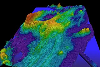
Axial Seamount A submarine volcano on the Juan de Fuca Ridge west of Oregon

Axial Seamount is a seamount and submarine volcano located on the Juan de Fuca Ridge, approximately 480 km (298 mi) west of Cannon Beach, Oregon. Standing 1,100 m (3,609 ft) high, Axial Seamount is the youngest volcano and current eruptive center of the Cobb–Eickelberg Seamount chain. Located at the center of both a geological hotspot and a mid-ocean ridge, the seamount is geologically complex, and its origins are still poorly understood. Axial Seamount is set on a long, low-lying plateau, with two large rift zones trending 50 km (31 mi) to the northeast and southwest of its center. The volcano features an unusual rectangular caldera, and its flanks are pockmarked by fissures, vents, sheet flows, and pit craters up to 100 m (328 ft) deep; its geology is further complicated by its intersection with several smaller seamounts surrounding it.

Bowie Seamount Submarine volcano in the northeastern Pacific Ocean

Bowie Seamount is a large submarine volcano in the northeastern Pacific Ocean, located 180 km (110 mi) west of Haida Gwaii, British Columbia, Canada.

Hawaii hotspot A volcanic hotspot located near the Hawaiian Islands, in the northern Pacific Ocean

The Hawaii hotspot is a volcanic hotspot located near the namesake Hawaiian Islands, in the northern Pacific Ocean. One of the most well-known and heavily studied hotspots in the world, the Hawaii plume is responsible for the creation of the Hawaiian – Emperor seamount chain, a chain of volcanoes over 5,800 kilometres (3,600 mi) long. Four of these volcanoes are active, two are dormant, and more than 123 are extinct, many having since been ground beneath the waves by erosion as seamounts and atolls. The chain extends from south of the island of Hawaiʻi to the edge of the Aleutian Trench, near the eastern edge of Russia.

Davidson Seamount Underwater volcano off the coast of Central California, southwest of Monterey

Davidson Seamount is a seamount located off the coast of Central California, 80 mi (129 km) southwest of Monterey and 75 mi (121 km) west of San Simeon. At 26 mi (42 km) long and 8 mi (13 km) wide, it is one of the largest known seamounts in the world. From base to crest, the seamount is 7,480 ft (2,280 m) tall, yet its summit is still 4,101 ft (1,250 m) below the sea surface. The seamount is biologically diverse, with 237 species and 27 types of deep-sea coral having been identified.

Daikakuji Guyot A seamount in the Hawaiian Emperor chain bend area

Daikakuji Seamount is a seamount and the southwesternmost volcanic feature in the Hawaiian Emperor chain bend area.

Koko Guyot A guyot near the southern end of the Emperor seamounts north of the bend in the Hawaiian-Emperor seamount chain.

Koko Guyot is a 48.1-million-year-old guyot, a type of underwater volcano with a flat top, which lies near the southern end of the Emperor seamounts, about 200 km (124 mi) north of the "bend" in the volcanic Hawaiian-Emperor seamount chain. Pillow lava has been sampled on the north west flank of Koko Seamount, and the oldest dated lava is 40 million years old. Seismic studies indicate that it is built on a 9 km (6 mi) thick portion of the Pacific Plate. The oldest rock from the north side of Koko Seamount is dated at 52.6 and the south side of Koko at 50.4 million years ago. To the southeast of the bend is Kimmei Seamount at 47.9 million years ago and southeast of it, Daikakuji at 46.7.

Nintoku Seamount A flat topped seamount in the Hawaiian-Emperor seamount chain

Nintoku Seamount or Nintoku Guyot is a seamount and guyot in the Hawaiian-Emperor seamount chain. It is a large, irregularly shaped volcano that last erupted 66 million years ago. Three lava flows have been sampled at Nintoku Seamount; the flows are almost all alkalic (subaerial) lava. It is 56.2 million years old.

Guide Seamount An underwater volcano in the eastern Pacific Ocean near the Davidson, Pioneer, Rodriguez, and Gumdrop seamounts

Guide Seamount is a seamount in the eastern Pacific Ocean, about 16.6±0.5 million years old. It is similar in shape and orientation to the nearby Davidson, Pioneer, Rodriguez, and Gumdrop seamounts. It is named for the United States Coast and Geodetic Survey survey ship USC&GS Guide.

Gumdrop Seamount A small underwater volcano on the flank of Pioneer Seamount, off the coast of Central California

Gumdrop Seamount is a small seamount located on the flank of Pioneer Seamount, off the coast of Central California. It is the northernmost of the related seamounts in the region, which includes Davidson, Guide, Pioneer, and Rodriguez seamounts. It is defined by a series of aligned cones separated by troughs filled with sediments, the majority of which are poorly defined. The largest cone rises to within 1,207 m (3,960 ft) of sea level. It is estimated to have a volume of about 100 km3 (24 cu mi), but the poorly defined base hinders observations of its size. Samples recovered from Gumdrop are highly vesicular in origin, and include alkalic basalt, hawaiite, and mugearite; however, their ages have yet to be determined.

Wōdejebato A guyot in the Marshall Islands northwest of the smaller Pikinni Atoll

Wōdejebato is a Cretaceous guyot or tablemount in the northern Marshall Islands, Pacific Ocean. Wōdejebato is probably a shield volcano and is connected through a submarine ridge to the smaller Pikinni Atoll 74 kilometres (46 mi) southeast of the guyot; unlike Wōdejebato, Pikinni rises above sea level. The seamount rises for 4,420 metres (14,500 ft) to 1,335 metres (4,380 ft) depth and is formed by basaltic rocks. The name Wōdejebato refers to a sea god of Pikinni.

Limalok A Cretaceous-Paleocene guyot in the Marshall Islands

Limalok is a Cretaceous-Paleocene guyot/tablemount in the southeastern Marshall Islands, one of a number of seamounts in the Pacific Ocean. It was probably formed by a volcanic hotspot in present-day French Polynesia. Limalok lies southeast of Mili Atoll and Knox Atoll, which rise above sea level, and is joined to each of them through a volcanic ridge. It is located at a depth of 1,255 metres (4,117 ft) and has a summit platform with an area of 636 square kilometres (246 sq mi).

Lo-En An Albian-Campanian guyot in the Marshall Islands in the Pacific Ocean

Lo-En or Hess is an Albian-Campanian guyot in the Marshall Islands. One among a number of seamounts in the Pacific Ocean, it was probably formed by a hotspot in what is present-day French Polynesia. Limalok lies southeast of Eniwetok which rise above sea level and Lo-En is almost connected to it through a ridge.

Takuyo-Daisan A guyot in the Western Pacific Ocean off Japan

Takuyo-Daisan is a guyot in the Western Pacific Ocean off Japan. It is 1,409 metres (4,623 ft) deep and has a square-shaped flat top surrounded by a perimeter ridge. Several other seamounts lie nearby.

Ioah Guyot

Ioah Guyot is a seamount in the Pacific Ocean, close to the Marshall Islands. Part of the Magellan Seamounts, it is a shield volcano that has erupted alkali basalt and hawaiite 87 million years ago, but may have continued erupting into the Miocene. During the Cretaceous, reefs developed on the guyot.

Allison Guyot Seamount in the Pacific Ocean

Allison Guyot is a tablemount (guyot) in the underwater Mid-Pacific Mountains, Pacific Ocean. It is a trapezoidal flat mountain rising 1,500 metres above the seafloor, with a 35 by 70 kilometres wide summit platform. The Mid-Pacific Mountains lie west of Hawaii and northeast of the Marshall Islands, but at the time of their formation were located in the Southern Hemisphere.

Vlinder Guyot

Vlinder Guyot is a guyot in the Western Pacific Ocean. It rises to a depth of 1,500 metres (4,900 ft) and has a flat top covering an area of 40 by 50 kilometres. On top of this flat top lie some volcanic cones, one of which rises to a depth of 551 metres (1,808 ft) below sea level. Vlinder Guyot has noticeable rift zones, including an older and lower volcano to the northwest and Oma Vlinder seamount south.

References

  1. 1 2 3 4 5 6 7 "Mapping Program: Rodriguez Seamount". MBARI. Feb 6, 2009. Archived from the original on 23 September 2009. Retrieved 8 December 2009.
  2. "Seamount Catalog". Seamounts database. EarthRef, a National Science Foundation project. Retrieved 2009-04-09.
  3. "Geology of Davidson Seamount". NOAA, Office of Ocean Exploration and Research. February 3, 2006. Retrieved December 2, 2009.
  4. 1 2 Clauge, David (October 13, 2003). "Cruise In The Classroom: Seamounts 2003 October 11- October 17, 2003". MBARI . Retrieved 8 December 2009.
  5. "Seamounts may serve as refuges for deep-sea animals that struggle to survive elsewhere". PhysOrg. February 11, 2009. Retrieved December 7, 2009.