Romkerhall

Last updated
Romkerhall RomkerhallHotel.jpg
Romkerhall
Romkerhall hydropower works Kraftwerk Romkerhalle.jpg
Romkerhall hydropower works
Romkerhall mit Kraftwerk und Wasserfall Okertal mit Kraftwerk und Wasserfall.jpg
Romkerhall mit Kraftwerk und Wasserfall

Romkerhall (also frequently called Romkerhalle) is a popular tourist destination on the River Oker in the Harz Mountains of Germany. There is a public car park here as well as a hotel and restaurant opposite the Romkerhall Waterfall. Romkerhall lies within the unincorporated area of Harz in the Lower Saxon county of Goslar in the Harz Mountains. The hotel and waterfall form a small tourist attraction which is marketed as the "Kingdom of Romkerhall - the smallest kingdom in the world!" (German: "Königreich Romkerhall − das kleinste Königreich der Welt!") [1]

Contents

Location

Romkerhalle lies in the Upper Harz within the Harz Nature Park, around 5 kilometres south of the village of Oker in the borough of Goslar and about 1.5 kilometres (both distances as the crow flies) northeast of the Oker Reservoir on the B 498 federal road which runs parallel to the River Oker, here at a height of 335 m above  sea level (NHN) . [2] About 200 metres to the south is the Romkerhalle Hydropower Station, in which electricity is generated from the waters of the reservoir. The inn belongs to the town of Goslar and the electricity station to the municipality of Schulenberg im Oberharz to the south of Goslar in the collective municipality of Oberharz. Between the power station and Romkerhalle the Große Romke and Kleine Romke streams approach from the east and discharge into the Oker.

History

In order to promote and facilitate traffic, the expansion of the road network in the area began in the early 19th century. In 1817, according to a plan by treasury secretary (Kammerssekretrie) von Eschwege, the first road was built in the Oker valley, running along the Ziegenrücken ridge past the Studentenklippe crags and Kästenecke. The extraction of timber was now made easier and timber hauliers could easily reach the Upper Harz. This narrow and romantic road still exists on the eastern side of the valley on its lower slopes and is walkable. It descends to Romkerhalle, where once a large, arched stone bridge crossed the Oker. [3] [4]

Under the direction of the chief mining engineer (Oberbergmeister), Ahrend, a new, "comfortable road" was driven through the Oker valley to the "birch valleys" (Birkentäler). This was built from 1856 to 1861 with great difficulty, requiring the blasting of large quantities of rock down to the river banks and costing a total of 28,945 thalers. In 1865, under the direction of the chief smelting engineer, timber was rafted for the last time on the river and the weir on the Oker below the church, built in 1542, was removed. After that, several wood sanding works were set up in the lower Oker valley. [3] [5]

The rocks of the Romkerhall Waterfall had attracted attention even before the waterfall was created. From 1861, the Forestry and Hunting Division in Brunswick leased an area of 40 square rods and two acres from the forest hamlet of Käste No. 3, Oker Mining District, to innkeeper Lüer from Oker for the purpose of establishing an inn. [6] A ceremonial opening by its owner and operator, H. Lüer, took place on 1 May 1863.

In 1863, in order to improve the accessibility of the property, the Harzburg Spa Commissar, Hermann Dommes, had a promenade path built from Harzburg across the Kästeklippen (Käste) to Romkerhalle. [7]

The first land registry records were only kept from when the Hulsch family took over the estate in 1890. In 1903, the "Villa Helene" was built as a guesthouse and, in 1928, a large hall was built over the Oker. In the last days of the Second World War the Oker bridge of what is now the B 498 was blown up near Waldhaus and immediately south of Romkerhalle. This did not prevent the advance of the US Army, however. In addition, the inn was badly damaged and its reconstruction lasted until 1948. [3] [5] [4]

Since 1988, the various managers of the local restaurant have advertised the place as the "Kingdom of Romkerhall". They justify this on the basis that the properties here do not belong to any municipality, but are located within an unincorporated area. [8]

Romkerhall Waterfall RomkerhallWasserfall.jpg
Romkerhall Waterfall
The stream leading to the waterfall RomkerhallWasserfallZufluss.jpg
The stream leading to the waterfall

Romkerhall Waterfall

Geography

Near Romkerhalle, on the rocky eastern flanks of the Oker valley below a spur of the Huthberg, the Kleiner Romke (441.7 m above NHN), [9] the Romkerhall Waterfall (Romkerhaller Wasserfall) tumbles through a height of about 64 metres [10] over the Romke Klippe crags (contemporaneously also known as the Rohmkerklippe or Marmorklippe). Its height makes it the highest artificial waterfall in the Harz Mountains. To create the waterfall, some of the waters of the Oker tributary, the Kleine Romke, are diverted along a roughly 350-metre-long ditch. [9]

History

The present location name of Romkerhalle (initially Rohmker-Halle) was first used when Lüer's "board and lodging house" (Restauration und Logirhaus von H. Lüer was opened in 1863. [11] In order to enhance the appeal of newly opened inn, in the same year the artificial waterfall was laid out. [12] This was initially only operated in the afternoons and formed a cascade which resembled the Staubbach Fall in Switzerland's Lauterbrunnen valley in the Bernese Oberland, which attracted thousands of visitors.

Geology

The rocks of the Romerkhall Waterfall consist mainly of limestones. In the Upper Devonian, about 370 million years ago, the area was covered by a sea. It was divided into basins and ridges. Limes were deposited on the ridges, which were closer to the surface of the water (carbonatic threshold facies of the Upper Harz Upper Devonian). About 300 million years ago, the rocks were folded, sunk, metamorphosed by intruding granites, later uplifted again, and then exposed by erosion. That is how this old limestone comes to form the rocks over which the waterfall drops as well as the Rabenklippe crags to the west. In the intervening Oker valley is argillaceous Kulm slate. There is a path up to the top of the waterfall on the hillside north of the rocks. At its foot, a few metres of dark slate-hornfels rocks of the Lower Carboniferous have been exposed. The waterfall rocks at the lookout platform consists of upper Devonian limestones, which are tectonically heavily deformed. About 290 million years ago, the molten Oker granite nearby hardened and overprinted all the nearby rocks in a process known as contact metamorphism. [13] [14] [15]

Tourism

Verlobungsinsel and Verlobungsbrucke in the Oker Valley near Romkerhall OkerVerlobungsinsel.JPG
Verlobungsinsel and Verlobungsbrücke in the Oker Valley near Romkerhall

Romkerhall is both a departure point for several hiking trails as well as a waypoint on others. Downstream a path runs along the Oker, which is surrounded by high rocks that are used, mainly at weekends, by rock climbers. There are also many large boulders in the river which, in places, have formed small islands, including Betrothal Island (Verlobungsinsel), which is checkpoint no. 116 in the Harzer Wandernadel hiking system. [16] From Romkerhall several steep paths lead up to the crags of the Treppenstein , the Ahrendsberger Klippen to the south, the Mausefalle on the Huthberg hill to the north and from there to the Kästeklippen . From the Ahrendsberger Klippen there is a clear view of Romkerhall and the waterfall. The Hallesche Hütte hut near the crags is the location of checkpoint no. 119 in the Harzer Wandernadel. [17]

Related Research Articles

Oker Sidestream of the river Aller

The Oker is a river in Lower Saxony, Germany, that has historically formed an important political boundary. It is a left tributary of the River Aller, 128 kilometres (80 mi) in length and runs in a generally northerly direction.

Goslar is a district in Lower Saxony, Germany. It is bounded by the districts of Göttingen, Northeim, Hildesheim and Wolfenbüttel, the city of Salzgitter, and by the states of Saxony-Anhalt and Thuringia (Nordhausen).

Ilsenburg Place in Saxony-Anhalt, Germany

Ilsenburg is a town in the district of Harz, in Saxony-Anhalt in Germany. It is situated under the north foot of the Harz Mountains, at the entrance to the Ilse valley with its little river, the Ilse, a tributary of the Oker, about six 6 miles (9.7 km) north-west of the town of Wernigerode. It received town privileges in 1959. Owing to its surrounding of forests and mountains as well as its position on the edge of the Harz National Park, Ilsenburg is a popular tourist resort. Since 2002 its officially a air spa.

Sankt Andreasberg Stadtteil of Braunlage in Lower Saxony, Germany

Sankt Andreasberg is a former town in the district of Goslar, in Lower Saxony, Germany. Since 1 November 2011, it is part of the town Braunlage. It is situated in the Harz, approximately 7 km west of Braunlage proper, and 20 km east of Osterode am Harz.

Zeterklippen mountain

The Zeterklippen are a striking rock formation or tor on the 930-metre-high Renneckenberg mountain, overlooking the Ilse valley in the Harz mountains in Germany. The Renneckenberg is an eastern sub-peak of the Brocken. The rocks themselves lie at a height of about 830 metres (2,720 ft) above sea level. They can be reached from the Molkenhausstern after about 2.5 km. The track initially runs uphill through dense spruce forest until the view opens out towards the Hohnekamm and down to Wernigerode. Then the route branches off to the right onto a steep, 0.5 km, path and, after about 200 m, a gentler 0.4 km path leads to the Große Zeterklippe. Immediately below this highest of the rocks is a mountain hut that dates to the time when a botanical garden had been laid out here as a replacement for the inaccessible Brockengarten.

Harzer Wandernadel

The Harzer Wandernadel is a system of hiking awards in the Harz mountains in central Germany. The hiker can earn awards at different levels of challenge by walking to the various checkpoints in the network and stamping his or her passbook to record the visit. With 222 checkpoints in three federal states and across five districts in the Harz and with membership in five figures, the system has gained a following Germany-wide.

Radau river in Germany

Radau is a river of Lower Saxony, Germany. It is right tributary of the Oker. It rises in the Harz range, leaves the mountains at Bad Harzburg, and discharges into the Oker near Vienenburg.

Kaiser Way

The Kaiser Way, literally "Emperor Way", is a thematic long distance footpath in the Harz mountains of Germany, which is about 110 km long and crosses both the Harz and the Kyffhäuser hills. From Goslar and Bad Harzburg on the northern edge of the Harz it runs across the Harz to Walkenried in the south; and then via Nordhausen to Tilleda on the Kyffhäuser.

Kästeklippen cliff in the Harz Mountains

The Kästeklippen, often shortened to Käste, is a rocky tor above the Oker valley in the Upper Harz mountains of central Germany. It lies at a height of 602 m above NN.

Treppenstein

The Treppenstein is a rock formation in the Oker valley in the Harz mountains of central Germany. It lies on the trail from the Romkerhall Waterfall to the Kästeklippen. The rocks consist of granite and have clearly undergone so-called "wool sack weathering" (Wollsackverwitterung).

Feigenbaumklippe

The Feigenbaumklippe is a rock formation in the Oker valley in the Harz mountains of central Germany. They lie on the hiking trail from the Kästeklippen crags to Romkerhall Waterfall. These granite rocks, which show clear signs of "wool sack weathering" (Wollsackverwitterung) are a favourite destination for hikers and offer a good view of the valley towards the west. The observation point has safety railings.

Oker (Goslar) District of Goslar in Lower Saxony, Germany

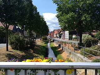
Oker is a borough of Goslar in Lower Saxony, Germany. Since 1952 a mining town in its own right within Wolfenbüttel district, it was incorporated into the Goslar municipality on 1 July 1972.

Northern Harz Boundary Fault

The Northern Harz Boundary Fault is a geological fault where the Harz Block, which consists of rocks formed during the Palaeozoic Era and folded in the course of Hercynian mountain building, borders on the Subhercynian Basin or Harz Foreland. The fault is also known in English as the Harz North Rim Fault or Harznordrand Thrust (Fault).

Ilse valley valley in Ilsenburg, Germany

The Ilse valley is the ravine of the Ilse stream in the northern boundary of the Harz mountain range in Germany. Part of the Harz National Park, it runs from the town of Ilsenburg at the foot of the mountain range up to the source region near the summit of the Brocken massif, the highest mountain of the range. The scenic valley is a popular hiking area.

Dehnenkopf mountain

The Dehnenkopf in the Harz Mountains of central Germany is a summit about 775 m above sea level (NN) near Torfhaus in the unincorporated area of Harz in the county of Goslar in Lower Saxony.

Elfenstein mountain

The Elfenstein is a hill spur, about 475 m above sea level (NN), in the northern foothills of the Harz Mountains of central Germany and the site of the eponymous granite rock formation above the town of Bad Harzburg. It is located in the unincorporated area of Harz in the county of Goslar in the state of Lower Saxony.

Lower Grumbach Pond dam in Between Hahnenklee and Wildemann, Goslar, Lower Saxony, GermanyClosest city: Clausthal-Zellerfeld

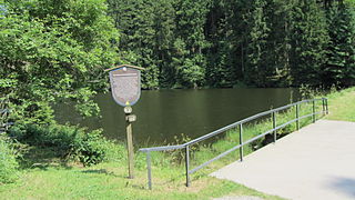
The Lower Grumbach Pond, usually just Grumbach Pond, is an old mining reservoir or Kunstteich between Hahnenklee and Wildemann in the Upper Harz mountains in Germany

Bettingerode Ortsteil of Bad Harzburg in Lower Saxony, Germany

Bettingerode is a village that forms a municipal district of Bad Harzburg in the district of Goslar in Lower Saxony. As of June 30, 2018, Bettingerode had a population of 438.

Bündheim District of Bad Harzburg in Lower Saxony, Germany

Bündheim, in Oker dialect: Binten is a suburb that forms a municipial district of Bad Harzburg in the district of Goslar in Lower Saxony, Germany. As of June 30, 2018, Bündheim had a population of 5,238.

References

  1. Königreich Romkerhall − das kleinste Königreich der Welt!, auf koenigreich-romkerhall.eu (Titel in Startseite)
  2. Topographische Karte Romkerhalle, at natur-erleben.niedersachsen.de
  3. 1 2 3 K. B. Fischer: Chronik des Amtes Harzburg…, 1912
  4. 1 2 R. Wieries: Geschichte des Amtes Harzburg nach seinen Forst-, Flur- und Straßennamen, 1937
  5. 1 2 A. Saft: Oker. Eine Chronik 1883–2007…, 2008
  6. Lower Saxon State Archives, Wolfenbüttel, 50 Neu 5 No. 4817.
  7. H. Schucht: Chronik und Heimatskunde des Hüttenortes Oker, 1888
  8. "Das Königreich Romkerhall und seine Geschichte". www.koenigreich-romkerhall.eu (in German). Retrieved 2016-05-31.
  9. 1 2 Map services of the Federal Agency for Nature Conservation
  10. Das Königreich Romkerhall<!no "e" at end--> und seine Geschichte, at koenigreich-romkerhall.eu
  11. Die vormals kaiserliche freie Reichsstadt Goslar am Harz, 1863, p. 153.
  12. H. Schucht: Chronik und Heimatskunde des Hüttenortes Oker, Harzburg, 1888, p. 150.
  13. F. Behme: Geologischer Harzführer…, 1922
  14. H.-J. Franzke & I. Joss: Granitfelsen und Romkerhaller Wasserfall im Okertal…, ohne Jahr
  15. H.-J. Franzke & R. Müller: Exkursion in einem geologischen Profil durch den West- und Mittelharz, 2012
  16. Harzer Wandernadel: Stempelstelle 116 / Verlobungsinsel in der Oker, at harzer-wandernadel.de Retrieved 29 Oct 2016.
  17. Harzer Wandernadel: Stempelstelle 119 / Hallesche Hütte (an den Ahrendsberger Klippen), at harzer-wandernadel.de. Retrieved 29 Oct 2016.

Literature

Coordinates: 51°51′34″N10°28′17″E / 51.85944°N 10.47139°E / 51.85944; 10.47139