
The River Wensum is a chalk river in Norfolk, England and a tributary of the River Yare, despite being the larger of the two rivers. The river is a biological Site of Special Scientific Interest and Special Area of Conservation.

Romsey is a town in the Test Valley district of Hampshire, England. The town is situated 7 miles (11 km) northwest of Southampton, 11 miles (18 km) southwest of Winchester and 17 miles (27 km) southeast of Salisbury. It sits on the outskirts of the New Forest, just over 3 miles (4.8 km) northeast of its eastern edge. The population of Romsey was 14,768 at the 2011 census.
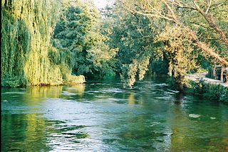
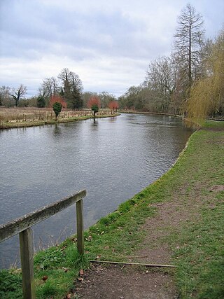
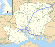
The River Test is a chalk stream in Hampshire in the south of England. It rises at Ashe near Basingstoke and flows southwards for 40 miles (64 km) to Southampton Water. Settlements on the Test include the towns of Stockbridge and Romsey. The river's valley gives its name to the local government district of Test Valley. Below the village of Longparish, the river is broadly followed by the Test Way, a long-distance footpath.

Andover is a town in the Test Valley district of Hampshire, England. The town is on the River Anton, a major tributary of the Test, and lies alongside the major A303 trunk road at the eastern end of Salisbury Plain, 18 miles (29 km) west of the town of Basingstoke. It is 14 miles (23 km) from Winchester, 35 miles (56 km) north of Southampton and 65 miles (105 km) from London.
Test Valley is a local government district with borough status in Hampshire, England, named after the valley of the River Test. The council is based in the borough's largest town of Andover. The borough also contains the town of Romsey and numerous villages and surrounding rural areas. A small part of the borough at its southern end lies within the New Forest National Park, and part of the borough north of Andover lies within the North Wessex Downs, a designated Area of Outstanding Natural Beauty.

Whitchurch is a town in the borough of Basingstoke and Deane in Hampshire, England. It is on the River Test, 13 miles (21 km) south of Newbury, Berkshire, 12 miles (19 km) north of Winchester, 8 miles (13 km) east of Andover and 12 miles (19 km) west of Basingstoke. Much of the town is a Conservation Area. Because of the amount of wildlife in and near the River Test, its course and banks are designated as Site of Special Scientific Interest. Whitchurch is the Gateway to the North Wessex Downs National Landscape; the third largest of Britain's National Landscapes.

Stotfold is a small rural town in the Central Bedfordshire borough of Bedfordshire, England. The town covers 2,207 acres (8.93 km2) and the River Ivel passes through the town. The population at the 2011 census was 9,632. Stotfold is close to the county border with Hertfordshire.

Stockbridge is a town and civil parish in the Test Valley district of Hampshire, England. It had a population of 592 at the 2011 census. It sits astride the River Test and at the foot of Stockbridge Down.

Barton Stacey is a village and undulating civil parish, which includes the hamlets of Bransbury, Newton Stacey, Drayton and Cocum, in the Test Valley district of Hampshire, England, centred about 7 miles (11 km) south-east of Andover. It is bounded to the north by the estate of Drayton Lodge, and, to the south, by the minor A30 road; both being east–west routes, and connected by The Street/Cocum Road, the main road that bisects the village. The distance between the A303 and A30 at this point is 2 miles (3.2 km), which is twice the width of the parish.
The River Anton is a chalk stream in Hampshire in south east England. It rises in Andover and flows southwards for approximately 8 miles (13 km) to meet the River Test near Chilbolton. The principal tributary of the Anton, the Pillhill Brook, joins the river at Upper Clatford.

The River Dever is a chalk stream in Hampshire in the south of England. It rises at West Stratton near Micheldever and flows westwards for 11 mi (18 km) to meet the River Test at Wherwell.
Upper Clatford is a village and civil parish in Hampshire, England. The village is in the valley of the River Anton, 3.5 miles (5.6 km) upstream from the point where it joins the River Test at the south.

Upton is a hamlet in Hampshire, located approximately 7 miles north of Andover. It has a population of approximately 250. The River Swift, a winterbourne, runs through it and can flood between December and February, causing minor problems. Upton is also the home of the Crown Inn, which is popular with locals and residents in Andover.
Andover was the name of a constituency of the House of Commons of the Parliament of England from 1295 to 1307, and again from 1586, then of the Parliament of Great Britain from 1707 to 1800 and of the Parliament of the United Kingdom from 1801 to 1918. It was a parliamentary borough in Hampshire, represented by two Members of Parliament until 1868, and by one member from 1868 to 1885. The name was then transferred to a county constituency electing one MP from 1885 until 1918.

Epsom Common is a 177.4-hectare (438-acre) Local Nature Reserve in Epsom, Surrey, England. It is owned and managed by Epsom and Ewell Borough Council. It is part of Epsom and Ashtead Commons, a Site of Special Scientific Interest.

Ruislip Woods is a Site of Special Scientific Interest and national nature reserve covering 726 acres (294 ha) in Ruislip in the London Borough of Hillingdon. The woods became London's first national nature reserve in May 1997. Ruislip Local Nature Reserve at TQ 090 899 is part of the national nature reserve.
East Anton is a suburb and housing development of Andover in the Test Valley district of Hampshire, England. It lies 1.5 miles (2.1 km) north-east from Andover. Formerly, it was a hamlet made up of two farms and related buildings.

The Angel Inn is a public house in Andover, Hampshire. Constructed in the mid-15th century, it is one of England's oldest surviving inns, and the oldest and most complete example in Hampshire. It is a Grade II* listed building, of "more than special interest nationally." Despite alterations in the 16th, 17th, 18th and 19th centuries, the medieval timber frame, features and decorative details remain "remarkably intact." Archaeological and documentary evidence suggest that it was built on the site of a previous inn—the College Inn—which was destroyed in the Great Fire of Andover in 1434.
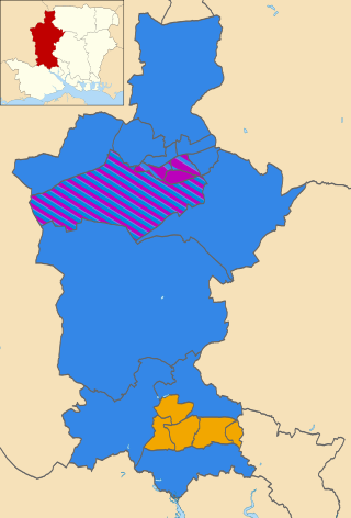
The 2019 Test Valley Borough Council election took place on 2 May 2019 to elect members of Test Valley Borough Council in England. This was on the same day as other local elections. The whole council was up for election on new boundaries, with the number of seats reduced from 48 across 24 wards to 43 across 20.
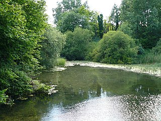
Anton Lakes is a 33.1-hectare (82-acre) Local Nature Reserve in Andover in Hampshire. It is owned by Test Valley Borough Council and managed by the council together with The Anton River Conservation Association.

 The mill after the fire in 2002
 The mill after restoration in 2003
