The Rosemarie and Dietrich Klemm Collection, deposited in the British Museum in London, consists of thousands of rock samples from the sites of Egyptian quarries. The collection was formed by the Egyptologist Rosemarie Klemm and the geologist Dietrich D. Klemm, both at Ludwig-Maximilians-Universität, Munich. Comparison with these rock samples can make it possible to identify, certainly or with probability, the origin of the stone used in ancient Egyptian architecture, statues and inscriptions.

The British Museum, located in the Bloomsbury area of London, in the United Kingdom, is a public institution dedicated to human history, art and culture. Its permanent collection numbers some 8 million works, and is among the largest and most comprehensive in existence having been widely sourced during the era of the British Empire, and documenting the story of human culture from its beginnings to the present. It is the first national public museum in the world.
London is the capital and largest city of both England and the United Kingdom. Standing on the River Thames in the south-east of England, at the head of its 50-mile (80 km) estuary leading to the North Sea, London has been a major settlement for two millennia. Londinium was founded by the Romans. The City of London, London's ancient core − an area of just 1.12 square miles (2.9 km2) and colloquially known as the Square Mile − retains boundaries that follow closely its medieval limits. The City of Westminster is also an Inner London borough holding city status. Greater London is governed by the Mayor of London and the London Assembly.
Rock or stone is a natural substance, a solid aggregate of one or more minerals or mineraloids. For example, granite, a common rock, is a combination of the minerals quartz, feldspar and biotite. The Earth's outer solid layer, the lithosphere, is made of rock.
Before its deposit in the Museum the collection was consulted in 1999 during conservation of the Rosetta Stone. The study showed a close resemblance to rock from a small granodiorite quarry at Gebel Tingar on the west bank of the Nile, west of Elephantine in the region of Aswan; the pink vein running across the upper part of the Rosetta Stone was also noted as typical of granodiorite from this region. [1]

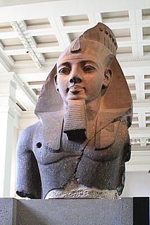
The Rosetta Stone is a granodiorite stele, found in 1799, inscribed with three versions of a decree issued at Memphis, Egypt in 196 BC during the Ptolemaic dynasty on behalf of King Ptolemy V. The top and middle texts are in Ancient Egyptian using hieroglyphic script and Demotic script, respectively, while the bottom is in Ancient Greek. As the decree has only minor differences between the three versions, the Rosetta Stone proved to be the key to deciphering Egyptian hieroglyphs, thereby opening a window into ancient Egyptian history.

Granodiorite is a phaneritic-textured intrusive igneous rock similar to granite, but containing more plagioclase feldspar than orthoclase feldspar. According to the QAPF diagram, granodiorite has a greater than 20% quartz by volume, and between 65% to 90% of the feldspar is plagioclase. A greater amount of plagioclase would designate the rock as tonalite.

The Nile is a major north-flowing river in northeastern Africa, and is the longest river in the world, though some sources cite the Amazon River as the longest. The Nile, which is about 6,650 km (4,130 mi) long, is an "international" river as its drainage basin covers eleven countries, namely, Tanzania, Uganda, Rwanda, Burundi, the Democratic Republic of the Congo, Kenya, Ethiopia, Eritrea, South Sudan, Republic of the Sudan and Egypt. In particular, the Nile is the primary water source of Egypt and Sudan.

A geologic map or geological map is a special-purpose map made to show geological features. Rock units or geologic strata are shown by color or symbols to indicate where they are exposed at the surface. Bedding planes and structural features such as faults, folds, foliations, and lineations are shown with strike and dip or trend and plunge symbols which give these features' three-dimensional orientations.
Wadi Allaqi, also transliterated as Wadi Allaqui or Wadi Alalaqi, is a wadi in southern Egypt. It begins in Sudan below Halayeb Triangle and its mouth is south of Aswan on the eastern shore of Lake Nasser.
Sir Ernest Alfred Thompson Wallis Budge was an English Egyptologist, Orientalist, and philologist who worked for the British Museum and published numerous works on the ancient Near East. He made numerous trips to Egypt and the Sudan on behalf of the British Museum to buy antiquities, and helped it build its collection of cuneiform tablets, manuscripts, and papyri. He published many books on Egyptology, helping to bring the findings to larger audiences. In 1920 he was knighted for his service to Egyptology and the British Museum.

The Arabian-Nubian Shield (ANS) is an exposure of Precambrian crystalline rocks on the flanks of the Red Sea. The crystalline rocks are mostly Neoproterozoic in age. Geographically - and from north to south - the ANS includes parts of Israel, Palestine, Jordan, Egypt, Saudi Arabia, Sudan, Eritrea, Ethiopia, Yemen, and Somalia. The ANS in the north is exposed as part of the Sahara Desert and Arabian Desert, and in the south in the Ethiopian Highlands, Asir province of Arabia and Yemen Highlands.

The Turin Papyrus Map is an ancient Egyptian map, generally considered the oldest surviving map of topographical interest from the ancient world. It is drawn on a papyrus reportedly discovered at Deir el-Medina in Thebes, collected by Bernardino Drovetti in Egypt sometime before 1824 AD and now preserved in Turin's Museo Egizio. The map was drawn about 1160 BC by the well-known Scribe-of-the-Tomb Amennakhte, son of Ipuy. It was prepared for Ramesses IV's quarrying expedition to the Wadi Hammamat in the Eastern Desert, which exposes Precambrian rocks of the Arabian-Nubian Shield. The purpose of the expedition was to obtain blocks of bekhen-stone to be used for statues of the king.

The Bayuda Desert, located at 18°N 33°E, is in the eastern region of the Sahara Desert, spanning approximately 100,000 km² of NE Sudan north of Omdurman and south of Korti, embraced by the great bend of the Nile in the N, E and S and limited by the Wadi Muqaddam in the W. The north to south aligned Wadi Abu Dom divides the Bayuda Desert into the eastern Bayuda Volcanic Field and the western ochre-coloured sand-sheets scattered with rocky outcrop.
Akoris ; Egyptian: Mer-nefer(et), Per-Imen-mat-khent(j), or Dehenet is the Greek name for the modern Egyptian village of Ṭihnā al-Ǧabal, located about 12 km north of Al Minya. The ancient site is situated in the southeast of the modern village.
Saï is a large island in the Nile River in Nubia between the second and third cataracts. It is 12 km long and 5.5 km wide. Saï was intermittently occupied by the Egyptians during the New Kingdom.
The Ptolemaic Decrees were a series of three decrees by synods of ancient Egyptian priests. They were issued in the Ptolemaic Kingdom, which controlled Egypt from 305 BC to 30 BC. In all three, the benefactions of the reigning Pharaoh, especially towards the priesthood, are recognised, and religious honours are decreed for him.
The decade of the 1790s in archaeology involved some significant events.
The Department of Ancient Egypt and Sudan is a department forming an historic part of the British Museum, housing the world's largest and most comprehensive collection of Egyptian antiquities outside the Egyptian Museum in Cairo.

Wadi Hammamat is a dry river bed in Egypt's Eastern Desert, about halfway between Al-Qusayr and Qena. It was a major mining region and trade route east from the Nile Valley in ancient times, and three thousand years of rock carvings and graffiti make it a major scientific and tourist site today.

Jubayt or Gebeit is a small town in eastern Sudan.
Ariab is a region of Sudan, located in the Nubian Desert. It is inhabited by the Beja people, and is home to the country's only commercial gold mine, run by French giant Areva. Gold mining has historically been crucially important for the desert region since Pharonic times.
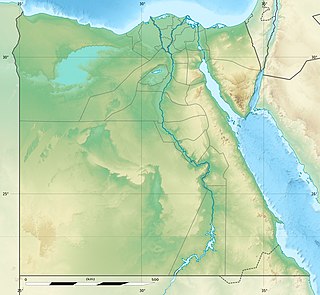
Gabal Tingar is a small mountain in Egypt, used as a granodiorite quarry in ancient times. The site is located on the west bank of the River Nile, west of Elephantine, near Aswan. It is thought to have been the source for the stone that was used to create the stele that the Rosetta Stone came from.
The Wadi el-Hudi is a wadi in Southern Egypt, in the Eastern Desert. Here were ancient quarries for amethyst. The Wadi el-Hudi is important in archaeology for its high number of rock inscriptions and stelae, mainly dating to the Middle Kingdom, as amethyst was especially popular in this period. The Wadi el-Hudi ends in the Nile valley a few kilometers north of Aswan and is coming there from the South-East. The ancient amethyst quarries are about 20 kilometres south-east from Aswan.
