Rotch Dome

Last updated
Location of Livingston Island in the South Shetland Islands Livingston-Island-location-map.png
Location of Livingston Island in the South Shetland Islands
Urvich Wall and Rotch Dome from near Basalt Lake on Byers Peninsula, Livingston Island in Antarctica Byers Peninsula, Rotch Dome.jpg
Urvich Wall and Rotch Dome from near Basalt Lake on Byers Peninsula, Livingston Island in Antarctica
Topographic map of Livingston Island and Smith Island Livingston-Island-Map-2010-15.png
Topographic map of Livingston Island and Smith Island

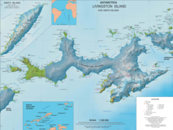
Rotch Dome is the sloping ice dome rising to 360 m immediately east of Byers Peninsula, and between Barclay Bay and Walker Bay in Livingston Island, South Shetland Islands, Antarctica. It is bounded by Urvich Wall to the west, surmounting Ivanov Beach to the northwest, Etar Snowfield to the north-northeast and Verila Glacier to the east-northeast, and is linked by a saddle to Casanovas Peak to the northeast.

Contents

The slopes of Rotch Dome west of 60º53'45"W were included in 2016 into the Antarctic Specially Protected Area Byers Peninsula (ASPA 126), with a designated zone comprising the northwestern part of Rotch Dome and the adjacent deglaciated ground on Ivanov Beach placed under greater restriction on access in order to prevent microbial or other contamination by human activity. [1]

Location

The highest point is located at 62°38′00″S60°52′59″W / 62.63333°S 60.88306°W / -62.63333; -60.88306 which is 10.4 km southwest of Casanovas Peak, 6.75 km north by west of Elephant Point, 6.1 km east of Tsamblak Hill, 5.37 km east-southeast of Nedelya Point and 4.77 km south by east of Rowe Point (British mapping in 1968, Bulgarian in 2005, 2009 and 2017).

Maps

In fiction

Geography of the thriller novel
The Killing Ship by Simon Beaufort Killing-Ship-Map.png
Geography of the thriller novel
The Killing Ship by Simon Beaufort

Rotch Dome is part of the mise-en-scène in the 2016 Antarctica thriller novel The Killing Ship by Simon Beaufort, with action spreading westwards from Hannah Point, skirting the dome and eventually reaching Byers Peninsula; the feature is shown on a sketch map of Livingston Island illustrating the book. [2] [3]

Notes

  1. Management Plan for Antarctic Specially Protected Area No. 126 Byers Peninsula. Measure 4 (2016), ATCM XXXIX Final Report. Santiago, 2016.
  2. S. Beaufort. The Killing Ship. Sutton, Surrey: Severn House Publishers, 2016. 224 pp. ISBN   978-0-7278-8639-2
  3. The Killing Ship. Susanna Gregory Website, 2019

Related Research Articles

<span class="mw-page-title-main">Etar Snowfield</span>

Etar Snowfield is a roughly crescent-shaped snowfield on western Livingston Island in the South Shetland Islands, Antarctica situated west of Urdoviza, Medven and Berkovitsa Glaciers, northwest of Verila Glacier, east of Ivanov Beach and south of Gerlovo Beach. It drains the west slopes of Oryahovo Heights and the north slopes of Rotch Dome, and flows into Barclay Bay between Mercury Bluff and Rowe Point. The feature extends 5 km (3 mi) inland, and 15 km (9 mi) in south-southwest to north-northeast direction.

<span class="mw-page-title-main">Verila Glacier</span> Glacier in Antarctica

Verila Glacier on Livingston Island in the South Shetland Islands, Antarctica is situated southeast of southern Etar Snowfield, southwest of Berkovitsa and Tundzha Glaciers, and west of Kamchiya Glacier. It is bounded by Rotch Dome to the west, Casanovas Peak and Snow Peak to the north, and Ustra Peak to the southeast. The glacier is roughly crescent-shaped, extending 7 nautical miles in an east-west direction and 2 nautical miles in a north-south direction, and drains southwards into Walker Bay, Bransfield Strait between John Beach and Liverpool Beach at Hannah Point. The glacier's bedrock is connected to Kaliman Island in Walker Bay by a 600 m long moraine tombolo. The area was visited by 19th century British and American sealers.

<span class="mw-page-title-main">Hannah Point</span>

Hannah Point is a point on the south coast of Livingston Island in the South Shetland Islands, Antarctica. It forms the east side of the entrance to Walker Bay and the west side of the entrance to South Bay. Surmounted by Ustra Peak to the north, with Liverpool Beach extending between the peak and the tip of Hannah Point. Ice-free area ca. 122 hectares.

<span class="mw-page-title-main">Casanovas Peak</span>

Casanovas Peak is the ice dome rising to 325 m at the base of Ioannes Paulus II Peninsula on Livingston Island, South Shetland Islands. It is linked to Rotch Dome on the west by Berrister Gap and surmounts Etar Snowfield to the northwest, Berkovitsa Glacier to the northeast and Verila Glacier to the south.

<span class="mw-page-title-main">Byers Peninsula</span>

Byers Peninsula is a mainly ice-free peninsula forming the west end of Livingston Island in the South Shetland Islands of Antarctica. It occupies 60 km2 (23 sq mi), borders Ivanov Beach to the northeast and is separated from Rotch Dome on the east by the ridge of Urvich Wall. The peninsula features more than 60 meltwater streams and as many lakes, notably Midge Lake, Limnopolar Lake and Basalt Lake. Byers Peninsula has a regime of special environmental protection under the Antarctic Treaty System and requires a permit to enter.

<span class="mw-page-title-main">Devils Point</span>

Devils Point is a point marking the southwest extremity of Byers Peninsula, Livingston Island in the South Shetland Islands, Antarctica and forming the southeast side of the entrance to Osogovo Bay and the west side of the entrance to Raskuporis Cove. The point is separated from Vardim Rocks to the south by Hell Gates. Lucifer Crags, a rocky bluff rising to 81 m at the south extremity of President Beaches, surmount Devils Point on the southwest, Acheron Lake on the northeast and Siren Lake on the east-southeast. The area was visited by early 19th century sealers.

<span class="mw-page-title-main">Robbery Beaches</span>

Robbery Beaches are beaches extending along the north side of Byers Peninsula, Livingston Island in the South Shetland Islands, Antarctica between Essex Point to the west and Nedelya Point to the east. They are crossed by Eridanus Stream and Bedek Stream.

<span class="mw-page-title-main">Bilyar Point</span>

Bilyar Point is a rounded ice-free point on Ivanov Beach in western Livingston Island, the South Shetland Islands in Antarctica projecting 350 m into Barclay Bay. Situated 3 km southwest of Rowe Point, northwest of Rotch Dome, 1.7 km northeast of Nedelya Point and 4.5 km east-northeast of Lair Point.

<span class="mw-page-title-main">Sevar Point</span>

Sevar Point is a point on the south coast of Byers Peninsula on Livingston Island in the South Shetland Islands, Antarctica situated 1.9 km east-southeast of Devils Point, 2.71 km west of Nikopol Point, and 2.97 km northeast of Long Rock in Morton Strait. It is surmounted by Wasp Hill on the north-northeast, Sealer Hill on the east-northeast, and forms the east side of the entrance to Raskuporis Cove.

<span class="mw-page-title-main">Urvich Wall</span>

Urvich Wall is the narrow ice-free and crescent-shaped ridge rising to 121 m on Livingston Island in the South Shetland Islands, Antarctica and bounded by Nedelya Point to the north and Rish Point to the southeast. The ridge is 6.7 km long and up to 400 m wide, and separates Byers Peninsula to the west from Rotch Dome to the east. It surmounts Oread Lake, Montemno Lake and Bedek Stream on the west.

<span class="mw-page-title-main">Tsamblak Hill</span>

Tsamblak Hill is a rocky hill trending 900 m in north–south direction, 450 m wide and rising to 113 m in eastern Byers Peninsula on Livingston Island in the South Shetland Islands, Antarctica. It surmounts Bedek Stream on the east, Feya Tarn on the south-southwest and Eridanus Stream on the west.

<span class="mw-page-title-main">Nedelya Point</span>

Nedelya Point is a sharp ice-free point at the southwest extremity of Ivanov Beach on the north coast of Livingston Island in the South Shetland Islands, Antarctica, projecting 300 m into Barclay Bay. It is linked by a chain of rocks to Cutler Stack, located 310 m to the north-northwest. The feature was visited by a field party from the British base camp Station P during the summer season 1957/58. It is part of the Antarctic Specially Protected Area ASPA 126 Byers Peninsula, situated in one of its two restricted zones.

<span class="mw-page-title-main">Window Island</span> Island in Antarctica

Window Island is a small ice-free island off the north coast of Ray Promontory in the northwest of Byers Peninsula, Livingston Island in the South Shetland Islands, Antarctica. The island has a surface area of 23 hectares and rises to 72 m (236 ft). It was known to the early 19th century sealers operating on Byers Peninsula.

<span class="mw-page-title-main">Clark Nunatak</span>

Clark Nunatak is a rocky peak rising to 147 m at the southwest edge of the ice cap of Rotch Dome in western Livingston Island, South Shetland Islands, Antarctica near the south extremity of Urvich Wall. It surmounts Volturnus Lake on the south.

<span class="mw-page-title-main">Rowe Point</span>

Rowe Point is a sharp, low ice-free point at the northeastern extremity of Ivanov Beach on the southeast coast of Barclay Bay in western Livingston Island in the South Shetland Islands, Antarctica. Mneme Lake is just west of the point.

<span class="mw-page-title-main">Snow Peak (Antarctica)</span>

Snow Peak is a snow-covered peak rising to 428 m in western Livingston Island in the South Shetland Islands, Antarctica. It is linked by a saddle to Casanovas Peak in the west, and surmounts Berkovitsa Glacier to the northwest, Fletcher Nunatak and Belev Nunatak to the northeast, Tundzha Glacier to the east and Verila Glacier to the southwest.

<span class="mw-page-title-main">Villard Point</span>

Villard Point is a point projecting 500 m into Barclay Bay from Robbery Beaches on Byers Peninsula, Livingston Island in the South Shetland Islands, Antarctica and forming the east side of the entrance to Baba Tonka Cove and the west side of the entrance to Kukuzel Cove.

<span class="mw-page-title-main">Lair Point</span>

Lair Point is a point projecting 570 m into Barclay Bay from Robbery Beaches on Byers Peninsula, Livingston Island in the South Shetland Islands, Antarctica and forming the east side of the entrance to Kukuzel Cove. Dominated by Lair Hill.

<span class="mw-page-title-main">Station P</span> Antarctic camp in Hannah Point, South Shetland Islands

Station P was a British base camp at the head of Mateev Cove on the east side of Hannah Point, Livingston Island in the South Shetland Islands, Antarctica that supported survey, geology and biology field work from 29 December 1957 until 15 March 1958. The camp was occupied by a six-member team led by Hugh Simpson. The surveyed areas included parts of Byers Peninsula, Elephant Point, Ioannes Paulus II Peninsula and Hurd Peninsula.

<span class="mw-page-title-main">Ivanov Beach</span> South Shetland Islands, Antarctica

Ivanov Beach is a mostly ice-free beach on the Drake Passage stretching 5 km (3.1 mi) in southwest–northeast direction on the southeast coast of Barclay Bay in western Livingston Island, South Shetland Islands in Antarctica. It extends to Nedelya Point and Byers Peninsula on the southwest, Rowe Point and Etar Snowfield on the northeast, and the slopes of Rotch Dome on the southeast. Its ice-free area is ca. 144 hectares.

References