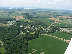

Roundhead is an unincorporated community in southeastern Roundhead Township, Hardin County, Ohio, United States. It has a post office with the ZIP code 43346. [1]
Roundhead is an unincorporated community in southeastern Roundhead Township, Hardin County, Ohio, United States. It has a post office with the ZIP code 43346. [1]

The first Euro-American settlement at Roundhead was made in 1832 on the site of a former Wyandot Indian village. [2] The community is named for the Wyandot chief Roundhead. [3] During its history, the community has also been referred to as "Round Head," "Round Heads," "Round Headstown," and "Roundheads Town." [4] A post office has been in operation at Roundhead since 1837. [5]
An archaeological site, the Zimmerman Kame, is located in the Roundhead vicinity; it is listed on the National Register of Historic Places. [6]
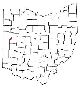
Located at an altitude of 1,004 feet (306 m), [4] it sits at the intersection of State Routes 117, 235, and 385, 2.75 miles (4.43 km) north of the northeast corner of Indian Lake and 13 miles (21 km) southwest of the city of Kenton, [7] the county seat of Hardin County. [8] Despite Roundhead's proximity to Indian Lake and the Great Miami River, which flows out of it to the Ohio River at Cincinnati, [9] the community is drained by the headwaters of the Scioto River, which meets the Ohio River at Portsmouth. [10]
Besides its post office, the community includes a Park, a volunteer fire department, [11] a United Methodist Church, a restaurant/bar, and two cemeteries. [12] [13]
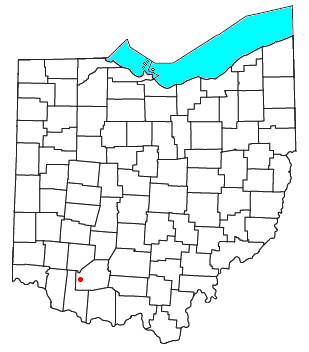
Pricetown is an unincorporated community in eastern Salem Township, Highland County, Ohio, United States.

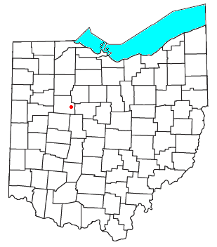
Dola is a census-designated place in central Washington Township, Hardin County, Ohio, United States. As of the 2020 United States Census it had a population of 143. It has a post office with the ZIP code 45835.

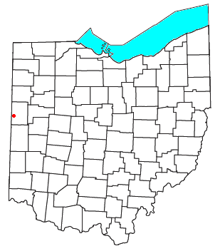
Raymond is a census-designated place in eastern Liberty Township, Union County, Ohio, United States. It has a post office with the ZIP code 43067. It is located at the intersection of State Routes 347 and 739.

Radnor is an unincorporated community and census-designated place (CDP) in central Radnor Township, Delaware County, Ohio, United States. As of the 2020 census it had a population of 180. Radnor has a post office with the ZIP code of 43066. It lies along State Route 203 at its intersection with Radnor Road.

Damascus is an unincorporated community and census-designated place in southern Mahoning and northern Columbiana counties in the U.S. state of Ohio. As of the 2020 census, it had a population of 418. The community lies at the intersection of U.S. Route 62 and State Routes 173 and 534.

Haydenville is an unincorporated community and census-designated place (CDP) in southern Green Township, Hocking County, Ohio, United States. As of the 2020 census the population of the CDP was 337.

Little Hocking is a census-designated place in southern Belpre Township, Washington County, Ohio, United States. It has a post office with the ZIP code 45742.

Kansas is a census-designated place in northwestern Liberty Township, Seneca County, Ohio, United States. It has a post office with the ZIP code 44841. It is located along State Route 635.

Morgantown is a small, unincorporated community crossroads village in central Benton Township, Pike County, Ohio, United States. Located at the junction of Morgans Fork and Auerville Roads, it once possessed a school and a store. Today, the community consists of a few houses and the Morgantown Church of Christ in Christian Union.
Hepburn is an unincorporated community in northern Dudley Township, Hardin County, Ohio, United States. It lies at the intersection of County Roads 144 and 227, 7+1⁄2 miles (12.1 km) east of the center of the city of Kenton, the county seat of Hardin County. Along the south side of the community runs the Scioto River. The community is served by the Kenton (43326) post office.

Logansville is an unincorporated community in central Pleasant Township, Logan County, Ohio, United States. It lies along State Route 47 at its intersection with County Road 24. The Great Miami River flows southward along the western edge of Logansville. The community lies 2+1⁄2 miles (4 km) north of the village of De Graff and 9 miles west of the city of Bellefontaine, the county seat of Logan County. It is located at 40°20′44″N83°55′50″W, and its altitude is 1,010 feet (308 m).

Kennard is an unincorporated community in eastern Salem Township, Champaign County, Ohio, United States. It lies at the intersection of Gray and Kennard Roads, less than 2 miles southwest of State Route 245. The headwaters of Kings Creek, a tributary of the Mad River, flow past Kennard. It is located approximately 10 miles (16 km) northwest of the city of Urbana, the county seat of Champaign County.

Millerstown is an unincorporated community in eastern Johnson Township, Champaign County, Ohio, United States. It lies at the intersection of Heck Hill, Ward, and Zimmerman Roads, 2+1⁄2 miles (4.0 km) north of U.S. Route 36. Nettle Creek, a tributary of the Mad River, flows past Millerstown. It is located approximately 4 miles northeast of the city of St. Paris and 10 miles (16 km) west-northwest of the city of Urbana, the county seat of Champaign County.

Brokensword is an unincorporated community on the border between the Holmes and Lykens townships of Crawford County, Ohio, United States. Located at the intersection of the concurrent State Routes 19 and 100 with Brokensword Road, it is six miles north and two miles west of the city of Bucyrus, the county seat. Broken Sword Creek flows a short distance to the south of the community.

Footville is an unincorporated community in southwestern Trumbull Township, Ashtabula County, Ohio, United States. It lies at the intersection of State Route 166 with Trask Road, 1+1⁄2 miles (2.4 km) east of the Geauga County line and 11+1⁄4 miles (18.1 km) southeast of the village of Jefferson, the county seat of Ashtabula County. Spring and Trumbull Creeks, which are both tributaries of the Grand River, pass near Footville.

Mexico is an unincorporated community in northeastern Tymochtee Township, Wyandot County, Ohio, United States. Located at 40°59′11″N83°11′36″W, it lies at an elevation of 810 feet.
Millwood is an unincorporated community in northwestern Jackson County, West Virginia, United States, along the Ohio River at the mouth of Mill Creek. It lies along West Virginia Routes 2 and 62 northwest of the city of Ripley, the county seat of Jackson County. Its elevation is 577 feet (176 m). Although Millwood is unincorporated, it has a post office, with the ZIP code of 25262.

Thackery is an unincorporated community in southeastern Jackson and southwestern Mad River Townships in Champaign County, Ohio, United States. It lies along State Route 55, southwest of the city of Urbana, the county seat of Champaign County.
Padua is an unincorporated community in western Washington Township, Mercer County, Ohio, United States. It lies at the intersection of State Route 49 and St. Anthony Road, west of the city of Celina, the county seat of Mercer County. Its elevation is 899 feet (274 m), and it is located at 40°30′30″N84°47′2″W.
Egypt is an unincorporated community in western Jackson Township, Auglaize County, Ohio, United States. Located at 40°23′8″N84°25′59″W, the community sits at an elevation of 971 feet (296 m), approximately 2 miles (3.2 km) west of the village of Minster.
Municipalities and communities of Hardin County, Ohio, United States | ||
|---|---|---|
| City |  | |
| Villages | ||
| Townships | ||
| CDP | ||
| Unincorporated communities | ||
| Footnotes | ‡This populated place also has portions in an adjacent county or counties | |
40°33′34″N83°50′07″W / 40.55944°N 83.83528°W
| | This Hardin County, Ohio state location article is a stub. You can help Wikipedia by expanding it. |