Ridgeway, Ohio

Last updated

Ridgeway, Ohio
Ridgeway looking southwest.jpg
Ridgeway from the air
OHMap-doton-Ridgeway.png
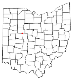
Location of Ridgeway, Ohio
Detailed map of Ridgeway, Ohio.png
Detailed map of Ridgeway
Coordinates: 40°30′44″N83°34′09″W / 40.51222°N 83.56917°W / 40.51222; -83.56917
Country United States
State Ohio
Counties Hardin, Logan
Townships Hale, Bokescreek
Government
   Mayor Kevin Holland [1]
Area
[2]
  Total0.57 sq mi (1.46 km2)
  Land0.57 sq mi (1.46 km2)
  Water0.00 sq mi (0.00 km2)
Elevation
[3]
1,050 ft (320 m)
Population
 (2020)
  Total314
  Density554.77/sq mi (214.34/km2)
Time zone UTC-5 (Eastern (EST))
  Summer (DST) UTC-4 (EDT)
ZIP code
43345
Area code(s) 937, 326
FIPS code 39-67118 [4]
GNIS feature ID2399073 [3]

Ridgeway is a village in Hardin and Logan counties in the U.S. state of Ohio. The population was 314 at the 2020 census.

Contents

History

Ridgeway was laid out in 1851 when the railroad was extended to the area. [5] Ridgeway receives its name from the Ridgeway family, the original owners of the town site. [5] The village was incorporated in 1858 as West Ridgeway. [6] A post office called Ridgeway has been in operation since 1865. [7]

Geography

According to the United States Census Bureau, the village has a total area of 0.59 square miles (1.53 km2), all land. [8]

Demographics

Historical population
CensusPop.Note
1870 277
1880 34223.5%
1890 321−6.1%
1900 44739.3%
1910 427−4.5%
1920 4566.8%
1930 375−17.8%
1940 3852.7%
1950 384−0.3%
1960 44816.7%
1970 379−15.4%
1980 3882.4%
1990 378−2.6%
2000 354−6.3%
2010 338−4.5%
2020 314−7.1%
U.S. Decennial Census [9]

2010 census

As of the census [10] of 2010, there were 338 people, 125 households, and 93 families living in the village. The population density was 572.9 inhabitants per square mile (221.2/km2). There were 133 housing units at an average density of 225.4 per square mile (87.0/km2). The racial makeup of the village was 97.0% White, 1.5% African American, 0.3% Asian, and 1.2% from two or more races. Hispanic or Latino of any race were 0.9% of the population.

There were 125 households, of which 40.8% had children under the age of 18 living with them, 55.2% were married couples living together, 13.6% had a female householder with no husband present, 5.6% had a male householder with no wife present, and 25.6% were non-families. 20.0% of all households were made up of individuals, and 5.6% had someone living alone who was 65 years of age or older. The average household size was 2.70 and the average family size was 3.12.

The median age in the village was 34.4 years. 29.3% of residents were under the age of 18; 7.4% were between the ages of 18 and 24; 27.8% were from 25 to 44; 26.3% were from 45 to 64; and 9.2% were 65 years of age or older. The gender makeup of the village was 47.0% male and 53.0% female.

2000 census

As of the census [4] of 2000, there were 354 people, 123 households, and 101 families living in the village. The population density was 589.5 inhabitants per square mile (227.6/km2). There were 136 housing units at an average density of 226.5 per square mile (87.5/km2). The racial makeup of the village was 98.02% White, 1.69% African American, and 0.28% from other races.

There were 123 households, out of which 47.2% had children under the age of 18 living with them, 64.2% were married couples living together, 13.0% had a female householder with no husband present, and 17.1% were non-families. 13.8% of all households were made up of individuals, and 7.3% had someone living alone who was 65 years of age or older. The average household size was 2.88 and the average family size was 3.14.

In the village, the population was spread out, with 30.8% under the age of 18, 9.6% from 18 to 24, 32.5% from 25 to 44, 17.2% from 45 to 64, and 9.9% who were 65 years of age or older. The median age was 33 years. For every 100 females there were 94.5 males. For every 100 females age 18 and over, there were 102.5 males.

The median income for a household in the village was $43,542, and the median income for a family was $46,250. Males had a median income of $36,875 versus $21,250 for females. The per capita income for the village was $18,537. About 2.2% of families and 2.9% of the population were below the poverty line, including 3.6% of those under age 18 and none of those age 65 or over.

Education

Ridgeway has a public library, a branch of the Ridgemont Public Library. [11]

Government

In the elections of November 2007, Robert Kelly was elected mayor without opposition, and Richard Ray was elected to the village council. Kelly Kelly was elected clerk-treasurer without opposition. [1]

Transportation

State Route 292 passes through Ridgeway from north to south.

Related Research Articles

<span class="mw-page-title-main">Hardin County, Ohio</span> County in Ohio, United States

Hardin County is a county located in the west central portion of the U.S. state of Ohio. As of the 2020 census, the population was 30,696. Its county seat and largest city is Kenton. The county was created in 1820 and later organized in 1833. It is named for John Hardin, an officer in the American Revolution.

<span class="mw-page-title-main">Elizabethtown, Illinois</span> Village in Illinois, United States

Elizabethtown is a village in and the county seat of Hardin County, Illinois, United States, along the Ohio River. The population was 299 at the 2010 census, down from 348 at the 2000 census. It is the least-populous county seat in the state.

<span class="mw-page-title-main">Gordon, Ohio</span> Village in Ohio, United States

Gordon is a village in Darke County, Ohio, United States. The population was 245 at the 2020 census.

<span class="mw-page-title-main">Palestine, Ohio</span> Village in Ohio, United States

Palestine is a village in Darke County, Ohio, United States. The population was 180 at the 2020 census.

<span class="mw-page-title-main">Centerville, Gallia County, Ohio</span> Village in Ohio, United States

Centerville, also known as Thurman, is a village in Gallia County, Ohio, United States. The population was 87 at the 2020 census. It is part of the rural Point Pleasant micropolitan area. It is located near U.S. Route 35 near the eastern terminus of State Route 279 as the highways parallel each other for about 1/2 mile.

<span class="mw-page-title-main">North Bend, Ohio</span> Village in Ohio, United States

North Bend is a village in Miami Township, Hamilton County, Ohio, United States, along the Ohio River. It is a part of the Greater Cincinnati area. The population was 835 at the 2020 census.

<span class="mw-page-title-main">Ada, Ohio</span> Village in Ohio, United States

Ada is a village in Hardin County, Ohio, United States, located about 69 miles (111 km) southwest of Toledo. The population was 5,334 at the 2020 census. It is the home of Ohio Northern University.

<span class="mw-page-title-main">Alger, Ohio</span> Village in Ohio, United States

Alger is a village in Hardin County, Ohio, United States. The population was 837 at the 2020 census.

<span class="mw-page-title-main">Dunkirk, Ohio</span> Village in Ohio, United States

Dunkirk is a village in Hardin County, Ohio, United States. The population was 774 at the 2020 census.

<span class="mw-page-title-main">Forest, Ohio</span> Village in Ohio, United States

Forest is a village in Hardin and Wyandot counties in the U.S. state of Ohio. The population was 1,350 at the 2020 census.

<span class="mw-page-title-main">McGuffey, Ohio</span> Village in Ohio, United States

McGuffey is a village in Hardin County, Ohio, United States. The population was 466 at the 2020 census.

<span class="mw-page-title-main">Mount Victory, Ohio</span> Village in Ohio, United States

Mount Victory is a village in Hardin County, Ohio, United States. The population was 601 at the 2020 census.

<span class="mw-page-title-main">Patterson, Ohio</span> Village in Ohio, United States

Patterson is a village in Hardin County, Ohio, United States. The population was 130 at the 2020 census.

<span class="mw-page-title-main">Gann, Ohio</span> Village in Ohio, United States

Brinkhaven, once known as Mount Holly and Gann, is a village in Knox County, Ohio, United States. The population was 114 at the 2020 census.

<span class="mw-page-title-main">Montezuma, Ohio</span> Village in Ohio, United States

Montezuma is a village in Mercer County, Ohio, United States. The population was 152 at the 2020 census.

<span class="mw-page-title-main">Port Jefferson, Ohio</span> Village in Ohio, United States

Port Jefferson is a village in Salem Township, Shelby County, Ohio, United States. The population was 308 at the 2020 census.

<span class="mw-page-title-main">Burkettsville, Ohio</span> Village in Ohio, United States

Burkettsville is a village in Darke and Mercer counties in the U.S. state of Ohio. The population was 272 at the 2020 census.

<span class="mw-page-title-main">Gratiot, Ohio</span> Village in Ohio, United States

Gratiot is a village in Licking and Muskingum counties in the U.S. state of Ohio. The population was 215 at the 2020 census.

<span class="mw-page-title-main">Verona, Ohio</span> Village in Ohio, United States

Verona is a village in Montgomery and Preble counties in the U.S. state of Ohio. The population was 403 at the 2020 census. It is part of the Dayton Metropolitan Statistical Area.

<span class="mw-page-title-main">Ridgeway, Wisconsin</span> Village in Wisconsin, United States

Ridgeway is a village in Iowa County, Wisconsin, United States. The population was 624 at the 2020 census. The village is adjacent to the Town of Ridgeway. It is part of the Madison Metropolitan Statistical Area.

References

  1. 1 2 Examiner Staff, The. "Village results", Bellefontaine Examiner, 2007-11-07, p. 2.
  2. "ArcGIS REST Services Directory". United States Census Bureau. Retrieved September 20, 2022.
  3. 1 2 U.S. Geological Survey Geographic Names Information System: Ridgeway, Ohio
  4. 1 2 "U.S. Census website". United States Census Bureau . Retrieved January 31, 2008.
  5. 1 2 Kohler, Minnie Ichler (1910). A Twentieth Century History of Hardin County, Ohio: A Narrative Account of Its Historical Progress, Its People and Principal Interests. Lewis Publishing Company. p.  184.
  6. The History of Hardin County, Ohio. Warner Beers & Company. 1883. p.  652.
  7. "Hardin County". Jim Forte Postal History. Retrieved December 14, 2015.
  8. "US Gazetteer files 2010". United States Census Bureau. Archived from the original on January 12, 2012. Retrieved January 6, 2013.
  9. "Census of Population and Housing". Census.gov. Retrieved June 4, 2015.
  10. "U.S. Census website". United States Census Bureau . Retrieved January 6, 2013.
  11. "Home". www.ridgemont.lib.oh.us. Retrieved July 1, 2023.