
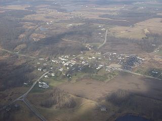
White Town is a ghost town in Rushcreek Township, Logan County, Ohio. It was located in Rushcreek Township. [1]
White Town is a ghost town in Rushcreek Township, Logan County, Ohio. It was located in Rushcreek Township. [1]
White Town was laid out in 1832 by William White, and named for him. [2]
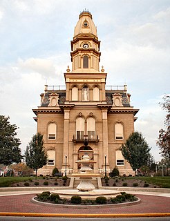
Logan County is a county in the U.S. state of Ohio. As of the 2010 census, the population was 45,858. The county seat is Bellefontaine. The county is named for Benjamin Logan, who fought Native Americans in the area.
Commerce Township, officially the Charter Township of Commerce, is a charter township of Oakland County, and suburb of Detroit, located in the U.S. state of Michigan. The population was 40,186 at the 2010 census. The terrain is rolling hills with large expanses of flat farmland and suburban development. The Huron River runs mostly north-south through the township. Commerce was formerly a weekend and summer resort for Detroiters because of the area's small inland lakes and peaceful seclusion, but due to recent development the cottages are now all permanent homes. There has been a sharp increase in population in the last few years, mostly on or near the several lakes and golf courses. Much of Proud Lake State Recreation Area is within the township. The northern terminus of M-5 is in Commerce. The busy highway would have continued north to Interstate 75, but because of the area's high property value and the many lakes that dot the landscape such a project would have been far too costly.
Jefferson Township is one of the seventeen townships of Logan County, Ohio, United States. The 2000 census found 2,946 people in the township.

Perry Township is one of the seventeen townships of Logan County, Ohio, United States. The 2000 census found 1,022 people in the township.

Bokescreek Township or Bokes Creek Township is one of the seventeen townships of Logan County, Ohio, United States. The 2000 census found 1,308 people in the township.

Rushcreek Township is one of the seventeen townships of Logan County, Ohio, United States. The 2000 census found 2,191 people in the township.
McArthur Township is one of the seventeen townships of Logan County, Ohio, United States. The 2000 census found 1,949 people in the township.

Richland Township is one of the seventeen townships of Logan County, Ohio, United States. The 2000 census found 2,455 people in the township.

Taylor Creek Township is one of the fifteen townships of Hardin County, Ohio, United States. As of the 2010 census the population was 521.

Rush Creek Township is one of the thirteen townships of Fairfield County, Ohio, United States. As of the 2010 census the population was 3,893, of whom 2,468 lived in the unincorporated portions of the township.
Springhills is an unincorporated community in northwestern Harrison Township, Champaign County, Ohio, United States. It lies at the intersection of State Route 245 with Crowl and Springhill-DeGraff Roads. Graves Creek, a subsidiary of the Great Miami River through Stony Creek, runs along the western edge of Springhills. It is located 6 miles (9.5 km) west of West Liberty and 11.5 miles (18.5 km) northwest of Urbana, the county seat of Champaign County.

Logansville is an unincorporated community in central Pleasant Township, Logan County, Ohio, United States. It lies along State Route 47 at its intersection with County Road 24. The Great Miami River flows southward along the western edge of Logansville. The community lies 2½ miles (4 km) north of the village of De Graff and 9 miles west of the city of Bellefontaine, the county seat of Logan County. It is located at 40°20′44″N83°55′50″W, and its altitude is 1,010 feet (308 m).

York Center is an unincorporated community in York Township, Union County, Ohio, United States. It is located at 40°24′28″N83°27′12″W, at the intersection of State Routes 47 and 739.

Essex is an unincorporated community on the east side of Rush Creek in the central part of Jackson Township, Union County, Ohio, United States. It is at 40°28′57″N83°18′57″W, at the intersection of State Routes 37 and 739.
Claibourne is an unincorporated community in Claibourne Township, Union County, Ohio, United States. It is located at 40°23′17″N83°20′57″W, at the intersection of Claibourne Road and Bethlehem-Claibourn Road.
Woodland is an unincorporated community in Jackson Township, Union County, Ohio, United States. It is located at 40°28′44″N83°15′27″W, at the intersection of Woodland Road and Fox Road, about five miles northeast of Richwood.
Aaronsburg is an extinct town in Morrow County, in the U.S. state of Ohio.

Big Springs is an unincorporated community in Logan County, in the U.S. state of Ohio.

Walnut Grove is an unincorporated community in Logan County, in the U.S. state of Ohio.
Yellowbud is an unincorporated community in Ross County, in the U.S. state of Ohio.
Municipalities and communities of Logan County, Ohio, United States | ||
|---|---|---|
| City |  | |
| Villages | ||
| Townships | ||
| CDPs | ||
| Unincorporated communities | ||
| Ghost towns | ||
| Footnotes | ‡This populated place also has portions in an adjacent county or counties | |
| This Logan County, Ohio state location article is a stub. You can help Wikipedia by expanding it. |