
New Jerusalem is an unincorporated community in Logan County, in the U.S. state of Ohio. [1]
New Jerusalem is an unincorporated community in Logan County, in the U.S. state of Ohio. [1]
A post office was established at New Jerusalem in 1876, and remained in operation until 1904. [2] [3]
New Jerusalem is located at the junction of Ohio State Routes 533 and 540, between Bellefontaine and the Zane Shawnee Caverns. [4] At an elevation of 1,467 feet (447 m), it is the highest populated place in Ohio. [1]

Pickaway County is a county in the U.S. state of Ohio. As of the 2020 census, the population was 58,539. Its county seat is Circleville. Its name derives from the Pekowi band of Shawnee Indians, who inhabited the area.
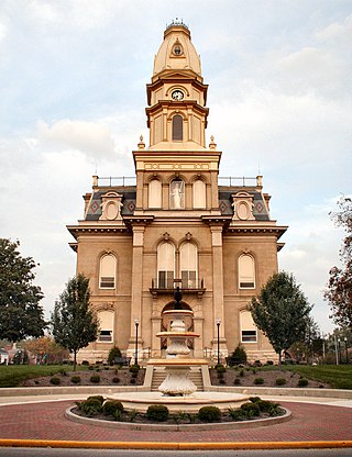
Logan County is a county located in the west central portion of the U.S. state of Ohio. As of the 2020 census, the population was 46,150. The county seat is Bellefontaine. The county is named for Benjamin Logan, who fought Native Americans in the area.

Logan County is a county in the U.S. state of Nebraska. As of the 2020 census, the population was 716. Its county seat is Stapleton.

Logan County is a county in the southwest Pennyroyal Plateau area of the U.S. Commonwealth of Kentucky. As of the 2020 census, the population was 27,432. Its county seat is Russellville.
Logan County is a county located in the U.S. state of Kansas. Its county seat and largest city is Oakley. As of the 2020 census, the county population was 2,762. The county was named for John Logan, a general during the American Civil War. One of the county's distinctive features is a mile-long stretch of Smoky Hill Chalk bluffs that tower 100 feet (30 m) high over the Smoky Hill River and are dubbed "Little Jerusalem" for resemblance to the ancient walled city. The formation is mostly on private land. In 2016, The Nature Conservancy purchased the property and the Little Jerusalem Badlands State Park opened to the public in October 2019.

Zanesfield is a village in Logan County, Ohio, United States of America. The population was 194 at the 2020 census. It is the smallest incorporated village in Logan County.
Ohio's 4th congressional district spans sections of the central part of the state. It is currently represented by Republican Jim Jordan, the current chair of the House Judiciary Committee, who has represented the district since 2007.

Logansville is an unincorporated community in central Pleasant Township, Logan County, Ohio, United States. It lies along State Route 47 at its intersection with County Road 24. The Great Miami River flows southward along the western edge of Logansville. The community lies 2+1⁄2 miles (4 km) north of the village of De Graff and 9 miles west of the city of Bellefontaine, the county seat of Logan County. It is located at 40°20′44″N83°55′50″W, and its altitude is 1,010 feet (308 m).

Orchard Island is an unincorporated community and residential and tourist area located in Washington and Stokes townships, Logan County, Ohio, United States. Although Orchard Island can only be accessed by road via Russells Point, most addresses on Orchard Island have a Lakeview ZIP Code (43331).
Cherokee Run is a stream in the U.S. state of Ohio.
McKees Creek is a stream in the U.S. state of Ohio. It is a tributary of Stony Creek.

Big Springs is an unincorporated community in Logan County, in the U.S. state of Ohio.

Bloom Center is an unincorporated community in Logan County, in the U.S. state of Ohio.

Cherokee is an unincorporated community in Logan County, in the U.S. state of Ohio.
Gretna is an unincorporated community in Logan County, in the U.S. state of Ohio.
Harper is an unincorporated community in Logan County, in the U.S. state of Ohio.

New Richland is an unincorporated community in Logan County, in the U.S. state of Ohio.

North Greenfield is an unincorporated community in Logan County, in the U.S. state of Ohio.

Walnut Grove is an unincorporated community in Logan County, in the U.S. state of Ohio.

White Town is a ghost town in Rushcreek Township, Logan County, Ohio. It was located in Rushcreek Township.
Municipalities and communities of Logan County, Ohio, United States | ||
|---|---|---|
| City |  | |
| Villages | ||
| Townships | ||
| CDPs | ||
| Unincorporated communities | ||
| Ghost towns | ||
| Footnotes | ‡This populated place also has portions in an adjacent county or counties | |
40°22′26″N83°39′27″W / 40.37389°N 83.65750°W
| | This Logan County, Ohio state location article is a stub. You can help Wikipedia by expanding it. |