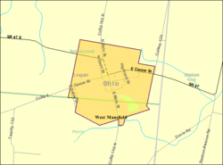
West Mansfield | |
---|---|
Village of West Mansfield | |
Coordinates: 40°24′2″N83°32′40″W / 40.40056°N 83.54444°W | |
Country | United States |
State | Ohio |
Counties | Logan |
Townships | Bokescreek, Perry |
Area | |
• Total | 0.86 sq mi (2.22 km2) |
• Land | 0.83 sq mi (2.16 km2) |
• Water | 0.03 sq mi (0.06 km2) |
Elevation | 1,083 ft (330 m) |
Population (2020) | |
• Total | 749 |
• Density | 900.24/sq mi (347.42/km2) |
Time zone | UTC-5 (Eastern (EST)) |
• Summer (DST) | UTC-4 (EDT) |
ZIP code | 43358 |
Area code(s) | 937, 326 |
FIPS code | 39-83818 |
GNIS feature ID | 2400138 [2] |
Website | westmansfield |
West Mansfield (officially the Village of West Mansfield) is a village located in Logan County, Ohio, United States. The population was 749 at the 2020 census.
A branch of the Logan County District Library serves the West Mansfield community. [3]
West Mansfield was laid out in 1848. [4] A post office called West Mansfield has been in operation since 1863. [5]
According to the United States Census Bureau, the village has a total area of 0.86 square miles (2.23 km2), of which, 0.83 square miles (2.15 km2) is land and 0.03 square miles (0.08 km2) is water. [6]
Census | Pop. | Note | %± |
---|---|---|---|
1880 | 333 | — | |
1890 | 431 | 29.4% | |
1900 | 875 | 103.0% | |
1910 | 913 | 4.3% | |
1920 | 737 | −19.3% | |
1930 | 675 | −8.4% | |
1940 | 739 | 9.5% | |
1950 | 756 | 2.3% | |
1960 | 791 | 4.6% | |
1970 | 753 | −4.8% | |
1980 | 716 | −4.9% | |
1990 | 830 | 15.9% | |
2000 | 700 | −15.7% | |
2010 | 682 | −2.6% | |
2020 | 749 | 9.8% | |
U.S. Decennial Census [7] |
As of the census [8] of 2010, there were 682 people, 271 households, and 190 families living in the village. The population density was 821.7 inhabitants per square mile (317.3/km2). There were 309 housing units at an average density of 372.3 per square mile (143.7/km2). The racial makeup of the village was 96.6% White, 0.9% African American, 0.1% Native American, 0.1% Asian, and 2.2% from two or more races. Hispanic or Latino of any race were 0.1% of the population.
There were 271 households, of which 38.0% had children under the age of 18 living with them, 52.0% were married couples living together, 12.2% had a female householder with no husband present, 5.9% had a male householder with no wife present, and 29.9% were non-families. 24.7% of all households were made up of individuals, and 9.3% had someone living alone who was 65 years of age or older. The average household size was 2.52 and the average family size was 2.99.
The median age in the village was 36 years. 26.2% of residents were under the age of 18; 7.1% were between the ages of 18 and 24; 27.3% were from 25 to 44; 24.8% were from 45 to 64; and 14.5% were 65 years of age or older. The gender makeup of the village was 50.0% male and 50.0% female.
As of the census [9] of 2000, there were 700 people, 276 households, and 203 families living in the village. The population density was 848.8 inhabitants per square mile (327.7/km2). There were 295 housing units at an average density of 357.7 per square mile (138.1/km2). The racial makeup of the village was 97.71% White, 0.14% African American, 0.14% Asian, 0.14% Pacific Islander, 0.29% from other races, and 1.57% from two or more races. Hispanic or Latino of any race were 0.29% of the population.
There were 276 households, out of which 31.9% had children under the age of 18 living with them, 58.3% were married couples living together, 12.3% had a female householder with no husband present, and 26.1% were non-families. 23.6% of all households were made up of individuals, and 11.2% had someone living alone who was 65 years of age or older. The average household size was 2.54 and the average family size was 3.01.
In the village, the population was spread out, with 26.6% under the age of 18, 8.4% from 18 to 24, 29.6% from 25 to 44, 21.4% from 45 to 64, and 14.0% who were 65 years of age or older. The median age was 36 years. For every 100 females, there were 82.3 males. For every 100 females age 18 and over, there were 88.3 males.
The median income for a household in the village was $41,731, and the median income for a family was $51,544. Males had a median income of $35,250 versus $22,143 for females. The per capita income for the village was $18,353. About 2.5% of families and 3.4% of the population were below the poverty line, including 3.3% of those under age 18 and 8.6% of those age 65 or over.
In the elections of November 2007, Edward Evans was elected mayor without opposition, and Sue Carpenter and Valerie Stanley were elected to the village council. Beverly Woodrum defeated Stacy Weiser for the position of clerk-treasurer. [10]
State Route 47 is a primary street in West Mansfield, transversing the village's downtown from east to west.
San Jose is a village in Logan and Mason counties, Illinois, United States, founded in 1858. The population was 479 at the 2020 census, down from 642 in 2010.
South Mansfield is a village in DeSoto Parish, Louisiana, United States. The population was 346 at the 2010 census. It is part of the Shreveport–Bossier City Metropolitan Statistical Area.
Waterloo is a village in Douglas County, Nebraska, United States. The population was 935 at the 2020 census.
Stapleton is a village in and the county seat of Logan County, Nebraska, United States. The population was 267 at the 2020 census.
Logan is a village in Quay County, New Mexico, United States. The population was 1,042 at the 2010 census.
North Robinson is a village in Crawford County, Ohio, United States. The population was 219 at the 2020 census.
Laurelville is a village in Hocking County, Ohio, United States. The population was 512 at the 2020 census.
Monroeville is a village in Huron County, Ohio, United States. The population was 1,300 at the 2020 census.
De Graff is a village located in Logan County, Ohio, United States. The population was 1,250 at the 2020 census.
Lakeview is a village in Logan County, Ohio, United States. The population was 1,184 at the 2020 census.
Rushsylvania is a village located in Logan County, Ohio, United States. The population was 491 at the 2020 census.
Valley Hi is a village in Logan County, Ohio, United States. The population was 228 at the 2020 census. The village is located nearby U.S. Route 33 and is about an hour northwest of Columbus. The village lies mostly in Jefferson Township, but its southernmost portion extends into Monroe Township.
West Liberty is a village in Logan County, Ohio, United States. The population was 1,770 at the 2020 census.
Logan Elm Village is a census-designated place (CDP) in Pickaway County, Ohio, United States, near the site of the Logan Elm. The population was 1,062 at the 2000 census.
Richmond Township is a township in Tioga County, Pennsylvania, United States. The population was 2,164 at the 2020 census.
Man is a town in Logan County, West Virginia, United States. The population was 772 at the 2020 census. The town is located along the Guyandotte River at the mouth of Buffalo Creek, which was the site of the 1972 Buffalo Creek Flood following a dam collapse. The name of the town reportedly derives from the last syllable of the surname of Ulysses Hinchman, who was a member of the House of Delegates from Logan County between 1866 and 1869.
Mitchell Heights is a town in Logan County, West Virginia, United States. The population was 315 at the 2020 census. The town was named for an early farm on which it was established.
Mount Gay-Shamrock is a census-designated place (CDP) in Logan County, West Virginia, United States.
West Logan is a town along the Guyandotte River in Logan County, West Virginia, United States. The population was 400 at the 2020 census. For unknown reasons, some sources report West Logan to lay west of the county seat at Logan, attributing to this fact the name.
Ridgeway is a village in Hardin and Logan counties in the U.S. state of Ohio. The population was 314 at the 2020 census.