Related Research Articles
Florenceville-Bristol is a town in the northwest part of New Brunswick, Canada. The town is located on the banks of the Saint John River in Carleton County. As of 2016, the population was 1,604.

Stratford is a town located in Queens County, Prince Edward Island.

Salisbury, New Brunswick is a village located in Westmorland County, New Brunswick, Canada. The village's population meets the requirements for "town" status under the Municipalities Act of the Province of New Brunswick; however, its municipal status has not been changed.
Green Mountain is a Canadian rural community in York County, New Brunswick.
Pemberton Ridge is a Canadian rural community in North Lake Parish, York County, New Brunswick.
Knoxford is a Canadian rural community in Carleton County, New Brunswick. There are two parts to Knoxford: Upper Knoxford (agricultural) and Lower Knoxford (residential). It is located 3.16 km NE of Royalton. There are two churches located in Knoxford, one in Lower Knoxford and one in Upper Knoxford. Lower Knoxford is home to the Praying Band Church. While the United Baptist Church is located in Upper Knoxford.
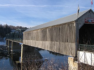
Peel is a Canadian rural community in Carleton County, New Brunswick. It is located on the east side of the Saint John River, 5.71 km NNW of Hartland, on the road to Stickney. It is part of Peel Parish.

Bloomfield is a community in the Canadian province of New Brunswick. It is located in Carleton County.

Debec is a community in Carleton County in the Canadian province of New Brunswick.
Johnville is a community in the Canadian province of New Brunswick. It is situated in Kent, a parish of Carleton County.
Napan is a community in the Canadian province of New Brunswick, approximately 140 kilometres (87 mi) north of Moncton. It is near Chatham, a neighbourhood of Miramichi, accessible from Highway 11.
Southampton is a Canadian rural community in York County, New Brunswick.

for the community named Molus River, see Molus River
Northampton is a Canadian community in Carleton County, New Brunswick.
McGrath Corner is a community in the Canadian province of New Brunswick, located in Wicklow Parish in the county of Carleton.
Lutes Mountain is a Canadian Community, located in Westmorland County, New Brunswick. It is named after famous railroad conductor, Neil Lutes. The Community is situated in southeastern New Brunswick, to the North West of Moncton, located partially within Moncton and Magnetic Hill Limits. Lutes Mountain is located around the intersection of New Brunswick Route 126 and New Brunswick Route 128.
Bass River is a small farming and forestry community located in Weldford Parish, New Brunswick that developed around the Bass River, a fresh water tributary of the Richibucto River. Bass River is located between the Intersection of Route 116 and Route 490.
Coldstream is a Canadian community in Brighton Parish, New Brunswick.
Beersville is a small community in Weldford Parish located 3.92 km SSE of Fords Mills and was named for John A. Beers (1860–1951) The community had a Post Office from 1900–1965 and in 1904 Beersville was a station on the Intercolonial Railway and a farming settlement with 1 post office, 1 store, 1 sawmill, 1 church and a population of 100. At one point it was a part of Emerson, at another, Emerson was a separate community but the place name was removed and the name is now honoured in the area by a road through Beersville called Emerson Road. Emerson was possibly named for Henry Robert Emerson (1853–1914), the Premier of New Brunswick from 1897–1900 and in 1904 Emerson was a farming settlement with 1 post office. Beersville is located on Route 465.
McKenzie Corner is a rural community in New Brunswick, Canada. There are two churches in the settlement: McKenzie Corner Baptist Church, which features a cemetery, and St. John's United Church.
References
- ↑ "Provincial Archives of New Brunswick". archives.gnb.ca. Retrieved 2016-12-02.
Coordinates: 46°29′02″N67°46′16″W / 46.484°N 67.771°W
| This New Brunswick location article is a stub. You can help Wikipedia by expanding it. |