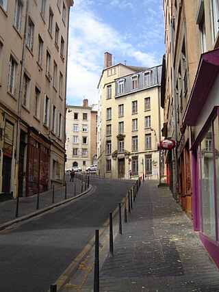
Rue Lainerie

Last updated
Rue Lainerie
Rue Lainerie (Lyon), juin 2019.jpg
Rue Lainerie (June 2019).
Former name(s)Rue de l'Asnerie
Type Street
Location 5th arrondissement of Lyon, Lyon, France
Postal code69005
Construction
Construction start5th century
Completion1911

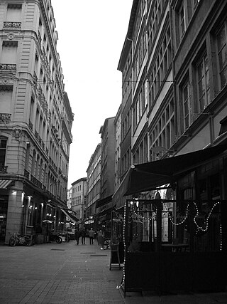
The Rue Lainerie is an ancient cobbled pedestrian street of the Vieux Lyon quarter, in the 5th arrondissement of Lyon. [1] From north to south, it connects two quarters, Saint-Paul and Saint-Jean, and more precisely the Place du Change and the Place Saint-Paul. There is currently an academy of music (section Vieux Lyon) at No. 1 and many hotels. The street is served by many buses (29-30-31-44-184), two metro stations and a velo'v station. It belongs to the zone classified as World Heritage Site by UNESCO.

Vieux Lyon Renaissance district of Lyon, France

The Vieux Lyon is the largest Renaissance district of Lyon. In 1954, Vieux-Lyon, the city's oldest district, became the first site in France to be protected under the Malraux law to protect France's cultural sites. Covering an area of 424 hectares at the foot of the Fourvière hill, it is one of Europe’s most extensive Renaissance neighborhoods. There are three distinct sections: Saint Jean, Saint Paul and Saint Georges.

5th arrondissement of Lyon French municipal arrondissement in Rhône-Alpes, France

The 5th arrondissement of Lyon is one of the nine arrondissements of the City of Lyon.

World Heritage Site place listed by the UNESCO as of special cultural or natural significance

A World Heritage Site is a landmark or area which is chosen by the United Nations Educational, Scientific and Cultural Organisation (UNESCO) as having cultural, historical, scientific or other form of significance, and is legally protected by international treaties. The sites are judged important to the collective interests of humanity.

Contents

History

The layout of the Rue Lainerie dates back the early Middle Ages and was completed in 1911. There are several possible spellings : Rue de l'Asnerie [2] or Rue Laisnerie, these names do not refer to the trade or craft of wool, but to a stable for asses which was in the street when it was created. During the Renaissance, the street was inhabited by wealthy people: for example, in No. 14 lived in a wealthy family of magistrates, the Palmier, later replaced by Claude de Bourg who modernized the street in 1510. [3] Thus, the architecture of the street offers a mixture of gothism and Renaissance style. In the eighteenth century, the community of Jansenists tailors were at No.5. [4] The school of the street was built in the 19th century. In its northern part, at the junction with the Rue François Vernay, several old houses were razed in 1911, under the mandate of President Édouard Herriot, during development works of the district which included the construction of the Gare de Lyon-Saint-Paul (1874) and the Palais de Bondy, housing the Salle Molière (1904). [5]

Middle Ages Period of European history from the 5th to the 15th century

In the history of Europe, the Middle Ages lasted from the 5th to the 15th century. It began with the fall of the Western Roman Empire and merged into the Renaissance and the Age of Discovery. The Middle Ages is the middle period of the three traditional divisions of Western history: classical antiquity, the medieval period, and the modern period. The medieval period is itself subdivided into the Early, High, and Late Middle Ages.

Renaissance European cultural period, 14th to 17th century

The Renaissance was a period in European history, covering the span between the 14th and 17th centuries and marking the transition from the Middle Ages to modernity. The traditional view focuses more on the early modern aspects of the Renaissance and argues that it was a break from the past, but many historians today focus more on its medieval aspects and argue that it was an extension of the Middle Ages.

Édouard Herriot French Radical politician

Édouard Marie Herriot was a French Radical politician of the Third Republic who served three times as Prime Minister and for many years as President of the Chamber of Deputies. He was leader of the first Cartel des Gauches.

Traboules

Several of the paths on the street are open to visitors. At No. 4, there is a façade of the sixteenth century, at No. 6, a façade of the fifteenth century, at No. 10, two staircases placed side by side and a gallery (this traboule signed an agreement with the city of Lyon for its opening), at No. 14, the gothic façade of the Mayet de Beauvoir house, built in 1516 [6] decorated with protruding flowers, mullioned windows, arches, medallions, a statue of the Virgin, and at No. 18, a nice staircase [7] and a building with an arched driveway with rib vaults that fall on caps adorned with angels, devils or animals. [8]

Rib vault Important gothic architecture element

A rib vault is an architectural feature used to cover a large interior space in a building, usually the nave of a church or cathedral, in which the surface of the vault is divided into webs by a framework of diagonal arched ribs. It is also called a "ribbed vault." It was a key feature of Gothic architecture. The thin stone ribs of the vault meet in a pointed arch, and carry the thrust of the weight of the roof outward and downwards to pillars on the ground floor, and to heavy flying buttresses outside the walls, rather than to the walls themselves. The use of rib vaults permitted the construction of much higher and thinner walls, and of stained glass windows of enormous size, which flooded the cathedrals with light.

See also

Related Research Articles

Rue des Marronniers street in the Bellecour quarter, in the 2nd arrondissement of Lyon

The Rue des Marronniers is a street located in the Bellecour quarter, in the 2nd arrondissement of Lyon. It is a small paved pedestrian street famous for its many bouchons. It is served by the metro station Bellecour and many buses. The street belongs to a zone classified as a World Heritage Site by UNESCO.

Place Ampère pedestrian square in the Ainay square, in the 2nd arrondissement of Lyon

The Place Ampère is a pedestrian square located in the Ainay square, in the 2nd arrondissement of Lyon. It is nearly the middle of the rue Victor-Hugo and is served by the metro station Ampère - Victor Hugo.

Place Sathonay square in Lyon, France

The Place Sathonay is a square located in the 1st arrondissement of Lyon, France, at the bottom of hill of La Croix-Rousse, in La Martinière quarter. It was named after Nicolas-Marie-Jean-Claude Fay de Sathonay, mayor of Lyon from 1805 to 1812, as a tribute for all the importants works undertaken under his presidency. The square is currently the third largest square in Lyon and belongs to the zone classified as World Heritage Site by UNESCO. According to Lyon geography agrégé Jean Pelletier, it is "one of the most interesting squares of Lyon", because of its harmonious proportions, its boundaries composed of buildings with beautiful 1920s facades, and its plantations, which brings "a charm tinged of poetry" and give it the appearance of a village square.

Passage Thiaffait urban area in Lyon, France

The Passage Thiaffait is an urban area located on the slopes of La Croix-Rousse, in the 1st arrondissement of Lyon. It has an entry by a portico and is a curved traboule (path) which ends with a staircase leading to the hill. The street belongs to the zone classified as World Heritage Site by UNESCO.
Rue de Brest street in Lyon, France

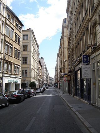
The Rue de Brest is a street located in the 2nd arrondissement of Lyon. This is one of the main shopping and tourist streets of the city center, parallel to the rue Édouard-Herriot. It begins in the wake of the rue Paul Chenavard and ends with the Place des Jacobins.

Montée des Carmélites thoroughfare in Lyon, France

The Montée des Carmélites is one of the oldest streets of Lyon, dating from Roman times, located in the 1st arrondissement of Lyon. It connects the Saint-Vincent quarter to the Plateau de la Croix-Rousse. It is situated between the rue de la Tourette and the rue Ray Fernand, and ends at the intersection of the rue Burdeau, rue du Jardin des Plantes and rue de l'Annonciade.

Rue Lanterne thoroughfare in Lyon, France

The Rue Lanterne is one of the oldest streets of Lyon created the Middle Ages, which is located in the 1st arrondissement of Lyon. It begins after the rue d'Algérie and ends against a facade of the rue Longue.
Rue Sainte-Catherine (Lyon) thoroughfare in Lyon, France

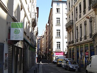
The rue Sainte-Catherine is a very old street at the foot of the slopes of La Croix-Rousse quarter, in the 1st arrondissement of Lyon. It is particularly known for being a drinking street. The street belongs to the zone classified as World Heritage Site by UNESCO.
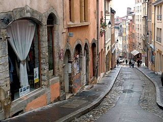
Montée de la Grande Côte street in the 1st arrondissement of Lyon, France

The Montée de la Grande Côte, or the Montée de la Grande-Côte, is a street of La Croix-Rousse quarter, located in the 1st arrondissement of Lyon, connecting the Terreaux quarter and the Plateau de la Croix Rousse. It is characterized by a high elevation and is more narrow at the bottom. The street belongs to the zone classified as World Heritage Site by UNESCO.

Rue de lArbre-Sec street in Lyon, France

The Rue de l'Arbre-Sec is an old street located in the 1st arrondissement of Lyon, near the Place des Terreaux and the Opera Nouvel. It starts perpendicular to the rue Édouard-Herriot and ends with the Quai Jean Moulin crossing the rue de la République. The name dates from the 14th century and was probably chosen because of a dry tree that could be seen in this street and of an inn sign.

Rue Burdeau street in Lyon, France

The Rue Burdeau is a street located in the 1st arrondissement of Lyon, at the bottom of the slopes of La Croix-Rousse, just above the Église Saint-Polycarpe, between the Saône and the Rhône. It leads at one side to the Montée Saint-Sébastien and at the other to the Jardin des Plantes and crosses the montée de la Grande Côte which renovation is completed. The street belongs to the zone classified as World Heritage Site by UNESCO.

Rue Royale, Lyon thoroughfare in Lyon, France

The Rue Royale is a street located in the 1st arrondissement of Lyon and was the main street of the quarter when it was created. It starts between the Place Servetus and the Rue de Provence and ends by joining the Grande Rue des Feuillants. There are many traboules closed which link the street with the Quai Lassagne and the rue d'Alsace-Lorraine. It is served by line C of the metro.
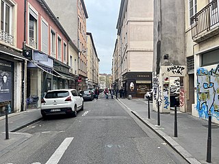
The Rue d'Austerlitz is a street in the 4th arrondissement of Lyon, in La Croix-Rousse quarter. It begins on the rue du Mail, at the corner of Place de la Croix-Rousse, crosses the rue du Pavilion, the rue de Belfort and the rue Aimé Boussange, and ends on Place Bellevue. Its name refers to the Battle of Austerlitz, one of the greatest victories of Napoleon. There are metro and velo'v stations.

The Rue Dumenge is a street located in the 4th arrondissement of Lyon, in the quarter of La Croix-Rousse. It begins on the rue du Mail, crosses the rue du Pavillon and the rue de Belfort and ends on the rue Dumont-d'Urville. The street is served by a metro station of the line C and a velo'v station.

Rue du Bœuf street in Lyon, France

The Rue du Bœuf is a 188-metre cobbled pedestrian street of the Vieux Lyon quarter, located in the 5th arrondissement of Lyon. Very representative of the Renaissance architecture of the neighborhood, it is lined only with old houses from the 16th or 17th century. The street connects the rue de Gadagne which it continues after the Place du Petit Collège and the intersection of the rue du Chemin Neuf, the rue de la Bombarde and the rue Tramassac which prolongs it. The street belongs to the zone classified as World Heritage Site by UNESCO.

Place Benoît-Crépu square in Lyon, France

The Place Benoît-Crépu is a stone-paved square, located in Saint-Georges quarter, on the banks of the Saône, in the 5th arrondissement of Lyon. It has fountains with dolphin heads, many benches and trees and a playground. The place belongs to the area classified as World Heritage Site by UNESCO.

Rue des Capucins street in the 1st arrondissement of Lyon, France

The Rue des Capucins is a street located in the 1st arrondissement of Lyon, between the slopes of La Croix-Rousse and the Place des Terreaux. Straight but slightly inclined, it continues the rue du Sergent Blandan, begins with the Place des Capucins and ends on the Place Croix-Paquet. It is parallel to the rue René Laynaud. The street belongs to the zone classified World Heritage Site by UNESCO.

Rue de Gadagne street in the 5th arrondissement of Lyon, France

The Rue de Gadagne is a paved pedestrian street of the Saint-Jean quarter, in the 5th arrondissement of Lyon. It extends the rue du Bœuf and ends on the rue Lainerie that leads itself to the Place Saint-Paul. It is located in the center of Vieux Lyon and is part to the area which includes a mosaic of squares : Place du Change, Place du Petit Collège and Place de la Baleine in the extension of rue Saint-Jean. The street belongs to the zone classified as World Heritage Site by UNESCO. It is served by buses 29-30-31-44-184, a metro station and three velo'v stations.

Rue du Sergent Blandan thoroughfare in Lyon, France

The Rue du Sergent Blandan is one of the oldest streets of Lyon. It connects Saint Vincent and the slopes of the Croix-Rousse quarters, in the 1st arrondissement of Lyon. The street starts rue Pareille, runs along the Place Sathonay, crosses the rue Hippolyte Flandrin, the rue Louis Vitet and the rue du Terme, and becomes the rue des Capucins just after the square of the same name. The street belongs to the zone classified World Heritage Site by UNESCO. It is named in honour of Sergent Blandan, who participated in the conquest of Algeria.

Place Croix-Paquet

The Place Croix-Paquet is a square located in the 1st arrondissement of Lyon, in the pentes de la Croix-Rousse quarter. It is formed by the intersection of the rue du Griffon, the rue des Capucins and the montée Saint-Sébastien. The square belongs to the zone classified World Heritage Site by UNESCO.

References

  1. Vanario, Maurice (2002). Rues de Lyon à travers les siècles (in French). Lyon: ELAH. p. 171. ISBN   2-84147-126-8.
  2. Vachet, Adolphe (1902). À travers les rues de Lyon (in French) (1982, Marseille ed.). Lyon: Laffitte reprints. p. 286. ISBN   2-7348-0062-4.
  3. Nicolas, Marie-Antoinette (2005). Le Vieux Lyon et ses traboules (in French). ELAH. ISBN   2-84147-161-6.
  4. Brun De La Valette, Robert (1969). Lyon et ses rues (in French). Paris: Le Fleuve. p. 48.
  5. Meynard, Louis (1932). Dictionnaire des lyonnaiseries — Les hommes. Le sol. Les rues. Histoires et légendes (in French). 3 (1982 ed.). Lyon: Jean Honoré.
  6. "Rue Lainerie" (in French). Rues de Lyon. Retrieved 24 December 2009.
  7. Pelletier, Jean (1985). Lyon pas à pas — son histoire à travers ses rues — Rive droite de la Saône, Croix-Rousse, quais et ponts de la Saône (in French). Roanne / Le Coteau: Horvath. p. 44. ISBN   2-7171-0377-5.
  8. Gambier, Gérald (2003). Vieux-Lyon, un patrimoine vivant (in French). Châtillon-sur-Chalaronne: La Taillanderie. p. 53. ISBN   2-87629-138-X.

Coordinates: 45°45′54″N4°49′41″E / 45.76500°N 4.82806°E / 45.76500; 4.82806

Geographic coordinate system Coordinate system

A geographic coordinate system is a coordinate system that enables every location on Earth to be specified by a set of numbers, letters or symbols. The coordinates are often chosen such that one of the numbers represents a vertical position and two or three of the numbers represent a horizontal position; alternatively, a geographic position may be expressed in a combined three-dimensional Cartesian vector. A common choice of coordinates is latitude, longitude and elevation. To specify a location on a plane requires a map projection.