The Rue de Rivoli is a street in central Paris, France. It is a commercial street whose shops include leading fashionable brands. It bears the name of Napoleon's early victory against the Austrian army, at the Battle of Rivoli, fought on 14–15 January 1797. Developed by Napoleon through the heart of the city, it includes on one side the north wing of the Louvre Palace and the Tuileries Gardens.

Châtelet station is a station of the Paris Métro and Île-de-France's RER commuter rail service, located in the centre of medieval Paris, on the border between the 1st and 4th arrondissements. It serves RER A, B and D, as well as lines 1, 4, 7, 11, and 14 of the Paris Métro; it is the southern terminus of Line 11. The station is made up of two parts connected by a long corridor: lines 7 and 11 under the Place du Châtelet and the Quai de Gesvre, next to the Seine; lines 1, 4 and 14 towards Rue Saint-Denis and the Rue de Rivoli.

The Palais-Royal is a former French royal palace located on Rue Saint-Honoré in the 1st arrondissement of Paris. The screened entrance court faces the Place du Palais-Royal, opposite the Louvre. Originally called the Palais-Cardinal, it was built for Cardinal Richelieu from about 1633 to 1639 by architect Jacques Lemercier. Richelieu bequeathed it to Louis XIII, before Louis XIV gave it to his younger brother, Philippe I, Duke of Orléans. As the succeeding Dukes of Orléans made such extensive alterations over the years, almost nothing remains of Lemercier's original design.

The Boulevard Saint-Michel is one of the two major streets in the Latin Quarter of Paris, France, the other being the Boulevard Saint-Germain. It is a tree-lined boulevard which runs south from the Pont Saint-Michel on the Seine and Place Saint-Michel, crosses the Boulevard Saint-Germain and continues alongside the Sorbonne and the Jardin du Luxembourg, ending at the Place Camille Jullian just before the Port-Royal RER station and the Avenue de l'Observatoire. It was created by Baron Haussmann to run parallel to the Rue Saint-Jacques which marks the historical north-south axis of Paris. It is known colloquially as Boul'Mich' in French.

This "quartier" of Paris got its name from the rue de la Chaussée-d'Antin in the 9th arrondissement of Paris. It runs north-northwest from the Boulevard des Italiens to the Église de la Sainte-Trinité.

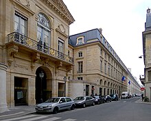
The Rue Saint-Honoré is a street in the 1st arrondissement of Paris, France. It is named after the collegial Saint-Honoré church, situated in ancient times within the cloisters of Saint-Honoré.
The wall of Charles V, built from 1356 to 1383 is one of the city walls of Paris built on orders granted by Charles V of France. It was built on the right bank of the river Seine outside the wall of Philippe Auguste. In the 1640s, the western part of the wall of Charles V was demolished and replaced by the larger Louis XIII wall, with the demolished material reused for the new wall. This new enclosure (enceinte) was completely destroyed in the 1670s and was replaced by the Grands Boulevards.

The Rue du Bœuf is a 188-metre cobbled pedestrian street of the Vieux Lyon quarter, located in the 5th arrondissement of Lyon. Very representative of the Renaissance architecture of the neighborhood, it is lined only with old houses from the 16th or 17th century. The street connects the rue de Gadagne which it continues after the Place du Petit Collège and the intersection of the rue du Chemin Neuf, the rue de la Bombarde and the rue Tramassac which prolongs it. The street belongs to the zone classified as World Heritage Site by UNESCO.

The Hôtel de Condé was the main Paris seat of the princes of Condé, a cadet branch of the Bourbons, from 1612 to 1764/70.
The Rue Rambuteau is a street in central Paris, France, named after the Count de Rambuteau who started the widening of the road prior to Haussmann's renovation of Paris. The philosopher Henri Lefebvre lived on the street and observed from his window the rhythms of everyday life at the intersection located behind the Centre Georges Pompidou.

The Rue Saint-Lazare is a street in the 8th and 9th arrondissements of Paris, France. It starts at 9 Rue Bourdaloue and 1 Rue Notre-Dame-de-Lorette, and ends at Place Gabriel-Péri and Rue de Rome.
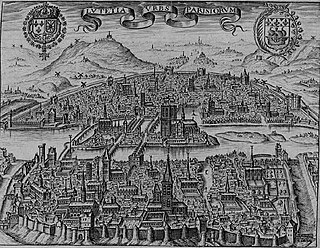
This article presents the main landmarks in the city of Paris within administrative limits, divided by its 20 arrondissements. Landmarks located in the suburbs of Paris, outside of its administrative limits, while within the metropolitan area are not included in this article.
The city of Paris has notable examples of architecture of every period, from the Middle Ages to the 21st century. It was the birthplace of the Gothic style, and has important monuments of the French Renaissance, Classical revival, the Flamboyant style of the reign of Napoleon III, the Belle Époque, and the Art Nouveau style. The great Exposition Universelle (1889) and 1900 added Paris landmarks, including the Eiffel Tower and Grand Palais. In the 20th century, the Art Deco style of architecture first appeared in Paris, and Paris architects also influenced the postmodern architecture of the second half of the century.

Paris during the reign of King Louis-Philippe (1830–1848) was the city described in the novels of Honoré de Balzac and Victor Hugo. Its population increased from 785,000 in 1831 to 1,053,000 in 1848, as the city grew to the north and west, while the poorest neighborhoods in the center became even more crowded.

The Rue Coquillière is one of the oldest paths of the 1st arrondissement of Paris, France.

The Rue Beaujolais is a street in the 1st arrondissement of Paris, France.

The Galerie de Montpensier is a gallery in the Palais-Royal in the 1st arrondissement of Paris, France.

The Rue de Harlay is a street on the Île de la Cité in the 1st arrondissement of Paris, France.

The Rue de Lille is a street in the 7th arrondissement of Paris, France, in the upscale Saint-Thomas-d'Aquin and Invalides quarters.