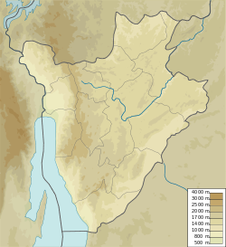
Kirundo Province is one of the eighteen provinces of Burundi, in north of the country bordering Rwanda. The economy is mostly based on agriculture, with a dispersed population and few sizable communities. Before 1970 large parts of the province were forested. Migrants from the south then cleared much of the vegetation to create agricultural land, and Kirundo became the breadbasket of Burundi. The civil war from 1993 to 2005 caused agricultural output to drop by more than half. Sice then, lack of farm inputs, poor infrastructure and shortages of water have caused widespread poverty.
These are some of the articles related to Burundi on the English Wikipedia:
The commune of Bugabira is a commune of Kirundo Province in northern Burundi. The capital is Bugabira. There are health centers at Muyange and Ruhehe.
Busoni is a commune of Kirundo Province in northern Burundi. The seat lies at Busoni.
The Commune of Bwambarangwe is a commune of Kirundo Province in northern Burundi.
The Commune of Gitobe is a commune of Kirundo Province in northern Burundi.

The Commune of Kirundo is a commune of Kirundo Province in northern Burundi.
The commune of Ntega is a commune of Kirundo Province in northern Burundi.
The Commune of Vumbi is a commune of Kirundo Province in northern Burundi.
Alain Tribert Mutabazi is a Burundian politician who was the governor of northern Province of Kirundo and later was appointed Minister of Defense.
Lake Mwungere is a lake in the Kirundo Province of Burundi.
Kabanga is a village and a colline in the Commune of Busoni, Kirundo Province, Burundi.
Ntega is a large village, the seat of the Commune of Ntega, Kirundo Province in the north of Burundi.
Mugendo is a village in the Commune of Ntega, Kirundo Province in the north of Burundi.
Busoni is a town and seat of the Commune of Busoni, Kirundo Province in northern Burundi.
Jean-Marie Muhirwa is a politician who was elected senator for Kirundo Province, Burundi in 2015. He resigned in 2016 to become a member of the East African Legislative Assembly (EALA).
Réverien Nzigamasabo is a politician who was governor of Kirundo Province, Burundi, from 2010 to 2015.
Nyamabuno Marsh is a marsh in the northeast of Kirundo Province, Burundi.
Bugabira is a village of the Commune of Kirundo, in the Kirundo Province of Burundi.
Mutwenzi is a village of the Commune of Kirundo, in the Kirundo Province of Burundi.


