Ruhengeri Musanze  | |
|---|---|
|   | |
| Coordinates: 1°30′S29°38′E / 1.500°S 29.633°E | |
| Country | |
| Admin. Province | Northern Province | 
| District | Musanze | 
| Area | |
| • Muhoza sector | 8.17 sq mi (21.15 km2) | 
| Elevation | 6,178 ft (1,883 m) | 
| Population | |
 • Total  | 153,368 | 
| • Muhoza sector | 69,741 | 
| • Muhoza sector density | 8,500/sq mi (3,300/km2) | 
| Climate | Cwb | 
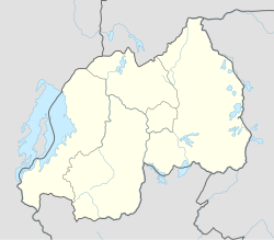
Ruhengeri, today known as Musanze is the third largest city in Rwanda and the capital of Musanze District in the Northern Province of Rwanda. The city has a population of 153,368 as of the 2022 census. [1]
Some sources now refer to the city itself as Musanze, after the district in which it lies within. [3] This has to do with the adopted policy of renaming Rwanda cities, which was done to eliminate memories of the past and to install new administrations in the country.[ citation needed ]
 Ruhengeri lies near the twin lakes of Lake Burera and Lake Ruhondo and is the gateway city to Volcanoes National Park and the famous mountain gorillas in the north-western part of the country.
The city's proximity to the Volcanoes National Park has made it a popular tourist destination with several restaurants and hotels mainly aimed at visitors to the national park.
| Climate data for Ruhengeri Airport (1991–2020) | |||||||||||||
|---|---|---|---|---|---|---|---|---|---|---|---|---|---|
| Month | Jan | Feb | Mar | Apr | May | Jun | Jul | Aug | Sep | Oct | Nov | Dec | Year | 
| Record high °C (°F) | 29.9 (85.8)  | 30.2 (86.4)  | 28.2 (82.8)  | 27.0 (80.6)  | 27.5 (81.5)  | 26.7 (80.1)  | 27.1 (80.8)  | 28.0 (82.4)  | 29.8 (85.6)  | 30.0 (86.0)  | 27.1 (80.8)  | 27.8 (82.0)  | 30.2 (86.4)  | 
| Mean daily maximum °C (°F) | 24.5 (76.1)  | 24.6 (76.3)  | 24.1 (75.4)  | 23.5 (74.3)  | 23.0 (73.4)  | 23.3 (73.9)  | 23.9 (75.0)  | 24.4 (75.9)  | 24.8 (76.6)  | 24.0 (75.2)  | 23.2 (73.8)  | 23.7 (74.7)  | 23.9 (75.0)  | 
| Daily mean °C (°F) | 18.1 (64.6)  | 18.3 (64.9)  | 18.1 (64.6)  | 18.1 (64.6)  | 17.9 (64.2)  | 17.6 (63.7)  | 17.7 (63.9)  | 18.3 (64.9)  | 18.5 (65.3)  | 18.1 (64.6)  | 17.5 (63.5)  | 17.4 (63.3)  | 18.0 (64.4)  | 
| Mean daily minimum °C (°F) | 11.8 (53.2)  | 12.0 (53.6)  | 12.0 (53.6)  | 12.7 (54.9)  | 12.9 (55.2)  | 11.9 (53.4)  | 11.6 (52.9)  | 12.2 (54.0)  | 12.2 (54.0)  | 12.1 (53.8)  | 11.7 (53.1)  | 11.1 (52.0)  | 12.0 (53.6)  | 
| Record low °C (°F) | 6.1 (43.0)  | 7.3 (45.1)  | 6.9 (44.4)  | 8.5 (47.3)  | 8.0 (46.4)  | 7.0 (44.6)  | 5.5 (41.9)  | 7.0 (44.6)  | 6.2 (43.2)  | 6.6 (43.9)  | 6.9 (44.4)  | 6.5 (43.7)  | 5.5 (41.9)  | 
| Average precipitation mm (inches) | 95.6 (3.76)  | 99 (3.9)  | 145.9 (5.74)  | 202.4 (7.97)  | 140.9 (5.55)  | 56.8 (2.24)  | 13.3 (0.52)  | 49.4 (1.94)  | 123.8 (4.87)  | 179.7 (7.07)  | 170.2 (6.70)  | 102.2 (4.02)  | 1,379.3 (54.30)  | 
| Average precipitation days (≥ 1.0 mm) | 11.2 | 11.9 | 18.4 | 20.8 | 16.3 | 4.9 | 1.5 | 4.9 | 16.0 | 22.3 | 21.2 | 14.2 | 163.6 | 
| Source: NOAA [4] | |||||||||||||
Ruhengeri is also home to the Institute of Applied Sciences (INES-Ruhengeri). [5] INES-Ruhengeri was established in 2003 in collaboration with the Catholic Diocese of Ruhengeri. [6]
The city is served by the Ruhengeri Airport. [7]
1°30′S29°38′E / 1.500°S 29.633°E