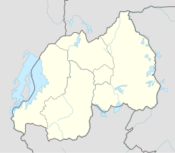
Ruhengeri Airport

Last updated
Ruhengeri Airport
Summary
Airport type Public, Civilian
OwnerRwanda Civil Aviation Authority
ServesRuhengeri, Rwanda
Location Ruhengeri, Flag of Rwanda.svg  Rwanda
Elevation  AMSL 6,100 ft / 1,860 m
Coordinates 01°30′00″S29°38′01″E / 1.50000°S 29.63361°E / -1.50000; 29.63361 (Ruhengeri Airport)
Map
Rwanda adm location map.svg
Airplane silhouette.svg
Ruhengei
Location of Ruhengeri Airport in Rwanda
Placement on map is approximate
Runways
Direction LengthSurface
ftm
15/334,8601,480Asphalt

Ruhengeri Airport is an airport in Ruhengeri, Rwanda.

Contents

Location

Ruhengeri Airport ( IATA : RHG, ICAO : HRYU) is located in Rwanda's Northern Province, in Musanze District, in the town of Ruhengeri. This location lies approximately 227 kilometres (141 mi), by air, northwest of Kigali International Airport, currently, the country's largest civilian airport. [1] The geographic coordinates of this airport are:1° 30' 0.00"S, 29° 38' 1.00"E (Latitude:-1.50000; Longitude:29.63361).

Overview

Ruhengeri Airport is a medium-sized airport that serves the town of Ruhengeri and neighbouring communities. It is one of the eight public civilian airports under the administration of the Rwanda Civil Aviation Authority. Ruhengeri Airport is situated at an altitude of about 1,860 metres (6,100 ft) above sea level. [2] The airport has a single asphalt runway that measures 1,480 metres (4,860 ft) in length. [3]

See also

Related Research Articles

<span class="mw-page-title-main">Northern Province, Rwanda</span> Province of Rwanda

Northern Province is one of Rwanda's five provinces. It was created in early January 2006 as part of a government decentralization program that re-organized the country's local government structures.

Kakira Airport is one of the 46 airports in Uganda. It is in Kakira, Jinja District, Eastern Region. The geographic coordinates of this airport are 00 degrees, 29 minutes, 56 seconds north and 33 degrees, 16 minutes, 57 seconds east. It is approximately 107 kilometres (66 mi), by air, east of Entebbe International Airport, the country's largest civilian and military airport.

Bugesera International Airport is an airport in the Bugesera District of Rwanda under construction since 2017.

Gisenyi Airport is an airport in Rwanda. It has IATA airport code GYI.

Butare Airport is an airport in Butare, Rwanda.

Nemba is a settlement in Rwanda.

Nemba Airport is an airport in Rwanda.

Voi Airport is an airport in Voi, Kenya.

Nyeri Airport is an airport in Nyeri Count, Kenya.

Narok Airport is an airport in Narok, Kenya.

Naivasha Airport is an airport in Naivasha, Kenya.

Mtito Andei Airport is an airport in Kenya.

Moyale Airport, also referred to as Moyale Lower Airport, is an airport located in the town of Moyale, Marsabit County, in the northern part of the Republic of Kenya, at the international border with Ethiopia. Its location is approximately 590 kilometres (370 mi), by air, northeast of Nairobi International Airport, the country's largest civilian airport. The geographic coordinates of this airport are:3° 27' 54.00"N, 39° 6' 18.00"E.

Embu Airport is an airport in Kenya.

Garba Tula Airport is an airport in Kenya.

Garissa Airport is an airport in Kenya.

Marsabit Airport is an airport in Marsabit, Kenya.

Makindu Airport is an airport in Makindu, Kenya.

University of Kigali (UoK) is a fully accredited and chartered university by the Government of Rwanda. UoK started its operations in October 2013.

Prime Cement Limited (PCL) is a cement manufacturer in Rwanda. It is a subsidiary of Milbridge Holding SA, a building materials manufacturer and distributor, with subsidiaries in Angola, the United Arab Emirates, Rwanda and South Africa.

References

  1. "Distance between , and Kigali (Kigali) (Rwanda)". distancecalculator.globefeed.com. Retrieved 2018-08-21.
  2. Elevation of Ruhengeri Airport
  3. "RHG - Ruhengeri [Ruhengeri Airport], 03, RW - Airport - Great Circle Mapper". www.gcmap.com. Retrieved 2018-08-21.

Coordinates: 01°30′00″S29°38′01″E / 1.50000°S 29.63361°E / -1.50000; 29.63361