Kamembe Airport

Last updated
Kamembe International Airport
Kamembe Airport from the runway, 2017 1.jpg
Kamembe airport terminal seen from the runway, 2017
Summary
Airport typeCivil
Owner Rwandan Government
OperatorRwanda Airports Authority
Serves Cyangugu
LocationKamembe, Rwanda
Elevation  AMSL 5,192 ft / 1,583 m
Coordinates 02°27′23″S28°54′35″E / 2.45639°S 28.90972°E / -2.45639; 28.90972
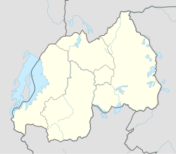
Map
Rwanda adm location map.svg
Airplane silhouette.svg
KME
Location of the airport in Rwanda
Runways
Direction LengthSurface
ftm
02/204,9211,500Asphalt

Kamembe International Airport, ( IATA : KME, ICAO : HRZA), is an airport in Rwanda. RwandAir operates a Dash 8-Q400 with seven flights per week to and from Kigali International Airport. The airport receives charter flights from Tanzania, Uganda and the Democratic Republic of the Congo, though not on a regular schedule. During the Rwandan Civil War, Kamembe airport was suggested as a site for transiting French arms to the interim government after April 1994. [1]

Contents

Kamembe Airport from the outside, 2017 1 Kamembe Airport from the outside, 2017 1.jpg
Kamembe Airport from the outside, 2017 1

Location

Kamembe Airport is located approximately 5 kilometres (3 mi), by road, north of Cyangugu's central business district, Rusizi District, in the Western Province of Rwanda. [2] The airport is located approximately 147.5 kilometres (92 mi), by air, southwest of Kigali International Airport, the largest airport in the country. [3] It sits at an altitude of 5,192 feet (1,583 m) above mean sea level. [4] The geographical coordinates of Kamembe Airport are: 02°27'23.0"S, 28°54'35.0"E (Latitude:-2.456389; Longitude:28.909722). [5]

Overview

Kamembe is a medium airport with one paved runway 02/20 that measures 4,921 feet (1,500 m) long and 148 feet (45 m) wide. [4]

History

The airport terminal building was heavily damaged by a 2008 earthquake, [6] and early in 2010 the Rwanda government announced that Kamembe Airport would be repaired and modernized. [7]

By the end of 2012 a new terminal was completed, a new control tower was opened, and Techno Sky, a branch of the Italian publicly owned ENAV corporation, had installed new navigation systems. [8]

During a May 2013 visit, Infrastructure Minister Albert Nsengiyumva announced that the runway would be widened and lengthened from 1.5 kilometres (4,900 ft) to  2 kilometres (6,600 ft) by 2015. [9] The airport re-opened in June 2015 and RwandAir began scheduled flights from the airport. [10]

Airlines and destinations

AirlinesDestinations
RwandAir Kigali [11]

Related Research Articles

There are a number of systems of transport in Burundi, including road and water-based infrastructure, the latter of which makes use of Lake Tanganyika. Furthermore, there are also some airports in Burundi.

<span class="mw-page-title-main">Transport in Rwanda</span>

The transport system in Rwanda centres primarily around the road network. Paved roads lie between the capital, Kigali, and most other major cities and towns in the country. Rwanda is also linked by road with other countries in the African Great Lakes, via which the majority of the country's imports and exports are made.

<span class="mw-page-title-main">Kigali</span> Capital and the largest city of Rwanda

Kigali is the capital and largest city of Rwanda. It is near the nation's geographic centre in a region of rolling hills, with a series of valleys and ridges joined by steep slopes. As a primate city, Kigali is a relatively new city. It has been Rwanda's economic, cultural, and transport hub since it was founded as an administrative outpost in 1907, and became the capital of the country at independence in 1962, shifting focus away from Huye.

<span class="mw-page-title-main">Cyangugu</span> City in Western Province, Rwanda

Cyangugu is a city and capital of the Rusizi District in Western Province, Rwanda. The city lies at the southern end of Lake Kivu, and is contiguous with Bukavu, Democratic Republic of the Congo, but separated from it by the Ruzizi River. Two bridges and a dam cross the river frontier.

<span class="mw-page-title-main">Rwanda Defence Force</span> Combined military forces of Rwanda

The Rwanda Defence Force is the military of the Republic of Rwanda. The country's armed forces were originally known as the Rwandan Armed Forces (FAR), but following the Rwandan Civil War of 1990–1994 and the Rwandan genocide of 1994 against the Tutsi, the victorious Rwandan Patriotic Front (Inkotanyi) created a new organization and named it the Rwandan Patriotic Army (RPA). Later, it was renamed to its current name.

<span class="mw-page-title-main">Kibuye, Rwanda</span> City in Western Province, Rwanda

Kibuye is a city in Karongi District, and the headquarters of the Western Province in Rwanda.

<span class="mw-page-title-main">Kigali International Airport</span> International airport in Rwanda

Kigali International Airport, formerly known as Kanombe International Airport, is the primary international airport serving Kigali, the capital of Rwanda. As of June 2024, there is an ongoing project to build another mega-airport in Bugesera District, Eastern Province, which will be the biggest and the main air gateway for all destinations in the country, in addition to serving as a transit airport for Goma and Bukavu in the eastern Democratic Republic of the Congo. There are 4 airlines based at Kigali Airport: RwandAir, the flag carrier airline of Rwanda; Akagera Aviation, a Rwandan heli-company; Tempus Jet, an American airline providing charter flights; and Nexus Aero, a Saudi VIP airline.

Tourism in Rwanda is the largest source of foreign exchange earnings in Rwanda. It was projected to grow at a rate of 25% every year from 2013–2018. The sector is the biggest contributor to the national export strategy. Total revenue generated from the sector in 2014 alone was USD 305 million.

<span class="mw-page-title-main">Malindi Airport</span> Airport in Kenya

Malindi Airport is an airport in Kenya.

<span class="mw-page-title-main">RwandAir Flight 205</span> 2009 aviation accident

RwandAir Flight 205 was a Canadair CRJ100ER that crashed into the Terminal Building after an emergency landing at Kigali, Rwanda killing one passenger. The flight was operated by JetLink Express on behalf of RwandAir. In the aftermath of the accident, RwandAir suspended all operations with JetLink Express.

<span class="mw-page-title-main">Air Rwanda</span>

Société Nationale des Transports Aériens du Rwanda, or Air Rwanda as the airline was commonly known was the national airline of Rwanda, with its base at Kigali International Airport in Kigali. The airline operated for 21 years. In 1996 the airline was rebranded and renamed to Rwanda Air which finally led to the formation of RwandAir in 2002.

Bugesera International Airport is an airport in the Bugesera District of Rwanda under construction since 2017.

Bugarama is a town in western Rwanda.

RwandAir Limited is the flag carrier airline of Rwanda. It operates domestic and international services to East Africa, Central Africa, West Africa, Southern Africa, Europe, the Middle East and Asia, from its main base at Kigali International Airport in Kigali.

Gisenyi Airport is an airport in Rwanda. It has IATA airport code GYI.

Butare Airport is an airport in Butare, Rwanda.

Nemba Airport is an airport in Rwanda.

<span class="mw-page-title-main">Cimerwa Cement Limited</span> Cement manufacturer in Rwanda

Cimerwa Cement Limited (CCL) is a manufacturer of cement in Rwanda with capacity of approximately 600,000 tones per year.

The Rwanda Standard Gauge Railway is a standard gauge railway (SGR) system, under development, linking the country to the neighboring countries of Tanzania and Uganda. It is intended to ease the transfer of goods between the Indian Ocean ports of Dar es Salaam and Mombasa, and the Rwandan capital Kigali. The system is expected to link, in the future, to Rwanda's two other neighbors, Burundi and the Democratic Republic of the Congo, as part of the East African Railway Master Plan. With no previously existing railway network, Rwanda is developing its railway system from scratch. The project is dependent on the construction of the Tanzanian and Ugandan SGR lines to the Rwandan border, which have not been completed as of October 2023.

Akagera Aviation School (AAS), is an aviation training school in Rwanda, that provides training for prospective pilots, for both rotary and fixed wing aircraft, serving the Rwanda Defence Force, RwandAir and General Aviation.

References

  1. Alison Des Forges (March 1999). Leave None to Tell the Story: Genocide in Rwanda – Acknowledging Genocide. New York City: Human Rights Watch. ISBN   1-56432-171-1 . Retrieved 31 May 2020.
  2. "Road Distance Between Rusizi Taxi Park, Cyangugu and Kamembe Airport in Rwanda" (Map). Google Maps . Retrieved 31 May 2020.
  3. Globefeed.com (31 May 2020). "Distance between Kigali International Airport KGL and Kamembe Airport KME, Flight Time/Duration". Globefeed.com. Retrieved 31 May 2020.
  4. 1 2 Great Circle Mapper (31 May 2020), Kamembe Airport (HRZA/KME), Greatcirclemapper.net, retrieved 31 May 2020
  5. "Location of Kamembe Airport, Rwanda" (Map). Google Maps . Retrieved 31 May 2020.
  6. Church Mission Society (4 February 2008). "Earthquake hits Rwanda and Congo". Oxford, United Kingdom: Churchmissionsociety.org. Retrieved 31 May 2020.
  7. Gérard Rugambwa (31 May 2010). "Kamembe Airport Will Be Rehabilitated". Kigali: Rwanda Information Office (ORINFOR). Archived from the original (Archived from the original on 16 March 2012) on 16 March 2012. Retrieved 31 May 2010.
  8. Ndahiro, A; Rwagatare, J., eds. (2 December 2015). Rwanda: Rebuilding of a Nation. African Books Collective. p. 161. ISBN   9791092401035 . Retrieved 31 May 2020.
  9. "Kamembe airport upgrade to boost tourism industry". New Times . Kigali. 29 September 2014. Retrieved 31 May 2020.
  10. Wolfgang Thome (15 June 2015). "Kamembe Airport ready to open new runway". eTurboNews.com. Retrieved 31 May 2020.
  11. New Times Rwanda (5 March 2010). "RwandAir to resume daily flights to Kamembe". New Times (Rwanda) . Kigali. Retrieved 31 May 2020.