Butare Airport

Last updated
Butare Airport
Summary
Airport typePublic
Owner Rwanda Civil Aviation Authority
ServesButare, Rwanda
Location Butare, Rwanda
Elevation  AMSL 5,801 ft / 1,768 m
Coordinates 02°35′42″S29°44′24″E / 2.59500°S 29.74000°E / -2.59500; 29.74000 (Butare Airport)
Map
Rwanda adm location map.svg
Airplane silhouette.svg
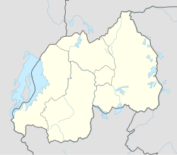
Butare
Location of Butare Airport in Rwanda
Placement on map is approximate
Runways
Direction LengthSurface
ftm
08/262,820860 Asphalt

Butare Airport is an airport in Butare, Rwanda. It is also known as Huye Airstrip.

Contents

Location

Butare Airport ( IATA : BTQ, ICAO : HRYI), is located in the city of Huye (formerly called Butare), in Huye District, Southern Province. Its location lies approximately 80 kilometres (50 mi), by air, south-west of Kigali International Airport, the country's largest civilian airport. [1] The geographic coordinates of this airport are:2° 35' 42.00"S, 29° 44' 24.00"E (Latitude:-2.59500; Longitude:29.74000).

Overview

Butare Airport is a small civilian airport that serves the town of Huye. It is one of the eight (8) airports that are administered by the Rwanda Civil Aviation Authority. [2] Butare Airport is situated 1,768 metres (5,801 ft) above sea level. [3] The airport has a single paved runway, which measures approximately 860 metres (2,820 ft) in length. [4] There is no terminal or any other building.

See also

References

  1. "Distance between Butare (Butare) and Kigali (Kigali) (Rwanda)". distancecalculator.globefeed.com. Retrieved 2018-08-21.
  2. "Airports". Rwanda Civil Aviation Authority. 2012-02-17. Archived from the original on 2012-02-17. Retrieved 2012-02-17.
  3. Elevation of Butare Airport
  4. "Butare Airport Code". Sulekha. 2013-02-03. Archived from the original on 2013-02-03. Retrieved 2013-02-03.