
Rangeli is a Municipality and rural market town in Morang District in the Koshi Zone of south-eastern Nepal. This municipality was formed merging existing four villages i.e.Amgachhi, Babiabirta, Darbesa and Rangeli itself since May 2014.

A Village Development Committee (VDC) in Nepal was the lower administrative part of its Ministry of Federal Affairs and Local Development. Each district had several VDCs, similar to municipalities but with greater public-government interaction and administration. There were 3,157 village development committees in Nepal. Each VDC was further divided into several wards depending on the population of the district, the average being nine wards.
Thokarpa is a village in Sindhupalchok District in the Bagmati Zone of central Nepal. At the time of the 2013 Nepal census it had a population of 6,243 and had 1,047 houses in it.
Lakshmanpur is a town in Banke District in the Bheri Zone of south-western Nepal. At the time of the 1991 Nepal census it had a population of 3,416 and had 668 houses in the town.
Naubasta is a town in Banke District in the Bheri Zone of south-western Nepal. At the time of the 1991 Nepal census it had a population of 11,160 and had 1663 houses in the town.
Lapu is a village development committee in Gorkha District in the Gandaki Zone of northern-central Nepal. At the time of the 1991 Nepal census, it had a population of 1,650 and had 362 houses in the village.
Taple (ताप्ले) is a village development committee in Gorkha District in the Gandaki Zone of northern-central Nepal. At the time of the 1991 Nepal census, it had a population of 4,398 and had 5000 houses in the town Hindu Muslim.
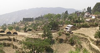
Mahadevsthan Mandan is a village development committee in Kavrepalanchok District in the Bagmati Zone of central Nepal.
Godamchaur is a village and former Village Development Committee that is now part of Godawari Municipality in Province No. 3 of central Nepal. At the time of the 1991 Nepal census it had a population of 3868 in 645 individual households. It has 9 small wards in this village development committee. Saathali is mostly inhabited by Newars.

Chulachuli is a rural municipality (gaunpalika) out of six rural municipality located in Ilam District of Province No. 1 of Nepal. There are a total of 10 municipalities in Ilam in which 4 are urban and 6 are rural.
Dhikurpokhari is a suburb and former Village Development Committee in Kaski District in the Gandaki Province of northern-central Nepal. At the time of the 1991 Nepal census it had a population of 7,392 persons living in 1,427 individual households.
Kakani is a Gaunpalika and former village development committee in Nuwakot District in Bagmati Pradesh of central Nepal. At the time of the 1991 Nepal census, the Kakani village development committee administered a population of 7816 living in 1343 individual households.

Bajung is a village development committee in Parbat District in the Dhawalagiri Zone of Western Development Region, Nepal. It is surrounded by Deupurkot to the north-east, Tilahar to the south-east, Durlung to the south-west and Kyang to the north-west. It is popularly said to be extended from the top of Maidan, a hill-top with historical identity to the basin of Modi River. At the time of the 2011 Nepal census it had a population of 4228 people living in 1,076 individual households.
[Gajarkot] is a village development committee in Tanahu District in the Gandaki Zone of central Nepal. At the time of the 1991 Nepal census it had a population of 5385 people living in 983 individual households. It contains 9 wards. Ward No.: 1 »» Kathekot, Ward No.: 2 »» Katahre, Ward No.: 3 »» Dumkot, Ward No.: 4&5 »» Putgau & Puttar, Ward No.: 6 »» Attrouli, Ward No.: 7 »» Baindi, Ward No.: 8 »» Gajarkot., & Ward No.: 9 »» Dumrebesi.
Doramba is a populated place and a ward of Doramba Rural Municipality. It was a village development committee before 10 March 2017. At the time of the 1991 Nepal census it had a population of 3640 people living in 664 individual households.
Katahariya is a municipality in Rautahat District in the Narayani Zone of south-eastern Nepal since September 2017. Before then, Katahariya was one of the Village Development Committees with 8 wards. At the time of the 1991 Nepal census, it had a population of 4,619 people living in 835 individual households. Katahariya is famous for its vegetables and cattle market. It has a well-maintained Farmers' market (vegetable) and Cattle (domestic-animal) market. Katahariya is a fast-growing VDC, with the main occupations of local people being business and farming.
Shivanagar was a village development committee in Chitwan District in the Narayani Zone of southern Nepal. At the time of the 1991 Nepal census it had a population of 6937 people living in 1314 individual households.
Pathari Shanishchare (पथरी-शनिश्चरे) is a Municipality in Morang District in the Koshi Zone of south-eastern Nepal. It was formed by merging three existing village development committees i.e. Hasandaha, Pathari and Sanischare in May 2014.

Sundar Haraicha is a municipality in Morang District of Province No. 1 in Nepal that was established on 10 March 2017 by merging the former municipalities Sundar Dulari and Koshi Haraicha. At the time of the 2011 Nepal census, the localities formed had a joint population of 80,518 people living in 18,610 individual households.
Bhojpur is a neighborhood in Bhojpur Municipality which is located in Bhojpur District in Province No. 1 of Nepal. The Bhojpur Village Panchayat was established in 1962 and was renamed as Bhojpur Village development committee in 1990.
