Rurata | |
---|---|
Physical characteristics | |
Mouth | |
• location | Kirundo Province |
• coordinates | 2°36′34″S30°03′48″E / 2.6094°S 30.0632°E |
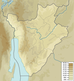
Rurata is a watercourse in Burundi. [1] It is located in Kirundo Province, in the northern part of the country, 120 kilometers northeast of the capital Bujumbura.
The surroundings around Rurata are a mosaic of farmland and natural vegetation. [2] The area around Rurata is densely populated, with 411 inhabitants per square kilometer. [3] A savannah climate prevails in the area. The average annual temperature in the area is 20 °C (68 °F). The warmest month is September, when the average temperature is 23 °C (73 °F), and the coldest is March, with 18 °C (64 °F). [4] Average annual rainfall is 1,170 millimetres (46 in). The wettest month is March, with an average of 178 millimetres (7.0 in) of precipitation, and the driest is July, with 1 millimetre (0.039 in) of precipitation. [5]
In February 2014 the Ministry of Agriculture and Livestock issued a call for international tenders for construction of a number of water works, including water supply works upstream of reservoir on arms of the Rurata and other rivers. [6] They called for tenders for construction of intake structures and regulators for the Rurata watercourse and others. [7]
In 2015 the RP64 Rurata-Ntega road was being rehabilitated by Paiosa, a Belgian Technical Cooperation program. [8]
In September 2018 it was reported that people were protesting about the way a bridge in the Rurata area was being rebuilt, more than three months after it was destroyed. The contract had been awarded without a call for tender, and the contractor was not qualified to do the job. The bridge is on the Bujumbura–Kirundo national road RN14. It is in Rurata, 5 kilometers from the road junction which goes to the Ntega commune and that which goes to the capital of the Kirundo commune. [9]
In November 2021 Cyriaque Nshimirimana, Second Deputy-Speaker of the Senate of Burundi, who represented the Kirundo constituency, met leaders of the province in the capital of the Commune of Ntega. His audience included heads of provincial and municipal services, colline chiefs, leaders of the Sangwe cooperatives and religious leaders. Concerns raised by the audience included the need to repair the Rurata–Ntega road. [10]
Kirundo Province is one of the eighteen provinces of Burundi, in north of the country bordering Rwanda. The economy is mostly based on agriculture, with a dispersed population and few sizable communities. Before 1970 large parts of the province were forested. Migrants from the south then cleared much of the vegetation to create agricultural land, and Kirundo became the breadbasket of Burundi. The civil war from 1993 to 2005 caused agricultural output to drop by more than half. Sice then, lack of farm inputs, poor infrastructure and shortages of water have caused widespread poverty.
The Van Daalen River is a river of Western New Guinea in Puncak Jaya and Puncak, Central Papua, Indonesia. It is a tributary of Tariku River.
The Sadang is a river of Sulawesi in South Sulawesi province, Indonesia. It is one of the major rivers which flow into the Strait of Macassar.
The Telen River is a river in East Kalimantan, Borneo island, Indonesia, about 110 kilometers north of the provincial capital Samarinda. It is a tributary of the Mahakam River.
Berau River is a river of East Kalimantan, Indonesia, about 300 kilometers north of the provincial capital Samarinda. Tributaries include the Kelai River.
The Kelai River is a river of Borneo, in the province of East Kalimantan, Indonesia, about 300 kilometers (190 mi) north of the provincial capital Samarinda. It is a tributary of the Berau River.
Gadis River is a river in northern Sumatra, Indonesia.
Peureulak River is a river in the province of Aceh, northern Sumatra, Indonesia, about 1,600 km northwest of the capital Jakarta.
Tembesi River is a river in Jambi province, Sumatra island, Indonesia, about 600 km northwest of the capital Jakarta. It is a tributary of the Batang Hari River. Tributaries include the Merangin River.
The commune of Bugabira is a commune of Kirundo Province in northern Burundi. The capital is Bugabira. There are health centers at Muyange and Ruhehe.
Peusangan River is a river in northern Sumatra, Indonesia, about 1,700 km northwest of the capital Jakarta.
Lake Quatre Lieues is a lake in the province of Quebec, Canada. It is set in a wilderness area and may be used for relaxation, fishing or hunting.
Koromilia is a village in the Kilkis region of Greece. It is situated in the municipal unit of Cherso, in the Kilkis municipality, within the Kilkis region of Central Macedonia.
Changchun (长春镇) is a town in Xiapu County, Fujian.
Shuimen She Ethnic Township (水门畲族乡) is a township in Xiapu County, Fujian, China.
Kabanga is a village and a colline in the Commune of Busoni, Kirundo Province, Burundi.
Ntega is a large village, the seat of the Commune of Ntega, Kirundo Province in the north of Burundi.
Nyavyamo Marsh is a marsh in the west of Kirundo Province, Burundi. Although parts are protected, it is mainly used for rice production.
Nunga Marsh is a marsh in the Commune of Ntega, in Kirundo Province, Burundi.
The Natural regions of Burundi are geographical subdivisions of Burundi that date to colonial times. They can be broadly grouped into the Plain zone in the west beside Lake Tanganyika and the East African Rift valley, the Congo-Nile ridge, the Central Plateaus and the Depressions to the north, east and south of the plateaus.