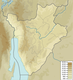
Kirundo Province is one of the eighteen provinces of Burundi, in north of the country bordering Rwanda. The economy is mostly based on agriculture, with a dispersed population and few sizable communities. Before 1970 large parts of the province were forested. Migrants from the south then cleared much of the vegetation to create agricultural land, and Kirundo became the breadbasket of Burundi. The civil war from 1993 to 2005 caused agricultural output to drop by more than half. Sice then, lack of farm inputs, poor infrastructure and shortages of water have caused widespread poverty.

The provinces of Burundi are subdivided into 119 communes. The communes are further subdivided into collines.
The commune of Bugabira is a commune of Kirundo Province in northern Burundi. The capital is Bugabira. There are health centers at Muyange and Ruhehe.
Busoni is a commune of Kirundo Province in northern Burundi. The seat lies at Busoni.
The Commune of Bwambarangwe is a commune of Kirundo Province in northern Burundi.
The Commune of Gitobe is a commune of Kirundo Province in northern Burundi.

The Commune of Kirundo is a commune of Kirundo Province in northern Burundi.
The Commune of Vumbi is a commune of Kirundo Province in northern Burundi.
Lake Mwungere is a lake in the Kirundo Province of Burundi.
The Murehe Forest is an area of forest in the north of the Kirundo Province of Burundi. It is protected by the Murehe Reserve, part of the Lacs du Nord Aquatic Landscape.
Lake Narungazi, or Lake Narugazi, Lake Narunganzi, is a lake in the Commune of Ntega in Kirundo Province of Burundi.

The Protected Aquatic Landscape of the North, also called the Northern Protected Waterway or Northern Protected Waterscape, is a protected area in Kirundo Province, Burundi. It covers eight lakes in the north of the province, and a forest. It was designated Ramsar site no. 2149 in March 2014.
Lake Kanzigiri is a lake in the Kirundo Province of Burundi.

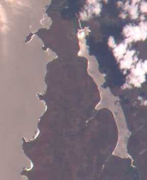
Lake Rwihinda, also known as the Lac aux Oiseaux is a lake in the Kirundo Province of Burundi. It is home to diverse migratory birds, which are the main tourist attraction in the region. However, despite being protected, it is under threat from encroaching agriculture in this very poor region.
Kabanga is a village and a colline in the Commune of Busoni, Kirundo Province, Burundi.
Lake Gitamo, or Lake Nagitamo is a lake in the Kirundo Province of Burundi.
Lake Gacamirindi, or Lake Gacamirinda, is a lake in the Kirundo Province of Burundi.
Rurata is a watercourse in Burundi. It is located in Kirundo Province, in the northern part of the country, 120 kilometers northeast of the capital Bujumbura.
Ntega is a large village, the seat of the Commune of Ntega, Kirundo Province in the north of Burundi.
Mugendo is a village in the Commune of Ntega, Kirundo Province in the north of Burundi.