Ashley County is a rural South Arkansas county with a culture, economy, and history based on timber and agriculture. Created as Arkansas's 52nd county on November 30, 1848, Ashley County has seven incorporated municipalities, including Hamburg, the county seat and Crossett, the most populous city. The county is also the site of numerous unincorporated communities and ghost towns. The county is named for Chester Ashley, a prominent lawyer in the Arkansas Territory and U.S. senator from the state from 1844 to 1848.
Nathaniel Mountain Wildlife Management Area is located on 10,675 acres (43.20 km2) south of Romney in Hampshire County, West Virginia. The wildlife management area's principle access road is off Grassy Lick Road. Nathaniel Mountain is owned by the West Virginia Division of Natural Resources (WVDNR), and is one of West Virginia's largest wildlife management areas. The WMA was expanded in November 2003 after the WVDNR purchased 1,800 acres (7.3 km2) from the MeadWestvaco Corporation.

New York State Wildlife Management Areas (WMAs) are conservation areas managed by the New York State Department of Environmental Conservation (NYSDEC) primarily for the benefit of wildlife, and used extensively by the public for hunting, fishing, and trapping. As of 2016, the NYSDEC owns and maintains 113 WMAs, with a total area of approximately 197,000 acres. The Wildlife Management Areas program is administered by the Division of Fish, Wildlife and Marine Resources of the NYSDEC.
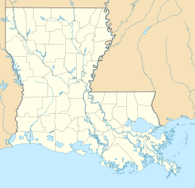
Loggy Bayou is a 17.3-mile-long (27.8 km) stream in northwestern Louisiana which connects Lake Bistineau with the Red River. Bistineau is the reservoir of Dorcheat Bayou, which flows 115 miles (185 km) southward from Nevada County, Arkansas, into Webster Parish. Loggy Bayou flows through south Bossier Parish, west of Ringgold, in a southerly direction through Bienville Parish, and into Red River Parish, where north of Coushatta it joins the Red River, a tributary of the Mississippi. At East Point, LA, the river has a mean annual discharge of 1,960 cubic feet per second.
The Sherburne Complex is a joint land management venture of the U.S. Fish and Wildlife Service, the Louisiana Department of Wildlife and Fisheries (LDWF), and the U.S. Army Corps of Engineers that began in 1983. The area consists of 44,000 acres (180 km2), and is managed by the Louisiana Department of Wildlife and Fisheries. The complex is located in the Morganza Flood way system of the Atchafalaya Basin about 30 miles (48 km) west of Baton Rouge, Louisiana and actually extends a little south of the I-10 Atchafalaya Basin Bridge at Whiskey Bay, Louisiana. The bridge crosses the Whiskey Bay Pilot Channel. Located on the graveled LA 975, the west boundary is on the east side of the Atchafalaya River with the east boundary being the East Protection Levee. The complex stretches just north of old highway 190, and a short distance to the south of I-10. The nearest town is Krotz Springs to the north off US 190.

Short Hills Wildlife Management Area is a 4,232-acre (17.13 km2) Wildlife Management Area (WMA) located in Rockbridge and Botetourt counties, Virginia. It covers approximately 10 miles (16 km) of ridgeline along the Short Hills range.

Mattaponi Wildlife Management Area is a 2,542-acre (10.29 km2) Wildlife Management Area (WMA) in Caroline County, Virginia. Located west of Bowling Green, the area protects a mixture of wetlands and upland forests at the confluence of the Mattaponi and South rivers.

Big Woods Wildlife Management Area is a 4,173-acre (16.89 km2) Wildlife Management Area (WMA) in Sussex County, Virginia. It comprises two tracts of land; the 2,208-acre (8.94 km2) main tract, located immediately adjacent Big Woods State Forest, and the 1,965-acre (7.95 km2) Parker's Branch tract, located nearby.
Elm Hall Wildlife Management Area is a 2,839 acre protected area in Assumption Parish Louisiana. The WMA is located five miles west of Napoleonville, with Lake Verret on the western border, farmland to the east, and is managed by the Louisiana Department of Wildlife and Fisheries (LDWF).
Clear Creek Wildlife Management Area is a 54,269-acre tract of protected area located in Vernon Parish, Louisiana. The Louisiana Department of Wildlife and Fisheries (LDWF) leases the land from Hancock Timber.
Dewey W. Wills Wildlife Management Area, also just called Dewey Wills Wildlife Management Area and formally known as the Saline Wildlife Management area, is a 63,901-acre tract of protected area located in LaSalle Parish, Catahoula Parish, and Rapides parish, in Central Louisiana. The Louisiana Department of Wildlife and Fisheries (LDWF) owns 63,901 acres, the LaSalle Parish School Board owns 1530 acres, and the U.S. Army Corps of Engineers (USCOE) owns 265 acres, managed by the LDWF.
The Richard K. Yancey Wildlife Management Area, formerly the Red River/Three Rivers Wildlife Management Area, is a 69,806-acre tract of protected area in lower Concordia Parish Louisiana. The area is owned by the Louisiana Department of Wildlife and Fisheries and the U.S. Army Corps of Engineers (USACOE). The WMA is located off LA 15 approximately 35 miles (56 km) south of Ferriday between the Red River and the Mississippi River.
Biloxi Wildlife Management Area also referred to as Biloxi WMA, is a 42,747 acre privately owned tract of protected marsh land located in St. Bernard Parish, Louisiana, managed by the Louisiana Department of Wildlife and Fisheries (LDWF). The land is owned by Biloxi Marsh Lands Corporation, owning approximately 90,000 acres (36,000 ha) of land in St. Bernard Parish, that started leasing land to the LDWF as early as 1957. Access is limited to boats as there are no roads in the WMA. The nearest road access is LA 46 to Shell Beach or LA 624 to Hopedale.
Peason Ridge Wildlife Management Area, also referred to as Peason Ridge WMA, is a 74,309-acre tract of protected area located in the Parishes of Natchitoches, Sabine, and Vernon, in the state of Louisiana. The WMA is managed by the Louisiana Department of Wildlife and Fisheries (LDWF).
Salvador Wildlife Management Area is a protected area in St. Charles Parish Louisiana covering a combined total of over 36,000 acres (15,000 ha). The WMA is located 11 miles (18 km) south of New Orleans, Louisiana, and provides habitat for many species of animal and plant life with hunting, fishing, and boating as the predominant activities. Commercial fishing or harvesting is not allowed.
Joyce Wildlife Management Area is a 34,520 acres (13,970 ha) protected area in Tangipahoa Parish, Louisiana, owned by the Louisiana Department of Wildlife and Fisheries. It is located 10 miles (16 km) south of Hammond and features a boardwalk leading into the swamps on the northwest corner.
Big Lake Wildlife Management Area, (WMA) also referred to as Big Lake State WMA, is a 19,231 acres (7,783 ha) tract of protected land located in Franklin, Tensas, and Madison Parish, Louisiana, owned and managed by the Louisiana Department of Wildlife and Fisheries (LDWF).
Bodcau Wildlife Management Area also referred to as Bodcau WMA, is a 34,355-acre tract of protected land located in Bossier and Webster Parish, Louisiana. The land is owned by the U.S. Army Corps of Engineers and managed under long-term lease by the Louisiana Department of Wildlife and Fisheries (LDWF).
J. C. "Sonny" Gilbert Wildlife Management Area is a 7,524-acre (3,045 ha) wildlife management area in Catahoula, Parish, Louisiana, owned by the Louisiana Department of Wildlife and Fisheries. It is located 6 miles (9.7 km) miles west of Sicily Island. The area contains the 17 ft (5.2 m) high Rock Falls, one of the tallest waterfalls in the state.