
North Willoughby is a suburb on the Lower North Shore of Sydney, in the state of New South Wales, Australia 9 kilometres north of the Sydney central business district, in the local government area of the City of Willoughby. Willoughby and Willoughby East are separate suburbs.
Route 695 is a local highway located in south central New Brunswick. It begins in the south at Route 124 in Springfield and runs for 35.2 kilometres (21.9 mi), through Arcadia, to its northern terminus in Jemseg at Route 105.

A Bee Card is a ROM cartridge developed by Hudson Soft as a software distribution medium for MSX computers. Bee Cards are approximately the size of a credit card but thicker. Compared to most game cartridges, the Bee Card is small and compact. Bee Cards were released in Japan and Europe but not North America because the MSX was unsuccessful. However, Atari Corporation adopted the Bee Card for the Atari Portfolio, a handheld PC released in 1989 in North America. Some Korg Synthesizers and workstations also used Bee Cards as external storage of user content like sound programs or song data. Even though these systems all use Bee Cards, they are incompatible.
Kolenchery is a small town in the Poothrikka gram panchayat in Ernakulam district, Kerala.
Hughes Road is an arterial road in South Mumbai linking Opera House with Kemps Corner. It is flanked by Hanging Gardens of Mumbai and the Towers of Silence on one side and the Porsche showroom, Augustus Villa 21 Hughes road, New Era School, RTI and Westside on the other. It is close to the Arabian Sea with Navi Mumbai, Uran, and Mira-Bhayandar being nearby cities.

The National Liberation Movement was a Guatemalan political party formed in 1954 by Carlos Castillo Armas. The party served as political platform for the military junta.
Rhaptopetalum geophylax is a species of plant in the family Lecythidaceae. It is endemic to Cameroon. Its natural habitat is subtropical or tropical moist lowland forests. It is threatened by habitat loss.
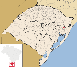
Igrejinha is a municipality located in the metropolitan area of Porto Alegre, in the state of Rio Grande do Sul, Brazil. Home to the Morro Alto da Pedra and the regional park Parque Alto da Pedra. The city has approximately 37,000 inhabitants and sits about 82 km from the capital city of the state, Porto Alegre.
The Festihorn is a mountain of the Swiss Pennine Alps, located west of St. Niklaus in the canton of Valais. It lies on the range south of the Jungtal, between the Sparruhorn and the Wasuhorn.
Hadwala Gujaran is a village in the Islamabad Capital Territory of Pakistan. It is located at 33° 26' 35N 73° 17' 45E with an altitude of 520 metres (1,710 ft).
Majiwada is a premium and upmarket locality in Thane city of Maharashtra state in India. It's nearly 4.5 kilometers from Thane railway station. Majiwada is strategically located in Thane along the Mumbai Nagpur Expressway.
Ramachandrapura is a small village and neighbourhood located in the outskirts of India's fifth-largest metropolitan area, Bangalore. It is accessible through Doddabommasandra and Jalahalli and Main Ramachandrapura Mutt was located in Hosanagar Shivamogga Dist. Many Indian cattle are present and they nursed well. Google Maps [[13.8652734, 75.0757448 ]].Ramachandrapura Karnataka 577418 https://www.google.com/maps/place/Ramachandrapura,+Karnataka+577418/@13.8701551,75.0794001,13z/data=!4m2!3m1!1s0x3bbb83cb6f51aaab:0x3234a01eb72ffed[[https://maps.app.goo.gl/YmDW9wQBV2wRPnPY6]]
Girka is a village in Kaita Local Government Katsina State, Nigeria.
Ifenat is a town in the Batha Region of Chad.
Ngathaingchaung or Ngathainggyaung and sometimes Nga-thaing Chaung and Ngatheingkhyonng is a town and sub-township in Yegyi Township, Pathein District of Ayeyarwady Region in Myanmar. The GMT time is +6.5 hours.

Panjgirain is a town of Darya Khan Tehsil, Bhakkar District, Punjab, Pakistan. It is also the headquarters of union council Punjgirain. It is located on Darya Khan Kalur Kot Road. There is a basic health unit (BHU) and Govt. High School for boys and girls here. A Panj Girain railway station is also on Multan Kundian railway track section.

Graydon or sometimes referred to as Graydon Hall is a neighbourhood in the city of Toronto, Ontario, Canada. It is located just south of Ontario Highway 401, West of a nearby neighborhood called Parkwoods, North of York Mills Road and west of the Don Valley Parkway.

Dokota is a small town located in Mailsi Tehsil in the Vehari District of Punjab, Pakistan.
SGPTA PU College is a pre-university college in Bangalore, Karnataka, India. It is affiliated to Karnataka Pre-University Education Board. It is located in APK Road, Thyagaraja Nagar
"Wide Open Road" is a song written by Johnny Cash. It became the first song he recorded for Sun Records.
