Rutshuru Airport | |||||||||||
---|---|---|---|---|---|---|---|---|---|---|---|
Summary | |||||||||||
Airport type | Public | ||||||||||
Serves | Rutshuru | ||||||||||
Elevation AMSL | 3,707 ft / 1,130 m | ||||||||||
Coordinates | 1°09′45″S29°25′47″E / 1.16250°S 29.42972°E Coordinates: 1°09′45″S29°25′47″E / 1.16250°S 29.42972°E | ||||||||||
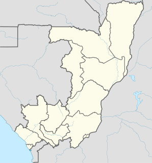
Map | |||||||||||
Runways | |||||||||||
| |||||||||||
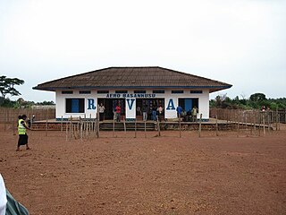
Rutshuru Airport( ICAO : FZNC) is an airport serving the town of Rutshuru in Democratic Republic of the Congo. The runway is 3 kilometres (2 mi) northwest of Rutshuru in the town of Kiwanja. [1]
The ICAOairport code or location indicator is a four-letter code designating aerodromes around the world. These codes, as defined by the International Civil Aviation Organization and published in ICAO Document 7910: Location Indicators, are used by air traffic control and airline operations such as flight planning.
Rutshuru, sometimes called Rushuru, is a town located in the North Kivu province of the eastern Democratic Republic of the Congo, and is headquarters of an administrative district, the Rutshuru Territory. The town lies in the western branch of the Albertine Rift between Lakes Edward and Kivu. The Ugandan border is 15 km east and the Rwandan border is 30 km south-east. Lava flows from the Nyamuragira volcano, 40 km south-west, have come within 7 km of the town in recent years.
The Democratic Republic of the Congo, also known as DR Congo, the DRC, DROC, Congo-Kinshasa, or simply the Congo, is a country located in Central Africa. It is sometimes anachronistically referred to by its former name of Zaire, which was its official name between 1971 and 1997. It is, by area, the largest country in Sub-Saharan Africa, the second-largest in all of Africa, and the 11th-largest in the world. With a population of over 78 million, the Democratic Republic of the Congo is the most populated officially Francophone country, the fourth-most-populated country in Africa, and the 16th-most-populated country in the world.
Ground transport in the Democratic Republic of Congo (DRC) has always been difficult. The terrain and climate of the Congo Basin present serious barriers to road and rail construction, and the distances are enormous across this vast country. Furthermore, chronic economic mismanagement and internal conflict has led to serious under-investment over many years.
Gemena Airport is an airport serving Gemena, the capital of the Sud-Ubangi District in Sud-Ubangi province in the Democratic Republic of the Congo.
Matari Airport is an airport serving Isiro, a city in the Orientale Province of the Democratic Republic of the Congo. The airport is 6 kilometres (3.7 mi) northwest of the city.
Kindu Airport is an airport serving the Lualaba River port of Kindu, Democratic Republic of the Congo.
Kananga Airport is an airport serving Kananga, Democratic Republic of the Congo.
Basankusu Airstrip is an airport serving Basankusu, a city on the Lulonga River in Équateur Province, Democratic Republic of the Congo.
Kolwezi Airport is an airport serving Kolwezi, the capital of Lualaba District in the Democratic Republic of the Congo. The airport is 6 kilometres (3.7 mi) south of Kolwezi.
Tshikapa Airport is an airport serving Tshikapa in Kasai-Occidental Province, Democratic Republic of the Congo.
Basango Mboliasa Airport serves the town of Kiri in Bandundu Province, Democratic Republic of the Congo.
Bunia Airport is an airport serving Bunia, a city in Orientale Province, Democratic Republic of the Congo.
Kalemie Airport is an airport serving Kalemie in Tanganyika Province and on Lake Tanganyika, in the southeastern Democratic Republic of the Congo.
N'Dolo Airport, also known as Ndolo Airport, is a secondary airport in the city of Kinshasa, Democratic Republic of the Congo, located in the commune of Barumbu near the city center.
Bétou Airport is an airport within the town of Bétou in the Likouala Department, Republic of the Congo. The runway also serves as part of the road leading westward out of town.
Beni Airport is an airport serving the city of Beni in Nord-Kivu Province, Democratic Republic of the Congo. The airport in 8 kilometres (5.0 mi) north of Beni, by the town of Mavivi.
Boende Airport is an airport serving the town of Boende in Tshuapa Province, Democratic Republic of the Congo.
Rutshuru Hydroelectric Power Station, also referred to as Rutshuru Hydropower Station, is a 13.8-megawatt (18,500 hp) hydroelectric power station under construction in the Democratic Republic of the Congo. The plant was finished in December 16, 2015.
Ikela Airport is an airport serving the market town of Ikela in Tshuapa Province, Democratic Republic of the Congo.
Ishasha Airport is an airport serving Ishasha, a town in the North Kivu Province of Democratic Republic of the Congo.
Kabalo Airport is an airport serving the town of Kabalo, in the Tanganyika Province of Democratic Republic of the Congo.
Tunta Airport is an airport serving the town of Kabinda, Kasai-Oriental Province, Democratic Republic of the Congo.
Vanga Airport is an airport serving the town of Vanga in Bandundu Province, Democratic Republic of the Congo.
The Aviation Safety Network (ASN) is a website that keeps track of aviation accidents, incidents, and hijackings. Their database contains details of over 10,700 reports. The ASN includes an aviation database with aviation investigations, news, photos, and statistics.
This article about an airport in the Democratic Republic of the Congo is a stub. You can help Wikipedia by expanding it. |