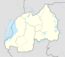
Rwanda, officially the Republic of Rwanda, is a landlocked country in the Great Rift Valley of East Africa, where the African Great Lakes region and Southeast Africa converge. Located a few degrees south of the Equator, Rwanda is bordered by Uganda, Tanzania, Burundi, and the Democratic Republic of the Congo. It is highly elevated, giving it the sobriquet "land of a thousand hills", with its geography dominated by mountains in the west and savanna to the southeast, with numerous lakes throughout the country. The climate is temperate to subtropical, with two rainy seasons and two dry seasons each year. It is the most densely populated mainland African country; among countries larger than 10,000 km2, it is the fifth-most densely populated country in the world. Its capital and largest city is Kigali.

Kigali is the capital and largest city of Rwanda. It is near the nation's geographic centre in a region of rolling hills, with a series of valleys and ridges joined by steep slopes. As a primate city, Kigali is a relatively new city. It has been Rwanda's economic, cultural, and transport hub since it was founded as an administrative outpost in 1907, and became the capital of the country at independence in 1962, shifting focus away from Huye.

Bugesera is a district (akarere) in Eastern Province, Rwanda. Its capital is Nyamata. The district is named after the old Kingdom of Bugesera.

Gasabo is a district (akarere) in Kigali city, the capital of Rwanda. The headquarter of Gasabo is located in Remera Sector. The district also includes large areas of the city itself, including Kacyiru, Kimironko, Remera, Nyarutarama and Kimihurura.

Kicukiro District is one of the three Districts which constitute the City of Kigali and is situated in the South-East of the City of Kigali. Is a district (akarere) located in Kigali Province, Rwanda. Kicukiro is home to a thriving market, a number of NGOs(Non-Government Organizations) and the Bralirwa Brewery. In addition, it is the headquarters for the Friends Church in Rwanda. Kicukiro District is also home to two major memorial sites associated with the Rwandan genocide. These are the Rebero Genocide Memorial Site where 14,400 victims are buried, and the Nyanza Genocide Memorial Site where 5,000 victims were killed after Belgian soldiers who were serving in the United Nations peacekeeping forces abandoned them.

Nyarugenge is a district (akarere) in Kigali Province, Rwanda. Its heart is the city centre of Kigali, and contains most of the city's businesses.

Rubavu District is one of the seven districts (akarere) in Western Province, Rwanda, with a total surface area of 388.4 km2. Its capital is Gisenyi, a large beach resort and border city. The Rubavu Urban area, which includes Gisenyi, Rugerero and other nearby localities, had a 2012 population of 149,209, the second most populous urban area in Rwanda.

Nyarugenge is a sector (umurenge) located in Nyarugenge District, Kigali Province, Rwanda.

Bank of Kigali (BK) is a commercial bank in Rwanda. It is licensed by the National Bank of Rwanda.

I&M Bank Rwanda Plc., is a commercial bank in Rwanda that is licensed by the National central Bank of Rwanda(central bank). It is the second largest bank in Rwanda.
Lycée de Kigali (LDK) is a secondary school in Kiyovu Cell, Nyarugenge Sector, Nyarugenge District, Kigali, Rwanda. It has A Level and O Level tracks. In 1974 the French government established the school, and it opened officially in 1975 and the Rwandan government took charge of the school in 1982. Lycée de Kigali celebrated 40 years of its existence on Friday July 31, 2015.
Jeanne d'Arc Debonheur is a Rwandan lawyer and politician who has been the Rwandan Cabinet Minister of Refugees and Disaster Management since 30 August 2017.

Mount Kigali or Mont Kigali in French, is a hill in Kigali City, Rwanda, after which the city was named. Mount Kigali is located directly West of the city center in Nyarugenge District. The majority of Nyarugenge District is located on the slopes of Mount Kigali. The western slopes of Mount Kigali end in the valley of the river Nyabarongo. At a height of 1,853 metres (6,079 ft), along with the taller Mont Jali at 2,078 metres (6,818 ft) directly to its North, it dominates over other hills in the city as they rise between 1300 and 1600 m. As a result, Mount Kigali offers expansive views of the entire city of Kigali to the east and north, the Southern Province to the west and south, and the Eastern Province to the east and south.
Nduwimana Jean Paul, commonly known as Noopja (; born August 7, 1983 in Nyarugenge, Rwanda, to Daniel Baranzira and Therese Mukamazimpaka, is a Rwandan recording artist, entrepreneur, writer and founder of record label called Country Records. Noopja is the founder of East African leading recording studio 'Country Records', the founder of Rwandan radio station 105.7 FM Country FM and director of 'Necessary Generation', a local non-governmental organization that helps vulnerable youth from different corners of Rwanda.
Mageragere Prison, officially Nyarugenge Correctional Facility, is a correctional facility located in Nyarugenge District, Kigali, Rwanda. Established in September 2016, Mageragere is the largest prison in Rwanda. As of August 2023, Mageragere houses approximately 9,000 inmates.
Mageragere is a sector (umurenge) in the Nyarugenge District of Kigali Province, Rwanda It is located in the west part of the city of Kigali.
Nyakabanda is a sector in the Nyarugenge District of Kigali Province, Rwanda. It is located in the south west part of the city of Kigali.
Kimisagara is a sector (umurenge) in the Nyarugenge District of Kigali Province, Rwanda. It is located in the southwest part of the city of Kigali.
Muhima is a sector (umurenge) in the Kigali Province, Nyarugenge district, Rwanda. It is located in the west part of the city of Kigali.
Kigali is a sector (umurenge) in Kigali, Nyarugenge district, Rwanda. It is located in the west part of the city of Kigali.


