The topic of this article may not meet Wikipedia's notability guideline for geographic features .(April 2024) |
Kigali | |
|---|---|
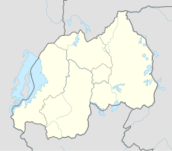 Location in Rwanda | |
| Coordinates: 1°56′59″S30°3′31″E / 1.94972°S 30.05861°E | |
| Country | |
| Province | City of Kigali |
| District | Nyarugenge |
| Area | |
• Total | 29.38 km2 (11.34 sq mi) |
| Elevation | 1,444 m (4,738 ft) |
| Population (2022 census) | |
• Total | 61,499 |
| • Density | 2,093/km2 (5,421/sq mi) |
| (2022 census) | |
| Time zone | UTC+2 (CAT) |
| • Summer (DST) | UTC+2 (not observed) |
Kigali is a sector (umurenge) in Nyarugenge District, Kigali City, Rwanda. It is located in the west part of the city of Kigali City. [1]