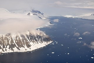
Reclus Peninsula is a 7 nautical miles peninsula on the west coast of Graham Land, Antarctica. It borders Charlotte Bay to its east.
Mikkelsen Bay is a bay, 15 nautical miles wide at its mouth and indenting 10 nautical miles, entered between Bertrand Ice Piedmont and Cape Berteaux along the west coast of Graham Land, Antarctica.
Northeast Glacier is a steep, heavily crevassed glacier, 13 nautical miles long and 5 nautical miles wide at its mouth, which flows from McLeod Hill westward and then south-westwards into Marguerite Bay between the Debenham Islands and Roman Four Promontory, on the west coast of Graham Land, Antarctica.
Neny Fjord is a bay, 10 nautical miles long in an east–west direction and 5 nautical miles wide, between Red Rock Ridge and Roman Four Promontory on the west coast of Graham Land, Antarctica.

Arrowsmith Peninsula is a cape about 40 miles (64 km) long on the west coast of Graham Land, west of Forel Glacier, Sharp Glacier and Lallemand Fjord, and northwest of Bourgeois Fjord, with Hanusse Bay lying to the northwest. It was surveyed by the Falkland Islands Dependencies Survey (FIDS) in 1955-58 and named for Edwin Porter Arrowsmith, Governor of the Falkland Islands.

Shoesmith Glacier is the largest glacier on Horseshoe Island, flowing westward into both Lystad Bay and Gaul Cove. Named by United Kingdom Antarctic Place-Names Committee (UK-APC) in 1958 in association with Horseshoe Island.
The Tabarin Peninsula is a peninsula 15 nautical miles long and 5 to 12 nautical miles wide, lying south of the trough between Hope Bay and Duse Bay and forming the east extremity of Trinity Peninsula in the Antarctic Peninsula.
Casey Inlet is an ice-filled inlet at the terminus of Casey Glacier, between Miller Point and Cape Walcott, on the east coast of Palmer Land, Antarctica.
Cugnot Ice Piedmont is an ice piedmont in Trinity Peninsula, Antarctica. It is about 15 nautical miles long and between 3 and 6 nautical miles wide, extending from Russell East Glacier to Eyrie Bay and bounded on the landward side by Louis Philippe Plateau.

Stonehouse Bay is a bay in Antarctica on the west side of Laubeuf Fjord, indenting the east coast of Adelaide Island between Hunt Peak and Sighing Peak. The bay is 5 nautical miles (9 km) wide. It was first sighted and surveyed in January 1909 by the French Antarctic Expedition under Jean-Baptiste Charcot. The bay was named for Bernard Stonehouse of the Falkland Islands Dependencies Survey (FIDS), a meteorologist in 1947-48 and biologist in 1949 at Stonington Island and leader of the FIDS sledge party which resurveyed the bay in 1948.
Stride Peak is a peak rising to 675 m at the head of Dalgliesh Bay, Pourquoi Pas Island, in Marguerite Bay. Named by United Kingdom Antarctic Place-Names Committee (UK-APC) in 1979 after Geoffrey A. Stride (1927–58), Falkland Islands Dependencies Survey (FIDS) diesel mechanic, Horseshoe Island, 1958, who, with S.E. Black and D. Statham, was lost between Dion Islands and Horseshoe Island in May 1958, in a breakup of the sea ice.
Penitent Peak is a peak between Mount Breaker and Ryan Peak on Horseshoe Island. Surveyed by Falkland Islands Dependencies Survey (FIDS) in 1955-57 and so named because of the snow penitents which are a characteristic feature in the vicinity of the peak.
Green Glacier is a glacier on the east side of Graham Land, Antarctica, 15 nautical miles (28 km) long and 4 nautical miles (7 km) wide, flowing from the plateau northeast between Dugerjav Peak and Rugate Ridge, and then east into Vaughan Inlet next north of Pirne Peak and south of the terminus of Hektoria Glacier.
Hunt Peak is a triangular rock peak, 610 metres (2,000 ft) high, marking the north side of the entrance to Stonehouse Bay on the east coast of Adelaide Island, Antarctica. It was discovered and first roughly surveyed in 1909 by the French Antarctic Expedition under Jean-Baptiste Charcot. It was resurveyed in 1948 by the Falkland Islands Dependencies Survey (FIDS), who named the point marked by this peak for Sergeant Kenneth D. Hunt, a mechanic for the expedition's Noorduyn Norseman airplane in 1950. Further survey in 1957–58 by the FIDS showed no definable point in the vicinity and the name was transferred to the peak.
Statham Peak is a prominent pointed peak rising to 1,170 m at the southwest end of Perplex Ridge, Pourquoi Pas Island, in northeast Marguerite Bay. Named by United Kingdom Antarctic Place-Names Committee (UK-APC) in 1979 after David Statham (1938–58), Falkland Islands Dependencies Survey (FIDS) meteorological assistant, Signy Island, 1957–58, and Horseshoe Island, 1958, who was lost with G.A. Stride and S.E. Black when the sea ice between Horseshoe Island and Dion Islands broke up during a sledge journey, May 1958.

Mount Searle is a peak between Sally and Gaul Coves on Horseshoe Island. Named for Derek J.H. Searle of Falkland Islands Dependencies Survey (FIDS), surveyor at Horseshoe Island in 1955 and 1956, who surveyed this feature.
Hoskins Peak is a peak 3 nautical miles (6 km) west of Contact Peak in southern Pourquoi Pas Island, Graham Land, Antarctica. It was mapped by the Falkland Islands Dependencies Survey (FIDS) from surveys, 1956–59, and named by the UK Antarctic Place-Names Committee for Arthur K. Hoskins, a FIDS geologist at Stonington Island in 1958 and Horseshoe Island in 1959.

Russet Pikes are Antarctic peaks just east of the mouth of Gaul Cove on Horseshoe Island. Surveyed by Falkland Islands Dependencies Survey (FIDS) in 1955–57. The name is descriptive; reddish-brown colour is visible on the feature most of the year, the slopes being too steep to retain snow cover for any length of time.

Reluctant Island is a small island off eastern Horseshoe Island. Surveyed by Falkland Islands Dependencies Survey (FIDS) in 1955–57. So named because of the feature's apparent reluctance to be recognized as an island; it did not appear on maps of the British Graham Land Expedition (BGLE) 1934–37 and was mapped as a peninsula by FIDS in 1948–50.

The Ryder Bay Islands Important Bird Area is a 520 ha designated site on the south-east coast of Adelaide Island, Antarctica. It has been identified as an Important Bird Area (IBA) by BirdLife International because it supports significant numbers of breeding seabirds, notably south polar skuas. The site encompasses the Léonie Islands lying at the mouth of Ryder Bay, as well as Rothera Point, the eastern headland of the bay.
![]() This article incorporates public domain material from "Ryan Peak (Antarctica)". Geographic Names Information System . United States Geological Survey.
This article incorporates public domain material from "Ryan Peak (Antarctica)". Geographic Names Information System . United States Geological Survey. 


