Related Research Articles

Hydrology is the scientific study of the movement, distribution, and management of water on Earth and other planets, including the water cycle, water resources, and environmental watershed sustainability. A practitioner of hydrology is called a hydrologist. Hydrologists are scientists studying earth or environmental science, civil or environmental engineering, and physical geography. Using various analytical methods and scientific techniques, they collect and analyze data to help solve water related problems such as environmental preservation, natural disasters, and water management.

Evapotranspiration (ET) is a term used to refer to the combined processes by which water moves from the earth’s surface into the atmosphere. It covers both water evaporation and transpiration. Evapotranspiration is an important part of the local water cycle and climate, as well as measurement of it plays a key role in agricultural irrigation and water resource management.

The Landsat program is the longest-running enterprise for acquisition of satellite imagery of Earth. It is a joint NASA / USGS program. On 23 July 1972, the Earth Resources Technology Satellite was launched. This was eventually renamed to Landsat 1 in 1975. The most recent, Landsat 9, was launched on 27 September 2021.

Within the atmospheric sciences, atmospheric physics is the application of physics to the study of the atmosphere. Atmospheric physicists attempt to model Earth's atmosphere and the atmospheres of the other planets using fluid flow equations, chemical models, radiation budget, and energy transfer processes in the atmosphere. In order to model weather systems, atmospheric physicists employ elements of scattering theory, wave propagation models, cloud physics, statistical mechanics and spatial statistics which are highly mathematical and related to physics. It has close links to meteorology and climatology and also covers the design and construction of instruments for studying the atmosphere and the interpretation of the data they provide, including remote sensing instruments. At the dawn of the space age and the introduction of sounding rockets, aeronomy became a subdiscipline concerning the upper layers of the atmosphere, where dissociation and ionization are important.

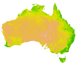
Satellite images are images of Earth collected by imaging satellites operated by governments and businesses around the world. Satellite imaging companies sell images by licensing them to governments and businesses such as Apple Maps and Google Maps.

The eddy covariance technique is a key atmospheric measurement technique to measure and calculate vertical turbulent fluxes within atmospheric boundary layers. The method analyses high-frequency wind and scalar atmospheric data series, gas, energy, and momentum, which yields values of fluxes of these properties. It is a statistical method used in meteorology and other applications to determine exchange rates of trace gases over natural ecosystems and agricultural fields, and to quantify gas emissions rates from other land and water areas. It is frequently used to estimate momentum, heat, water vapour, carbon dioxide and methane fluxes.

The normalized difference vegetation index (NDVI) is a simple graphical indicator that can be used to analyze remote sensing measurements, often from a space platform, assessing whether or not the target being observed contains live green vegetation.

The law of water balance states that the inflows to any water system or area is equal to its outflows plus change in storage during a time interval. In hydrology, a water balance equation can be used to describe the flow of water in and out of a system. A system can be one of several hydrological or water domains, such as a column of soil, a drainage basin, an irrigation area or a city. Water balance can also refer to the ways in which an organism maintains water in dry or hot conditions. It is often discussed in reference to plants or arthropods, which have a variety of water retention mechanisms, including a lipid waxy coating that has limited permeability.
Geographic information systems (GISs) have become a useful and important tool in the field of hydrology to study and manage Earth's water resources. Climate change and greater demands on water resources require a more knowledgeable disposition of arguably one of our most vital resources. Because water in its occurrence varies spatially and temporally throughout the hydrologic cycle, its study using GIS is especially practical. Whereas previous GIS systems were mostly static in their geospatial representation of hydrologic features, GIS platforms are becoming increasingly dynamic, narrowing the gap between historical data and current hydrologic reality.
Groundwater models are computer models of groundwater flow systems, and are used by hydrologists and hydrogeologists. Groundwater models are used to simulate and predict aquifer conditions.
The Penman–Monteith equation approximates net evapotranspiration (ET) from meteorological data, as a replacement for direct measurement of evapotranspiration. The equation is widely used, and is the standard method for modeling evapotranspiration used by the United Nations Food and Agriculture Organization. The resulting estimate is reference evapotranspiration, ETo.
Agricultural hydrology is the study of water balance components intervening in agricultural water management, especially in irrigation and drainage.
GSSHA is a two-dimensional, physically based watershed model developed by the Engineer Research and Development Center of the United States Army Corps of Engineers. It simulates surface water and groundwater hydrology, erosion and sediment transport. The GSSHA model is used for hydraulic engineering and research, and is on the Federal Emergency Management Agency (FEMA) list of hydrologic models accepted for use in the national flood insurance program for flood hydrograph estimation. Input is best prepared by the Watershed Modeling System interface, which effectively links the model with geographic information systems (GIS).
The following outline is provided as an overview of and topical guide to hydrology:
DPHM-RS is a semi-distributed hydrologic model developed at University of Alberta, Canada.

METRIC is a computer model developed by the University of Idaho, that uses Landsat satellite data to compute and map evapotranspiration (ET). METRIC calculates ET as a residual of the surface energy balance, where ET is estimated by keeping account of total net short wave and long wave radiation at the vegetation or soil surface, the amount of heat conducted into soil, and the amount of heat convected into the air above the surface. The difference in these three terms represents the amount of energy absorbed during the conversion of liquid water to vapor, which is ET. METRIC expresses near-surface temperature gradients used in heat convection as indexed functions of radiometric surface temperature, thereby eliminating the need for absolutely accurate surface temperature and the need for air-temperature measurements.
The flash flood guidance system (FFGS) was designed and developed by the Hydrologic Research Center, a non-profit public-benefit corporation located in San Diego, CA, US, for use by meteorological and hydrologic forecasters throughout the world. The primary purpose of the FFGS is to provide operational forecasters and disaster management agencies with real-time information pertaining to the threat of small-scale flash flooding throughout a specified region.
A vegetation index (VI) is a spectral imaging transformation of two or more image bands designed to enhance the contribution of vegetation properties and allow reliable spatial and temporal inter-comparisons of terrestrial photosynthetic activity and canopy structural variations.
BAITSSS is biophysical Evapotranspiration (ET) computer model that determines water use, primarily in agriculture landscape, using remote sensing-based information. It was developed and refined by Ramesh Dhungel and the water resources group at University of Idaho's Kimberly Research and Extension Center since 2010. It has been used in different areas in the United States including Southern Idaho, Northern California, northwest Kansas, and Texas.
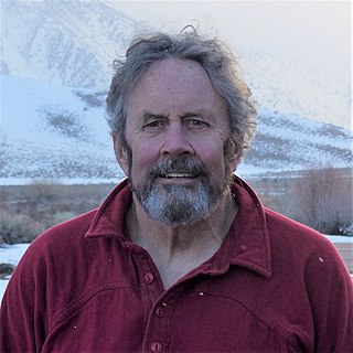
Jeff Dozier is an American snow hydrologist, environmental scientist, researcher and academic. He is Distinguished Professor Emeritus and Founding Dean of the Bren School of Environmental Science & Management at the University of California, Santa Barbara.
References
- ↑ "Precious Resources: Water and Landsat's Thermal Band" (PDF). NASA. Archived from the original (PDF) on 2011-07-21. Retrieved 2010-04-04.
- ↑ "FAO Irrigation and Drainage Paper No. 56. Crop Evapotranspiration (guidelines for computing crop water requirements)". Food and agricultural organization. 1998. Retrieved 2015-02-22.
- ↑ "A scientific description of SEBAL procedure" (PDF). WaterWatch. Retrieved 2010-04-08.
- ↑ "SEBAL". WaterWatch. Retrieved 2010-04-08.
- ↑ "El uso de la teledetección para fortalecer el trabajo de los COTAS" (PDF). State of Guanajuato Water Committee. 2008. Retrieved 2010-04-08.
- ↑ "Water Watchers". NASA. 2010-01-21. Retrieved 2010-04-08.
- ↑ "Estimating actual evapotranspiration through remote sensing techniques to improve agricultural water management: A case study in the transboundary Olifants catchment in the Limpopo basin, South Africa". UNESCO-IHE. Retrieved 2010-04-04.
- ↑ "Application of remote sensing in national water plans" (PDF). Futurewater. February 2009. Retrieved 2010-04-04.