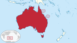
The Coral Sea Islands Territory is an external territory of Australia which comprises a group of small and mostly uninhabited tropical islands and reefs in the Coral Sea, north-east of Queensland, Australia. The only inhabited island is Willis Island. The territory covers 780,000 km2 (301,160 sq mi), most of which is ocean, extending east and south from the outer edge of the Great Barrier Reef and includes Heralds Beacon Island, Osprey Reef, the Willis Group and fifteen other reef/island groups. Cato Island is the highest point in the Territory.

Geography of the Federated States of Micronesia (FSM), a country located in the western Pacific Ocean, and in the Micronesia cultural and ecological sub-region of Oceania. While its total land area is very small at 702 km2 (271 sq mi), it has the 14th largest exclusive economic zone at 2,996,419 km2 (1,156,924 sq mi).

Pulau Tekong, also known colloquially as Tekong or Tekong Island, is the second-largest of Singapore's outlying islands after Jurong Island. Tekong is located off Singapore's northeastern coast, east of Pulau Ubin. Since the 1990s, the island has been used by the Singapore Armed Forces (SAF) and is generally restricted from public access. Transport to the island for permitted persons is via the SAF Changi Ferry Terminal at Changi Beach.

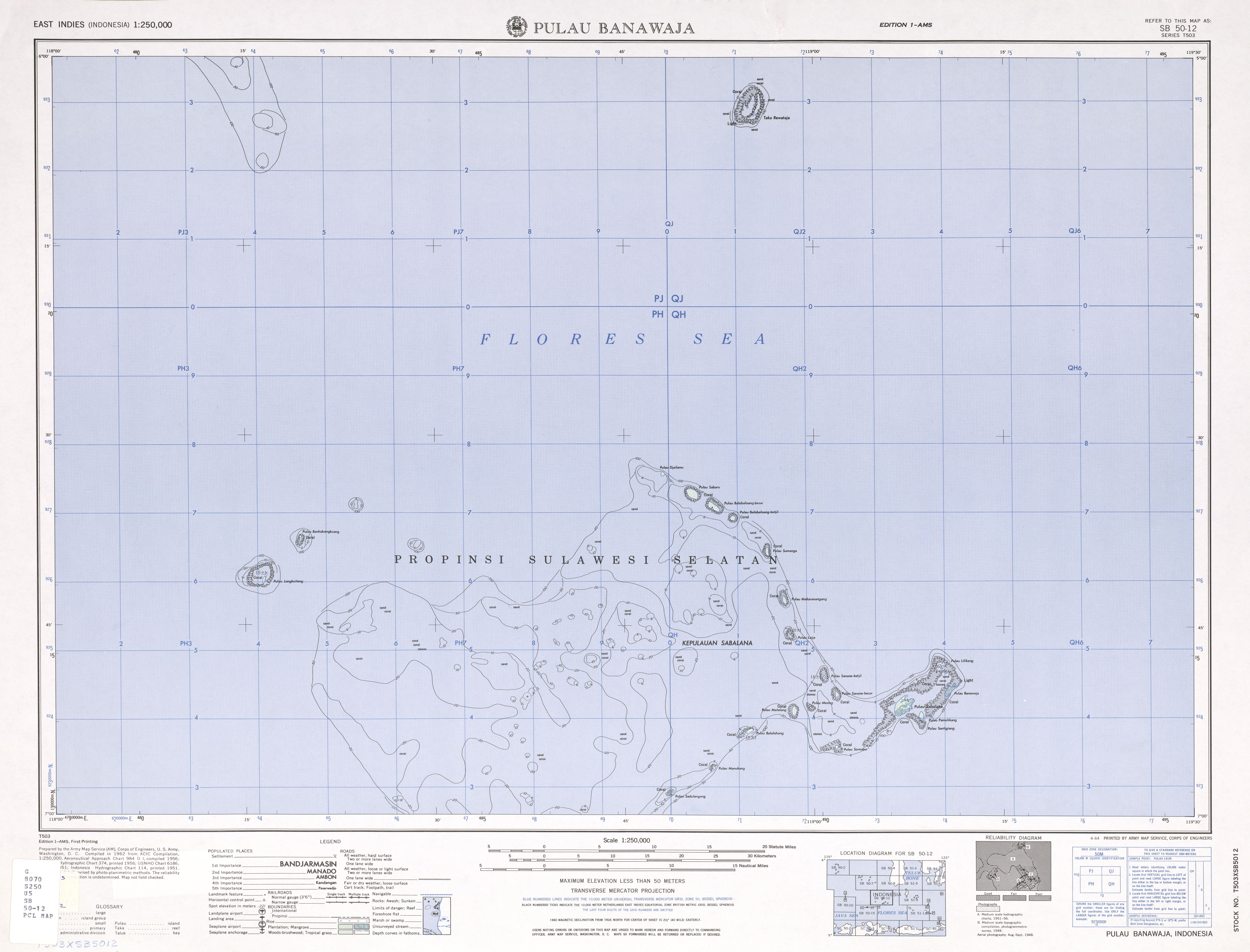
The Celebes Sea, or Sulawesi Sea, of the western Pacific Ocean is bordered on the north by the Sulu Archipelago and Sulu Sea and Mindanao Island of the Philippines, on the east by the Sangihe Islands chain, on the south by Sulawesi's Minahasa Peninsula, and on the west by northern Kalimantan in Indonesia. It extends 420 miles (675 km) north-south by 520 mi (840 km) east-west and has a total surface area of 110,000 square miles (280,000 km2), to a maximum depth of 20,300 feet (6,200 m). South of the Cape Mangkalihat, the sea opens southwest through the Makassar Strait into the Java Sea.

Natuna Regency is an islands regency located in the northernmost part of the Province of Riau Islands, Indonesia. It contains at least 154 islands, of which 127 of them are reported as uninhabited. This archipelago, with 264,198.37 km2 area, contains 15 sub-districts, including the island district of Pulau Laut, Bunguran/Greater Natuna Island, the island district of Pulau Tiga, the island district of Midai, the island district of Subi, and the island district of Serasan.
Pulau Hantu is located to the south of the main island of Singapore, off the Straits of Singapore. Pulau Hantu is actually made up of two islets: Pulau Hantu Besar and Pulau Hantu Kechil, with a total area of 12.6 hectares. At low tide, it is possible to wade across the shallow lagoon between the two islands, but not at high tide.

Kayangel (Ngcheangel) is the northernmost state of Palau 24 km (15 mi) north of Koror. The land area is about 1.4 km2 (0.54 sq mi). The population is 54.

The Sangihe Islands – Indonesian: Kepulauan Sangihe – are a group of islands which constitute two regencies within the province of North Sulawesi, in northern Indonesia, the Sangihe Islands Regency and the Sitaro Islands Regency. They are located north-east of Sulawesi between the Celebes Sea and the Molucca Sea, roughly halfway between Sulawesi and Mindanao, in the Philippines; the Sangihes form the eastern limit of the Celebes Sea. The islands combine to total 813 square kilometers (314 sq mi), with many of the islands being actively volcanic with fertile soil and mountains.
The Derawan Islands are in the province of East Kalimantan in Indonesia. They consist of 31 islands, most well known among these are the islands of Derawan, Kakaban, Maratua, and Sangalaki. There are also numerous submerged reefs and islets. They are located in the Sulawesi Sea, on the coastal shelf of East Kalimantan. The islands are part of the Berau Regency.

Nonouti is an atoll and district of Kiribati. The atoll is located in the Southern Gilbert Islands, 38 km north of Tabiteuea, and 250 km south of Tarawa. The atoll is the third largest in the Gilbert Islands and is the island where the Roman Catholic religion was first established in Kiribati, in 1888.
The Rowley Shoals is a group of three atoll-like coral reefs south of the Timor Sea, about 260 km (160 mi) west of Broome on the northwestern Australian coast, centered on 17°20′S119°20′E, on the edge of one of the widest continental shelves in the world. Each atoll covers an area of around 80 to 90 km2 within the rim of the reef, including the lagoons, while the land areas are negligible. They belong to Western Australia. They all rise steeply from the surrounding ocean floor. To the northeast lie the Scott and Seringapatam Reefs which are located on the same undersea platform.

The Pacific Remote Islands Marine National Monument is a group of unorganized, mostly unincorporated United States Pacific Island territories managed by the United States Fish and Wildlife Service of the United States Department of the Interior and the National Oceanic and Atmospheric Administration (NOAA) of the United States Department of Commerce. These remote refuges are "the most widespread collection of marine- and terrestrial-life protected areas on the planet under a single country's jurisdiction". They protect many endemic species including corals, fish, shellfish, marine mammals, seabirds, water birds, land birds, insects, and vegetation not found elsewhere.
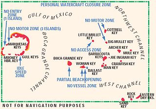
The Mule Keys are a group of scattered islets in the Florida Keys in Monroe County, Florida, United States. They are between 3 and 12 mi west of Key West, separated from it by the Northwest Channel. On the west, they are separated from the Marquesas Keys by the 6-mile (9.7 km) wide Boca Grande Channel. They belong to the outlying islands of the Florida Keys. Administratively, they are an unincorporated area of Monroe County. The islets are part of the Key West National Wildlife Refuge. The area of the islets totals 1.07 sq mi (2.8 km2), of which 1.02 sq mi (2.6 km2) are land area and 0.05 sq mi (0.13 km2) inland water bodies. The islets are uninhabited except for Mule Key, for which the census of 2000 lists one housing unit with a population of two.

Laubeuf Fjord is a sound in Antarctica, 40 kilometres long in a north-south direction and averaging 16 km (10 mi) wide, lying between the east-central portion of Adelaide Island and the southern part of Arrowsmith Peninsula, Graham Land. It connects Hanusse Bay to the north with Marguerite Bay to the south. The southern 'border' between Laubeuf Fjord and Marguerite Bay is formed by the line between Rothera Point, Adelaide Island, and Cape Sáenz, which is the southernmost point of the Arrowsmith Peninsula. The fjord was discovered by the French Antarctic Expedition, 1908–10, under Jean-Baptiste Charcot, and named by him for Maxime Laubeuf, a French marine engineer who supervised building the engine for the ship Pourquoi-Pas.

Baubau is a city in Southeast Sulawesi province, Indonesia. The city is located on the southwest coast of Buton island. Baubau attained city status on 21 June 2001, based on Indonesian Law Number 13, for the year 2001. It covers an area of 294.98 km2, including about 30 km2 of water area, and had a population of 136,991 at the 2010 Census and 159,248 at the 2020 Census; the official estimate as at mid 2021 was 161,354.

Cay Sal Bank is the third largest and the westernmost of the Bahama Banks. It is located between 23º27'N - 24º10'N and 079º25'W – 080º35'W. In a geographical sense, it is separate from the Bahamas proper as it is much closer to Cuba than to the closest Bahamian island. It is separated by Santaren Channel from the Great Bahama Bank, the western rim of which is 50 km (31 mi) to the east. The Straits of Florida separate it from the United States mainland and the Florida Keys.
Tambelan archipelago is a group of 68 islands off the west coast of West Kalimantan, (Borneo), Indonesia, just north of the equator. The archipelago is located on the north opening of Karimata Strait which separates Borneo and Belitung island. Geographically it is part of the Tudjuh Archipelago, and administratively forms a district (kecamatan) of Bintan Regency within the Riau Islands Province. It covers a land area of 90.4 km2 and had a population of 4,975 at the 2010 Census. Major islands include Big Tambelan, Mendarik, Uwi, Benua, and Pejantan. The islands are divided into eight administrative villages (kelurahan) - Batu Lepuk, Kampung Hilir, Kampung Melayu, Kukup, Pengikik, Pulau Mentebung, Pulau Pinang and Teluk Sekuni.

North Minahasa Regency is a regency in North Sulawesi, Indonesia. Its capital is Airmadidi. It was originally part of the Minahasa Regency until it was established as a separate regency on 20 November 2003. It covers an area of 1,059.24 km2, and had a population of 188,904 at the 2010 Census; this had risen to 224,993 at the 2020 Census. The Regency includes the offshore islands of Bangka and Talisei to the north of Sulawesi, and Mantenang and Naeng Besar to the northwest.
Rondo Island is Indonesia's northernmost territory, located in the Andaman Sea, with a 0.650 km2 area 35m above sea level. The island is one of the outlying islands of Indonesia in the Aceh province of the Sumatra region. It is administratively part of Ujung Bau village in the Sukakarya District of Sabang City, whose administration center is on Weh Island, south of Rondo. Rondo is 50 km offshore from Indonesia's Sumatra mainland. This otherwise uninhabited island, accessible only by boat, has an Indonesian military outpost with a heliport and blue-roofed barracks, an adjacent lighthouse complex with a red-roofed lighthouse keeper's house and a white skeletal lighthouse topped with a viewing gallery and lantern.