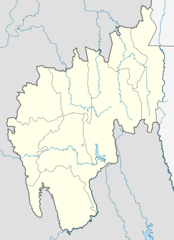
South Tripura is an administrative district in the state of Tripura in northeastern India.
The Feni is a river in southeastern Bangladesh and Tripura state of India. It is a trans-boundary river that is the subject of an ongoing dispute about water rights. The Feni River originates in South Tripura district and flows through Sabroom town and then enters Bangladesh. Muhuri River, also called Little Feni, from Noakhali District joins it near its mouth. The river is navigable by small boats as far as Ramgarh, about 80 kilometres (50 mi) upstream.

Sidhi is a town and a municipality in Sidhi district in the Indian state of Madhya Pradesh. It is the headquarters of the Sidhi district.

Barpeta is a major city in Barpeta district of the state of Assam in India and is district headquarters. The city is located 90 kilometres (56 mi) north west of Guwahati and is one of the major cities in Western Assam. It is also called Satra Nagari of Assam due to the presence of various Vaishnavite Satras in the vicinity.

Udaipur (/ˈuːdaɪˌpʊə/), formerly known as Rangamati, is the third biggest urban area in the Indian state of Tripura. The town was a capital of the state during the reign of the Manikya dynasty. It is famous for the Tripura Sundari temple also known as Tripureswari temple, one of the 51 Shakti Peethas. It is a Municipal Council in Gomati district & also the headquarter of Gomati district. Udaipur is about 51 km from Agartala, the capital of Tripura.
Badharghat is a census town in West Tripura district in the state of Tripura, India.
Belonia is a town and municipal council in South Tripura district, Tripura, India. It is also the headquarters of South Tripura District. It is linked with Agartala by National Highway 108A from Belonia to Jolaibari and via National Highway 8 from Jolaibari to Agartala. Belonia lies on the border with Bangladesh.
Bihpuria is a small town in Lakhimpur district in the state of Assam, India. Bihpuria is located at 27.03°N 93.90°E.

Dadri is a town and a municipal board in Gautam Buddha Nagar District in the state of Uttar Pradesh, India. Noida, Dadri and Jewar are the 3 sub-divisions of GB Nagar district, each headed by a SDM.
Hinjilicut (Hinjilikatu) is a town and municipality of Ganjam district in the Indian state of Odisha.
Kamalpur is a town and a Nagar Panchayat in Dhalai District in the Indian state of Tripura around 93 km from the state capital Agartala. It is the largest Sub-divisional town in Dhalai District.
Ranirbazar is a town and a Municipal Council in West Tripura district in the Indian state of Tripura.
Sonamura is a town and a Nagar Panchayat in the Indian state of Tripura. It is the headquarter of Sonamura Subdivision in Sipahijala district and lies on the border with Bangladesh to the east of Comilla.
Teliamura is a town and a Municipal Council in Khowai district in the Indian state of Tripura. It is on National Highway No. 08 of India. It is also the headquarters of the recently included sub-division of Teliamura. It is 45 km from Agartala, Capital of Tripura, 35 km from Khowai and 42 km from Ambassa.

Channarayapatna or Channarayapattana is a town and Taluk headquarters in Hassan district of Karnataka, India. It lies on the Bangalore-Mangalore National Highway-75 in Karnataka, India. Jain pilgrimage Shravanabelagola is a famous site in the taluk. Channarayapatna has major railway connection from Bangalore to Mangalore, Karwar, and Mysore.
Pratapgarh is a census town in West Tripura district in the Indian state of Tripura.
Wangjing is a town and a municipal council in Thoubal district in the Indian state of Manipur. It is about 6 km from district headquarters and an agricultural town in Thoubal district in the Indian state of Manipur. It is bordered by Heirok village in the east, Tentha village in the south-west, and on the other side by agricultural land. Wangjing River, a rivulet flowing down from the eastern hills, runs through the middle of the town, serving as a natural spring. It is connected to other parts of the state by the Imphal–Moreh national highway. It is the junction between Heirok and Tentha village.

Sipahijala District is a district of Tripura, India. This district was created in January 2012 when four new districts were established in Tripura, taking the number of districts in the state from four to eight. Part of the district was formed from the former district of West Tripura. The principal towns in the district are Bishalgarh, Bishramganj, Melaghar and Sonamura.
Gandhigram is a town in Tripura, India. located around 10 km from city centre Agartala. It comes under Sadar district. It has an old age home called Sandhyoneer.
Santirbazar is a town and Municipal Council in South Tripura district, Tripura, India located 84 kms away from state capital Agartala. It is linked with Agartala by National Highway 8 via Udaipur and Bishramganj to Sabroom.