
Interstate 19 (I-19) is a north–south Interstate Highway located entirely within the US state of Arizona. I-19 travels from Nogales, roughly 90 meters (300 ft) from the Mexican border, to Tucson, at I-10. The highway also travels through the cities of Rio Rico, Green Valley, and Sahuarita.

Pima County is a county in the south central region of the U.S. state of Arizona. As of the 2020 census, the population was 1,043,433, making it Arizona's second-most populous county. The county seat is Tucson, where most of the population is centered. The county is named after the Pima Native Americans, also known as Tohono O'odham, who are indigenous to this area.
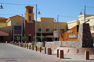
Sahuarita is a town in Pima County, Arizona, United States. Sahuarita is located south of the Tohono O'odham Nation and abuts the north end of Green Valley, 15 miles (24 km) south of Tucson. The 2022 population estimate was 35,638.
Luna Lake is a natural body of water that covers approximately 75 acres (0.30 km2) of land. It is located about three miles (5 km) southeast of Alpine, Arizona, at the elevation of 7,890 ft (2,400 m), and is the centerpiece of the Luna Lake Wildlife Area.

Alamo Lake State Park is a state park of Arizona, USA, centered on Alamo Lake, a flood control and recreational reservoir. The park is located in western Arizona about 38 miles (61 km) north of Wenden. It is accessed via a paved two-lane road off either U.S. Route 60 to the south or U.S. Route 93 to the east. Owing to its remoteness, the park is often considered one of the "best kept secrets" of the state park system.
KEVT was a radio station licensed to Sahuarita, Arizona, United States, and served the Tucson area. KEVT was owned by One Mart Corporation.
During World War II, the United States Army Air Forces (USAAF) established numerous airfields in Arizona for training pilots and aircrews of USAAF fighters and bombers.
Becker Lake is a reservoir managed as a trophy trout lake. Located near Springerville, Arizona, Becker Lake is part of the 622-acre (252 ha) Becker Lake Wildlife Area. Built around the year 1880, it is one of the oldest reservoirs in the White Mountains. The Arizona Game and Fish Department acquired the lake and property around it in 1973. The lake is located at 6,910 feet (2,110 m).
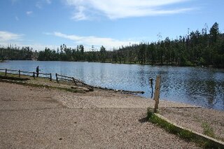
Black Canyon Lake is a lake in Navajo County, Arizona, United States.

East Clear Creek is located in the Mogollon Rim area of the state of Arizona. The closest town Winslow is 45 miles (72 km) away.
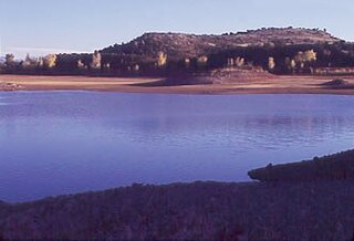
The Lyman Reservoir is the largest lake in the region. Lyman Lake State Park, is located in and administered by the Apache-Sitgreaves National Forest, attracts anglers, as well as campers and water skiers year-round.
Rainbow Lake is a 116-acre manmade lake near the town of Pinetop-Lakeside and the community of Lake of the Woods in southern Navajo County, Arizona, United States. The lake was created in 1903 when Mormon settlers dammed Walnut Creek, a tributary of the Little Colorado River, to impound water for irrigation.
Arivaca Lake is located in southern Arizona, 60 miles (97 km) south of Tucson near Arivaca, Arizona. In mid-1999, there was a total fish kill at this lake due to oxygen depletion. The facilities are maintained by the Arizona Game and Fish Department.

Patagonia Lake is a man-made reservoir in Santa Cruz County, Arizona, United States, located southwest of the town of Patagonia, Arizona and northeast of Nogales. The lake was created by damming Sonoita Creek, and is a popular area for boating and sport fishing. Facilities are maintained by Arizona State Parks as part of Patagonia Lake State Park.
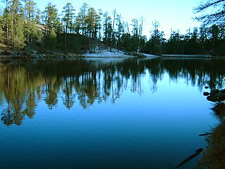
Rose Canyon Lake is located 30 miles (48 km) northeast of Tucson, Arizona in the Santa Catalina Mountains on Mount Lemmon.

Kennedy Lake is located in Tucson at J. F. Kennedy Park, north of Ajo Way between La Cholla Boulevard and Mission Road.

Fool Hollow Lake is a public lake located in Navajo County, Arizona, near the city of Show Low. The lake is operated by the Arizona State Parks Department, and consists of 150 acres (61 ha), with an average depth of 23 feet (7.0 m) together with a variety of fish species.
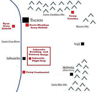
The Sahuarita Air Force Range, also known as the Sahuarita Bombing & Gunnery Range, was built just east of Sahuarita, Arizona, in 1942. It was used for the training of bombardiers, aerial gunners, anti-aircraft gunners, and others during World War II and the Korean War. The abandoned Sahuarita Flight Strip is located in the southwestern corner of the range, and was used as an emergency flight strip until 1978. Before deactivation, the airspace over the range was protected by its own restricted area, R-310.

The Sahuarita Unified School District is the school district serving Sahuarita and Green Valley, Arizona. The district serves 5,800 students.


