Saint John (BB Parliament constituency)

Last updated

Saint John is a constituency in the Saint John parish of Barbados. It was established in 1645 as one of the original eleven constituencies. [1] Originally the constituency, like the other original ten, was represented by 2 members until 1971 when the single-member system was introduced. Since 2018, it has been represented in the House of Assembly of the Barbadian Parliament by Charles McDonald Griffith. Griffith is a member of the BLP. [n 1]

Contents

Since the 1961 Barbadian general election, Saint John had been considered an electoral strong hold of the DLP until 2018 where the constituency elected its first non-DLP member in several decades.

Boundaries

The constituency runs:

From a point on the entrance to the sea coast at Three Boys Rock in a straight line through the triangulation station S.38 to point in the center of the road called Highway F, opposite to a monument (B.11) placed on the northern side of the road; thence in a westerly direction along the middle of Highway F to a point on the road opposite to a monument (B.10) placed at the end of an unclassified road at Foster Hall; thence in a south westerly direction to another monument (B.9) placed near the edge of Hackleton’s Cliff; thence in a south westerly direction along an unclassified road to its junction with Malvern-Venture-Road; thence in a southerly direction along the middle of the Malvern-Venture-Mt. Tabor Road to its junction with the Mt. Tabor-Claybury Road; thence in a westerly direction along the middle of Mt. Tabor-Claybury Road to its junction with the Claybury-Uplands Road; thence in a south easterly and then in a southerly direction along the Claybury-Uplands Road to its junction with Highway 3B (the Golden Ridge-Pool Road); thence in an easterly direction along Highway 3B to its junction with the road leading to Belle Farm; thence in a southerly and then easterly direction along the entrance to Belle Farm to its junction with the Ellesmere-Todds Road; thence in an easterly direction along the Ellesmere-Todds Road to its junction with the Four Roads-Woodland Road; thence in a southerly, easterly and then southerly direction along the Four Roads-Woodland Road to its junction with Highway 4 (Woodland-Kendal Road); thence in an easterly direction along the middle of Highway 4 to the centre of the culvert over the gully; thence in a southerly and south easterly direction along this gully to a point which is marked by a monument (B.12); thence proceeding north eastwards along a line joining this monument to another monument (B.13) placed on the western side of the public road called Featherbed Lane, then in a north easterly direction along the line joining this point to a monument (B.14) placed at the end of the unclassified road at Hillview; then generally eastwards along the unclassified road to the unclassified public road running from St. Philip’s Church to Cliff Plantation; thence along this road in a northerly direction to its junction with a track at the point where the road turns to the west, then northwards and eastwards along this track to its junction with an unclassified road leading from Guinea Plantation Yard to Dodds Land, thence in a northerly direction along this road to its junction with a track; then in a generally easterly direction along this track to its junction at Moncrieffe with a public road leading from District “C” Police Station to Massiah Street; thence in a northerly direction along the District “C”-Massiah Street Road to its junction with a public road leading to Mt. Pleasant Plantation; thence in an easterly direction and then in a north easterly direction along this public road to its junction with the Stewart Hill Road; thence in an easterly direction along the middle of Stewart Hill Road to its junction with the Thickets-Palmers Road; thence along the middle of the Thickets-Palmers Road in a northerly direction to its junction with the Supers-College Savannah Road; thence along the middle of the Supers-College Savannah Road to a monument (B.15) located at the St. Mark’s Church driveway; thence in a straight line to a monument (B.16) near the edge of the cliff on the sea coast; thence in a northerly direction along the sea coast to the point on the coast known as Three Boys Rock (the starting point) [2]

History

Members of Parliament

The following list contains the Members of Parliament for the Saint John since the introduction of the single-member system in 1971.

ElectionMemberParty
1971 Errol Barrow DLP [3]
1976 Errol Barrow DLP [4]
1981 Errol Barrow DLP [5]
1986 Errol Barrow DLP [6]
1987 David Thompson DLP [7]
1991 David Thompson DLP [8]
1994 David Thompson DLP [9]
1999 David Thompson DLP [10]
2003 David Thompson DLP [11]
2008 David Thompson DLP [12]
2011 Mara Thompson DLP [13]
2013 Mara Thompson DLP [14]
2018 Charles Griffith BLP [15]
2022 Charles Griffith BLP [16]

Notes

  1. As with all constituencies, the constituency elects one member of parliament (MP) by the first past the post system of election at least every five years.

Related Research Articles

<span class="mw-page-title-main">Saint Michael, Barbados</span> Parish

The parish of St. Michael is one of eleven parishes of Barbados. It has a land area of 39 km2 (15 sq mi) and is found at the southwest portion of the island. Saint Michael has survived by name as one of the original six parishes created in 1629 by Governor Sir William Tufton.

<span class="mw-page-title-main">Avalon (electoral district)</span> Federal electoral district in Newfoundland and Labrador, Canada

Avalon is a federal electoral district on Newfoundland Island in Newfoundland and Labrador, Canada. It has been represented in the House of Commons of Canada since 2004.
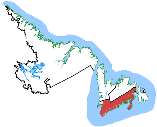
<span class="mw-page-title-main">Random—Burin—St. George's</span> Federal electoral district in Newfoundland and Labrador, Canada

Random—Burin—St. George's was a federal electoral district in Newfoundland and Labrador, Canada, that was represented in the House of Commons of Canada from 2004 to 2015.
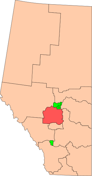
<span class="mw-page-title-main">Wetaskiwin (federal electoral district)</span> Federal electoral district in Alberta, Canada

Wetaskiwin was a federal electoral district in Alberta, Canada, that was represented in the House of Commons of Canada from 1925 to 2015.

<span class="mw-page-title-main">Christ Church, Barbados</span> Parish in Barbados

The parish of Christ Church is one of eleven historic political divisions of Barbados. It has a land area of 57 km2 (22 sq mi) and is found at the southern end of the island. Christ Church has survived by name as one of the original six parishes created in 1629 by Governor Sir William Tufton.

<span class="mw-page-title-main">Saint Andrew, Barbados</span> Parish in Barbados

Saint Andrew is one of eleven parishes of Barbados. It is situated in the northeastern area in the country.

<span class="mw-page-title-main">Saint James, Barbados</span> Parish in Barbados

The parish of Saint James is an area located in the western central part of the country of Barbados. Increasingly St. James is becoming known as the playground of the rich and famous, and as a haven for sun-starved tourists with its up-market hotel resorts.
<span class="mw-page-title-main">Saint Lucy, Barbados</span> Parish in Barbados

The parish of Saint Lucy is the northernmost area in the country of Barbados. Saint Lucy is the only parish of Barbados out of the eleven to be named after a female patron saint, Saint Lucy of Syracuse. Saint Lucy's shape also resembles a peninsula, surrounded on three sides by the Atlantic Ocean to the north, east and west. The Harrison Point Lighthouse is located in Harrisons, Saint Lucy between Great Head and Norse's Bay, also in Saint Lucy. To the south lies the neighbouring Parish of Saint Peter.

<span class="mw-page-title-main">Saint Peter, Barbados</span> Parish in Barbados

The Parish of Saint Peter is one of eleven parishes in the Caribbean island country of Barbados. It is named after the Christian Apostle and patron saint, Saint Peter. It is located in the north of Barbados, and is the only parish besides Saint Lucy that extends from the east coast to the west.

<span class="mw-page-title-main">Hamilton Centre (federal electoral district)</span> Federal electoral district in Ontario, Canada

Hamilton Centre is a federal electoral district in Hamilton, Ontario, Canada, that has been represented in the House of Commons of Canada since 2004.

<span class="mw-page-title-main">Sault Ste. Marie (federal electoral district)</span> Federal electoral district in Ontario, Canada

Sault Ste. Marie is a federal electoral district in Ontario, Canada, that has been represented in the House of Commons of Canada since 1968.

<span class="mw-page-title-main">Saskatoon West</span> Federal electoral district in Saskatchewan, Canada

Saskatoon West is a federal electoral district in Saskatchewan, Canada, that was represented in the House of Commons of Canada from 1979 to 1988, and again in 2015.
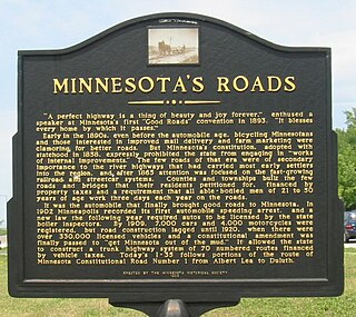
<span class="mw-page-title-main">Legislative route (Minnesota)</span>

In the U.S. state of Minnesota, a legislative route is a highway number defined by the Minnesota State Legislature. The routes from 1 to 70 are constitutional routes, defined as part of the Babcock Amendment to the Minnesota State Constitution, passed November 2, 1920. All of them were listed in the constitution until a 1974 rewrite. Though they are now listed separately in §161.114 of the Minnesota Statutes, the definitions are legally considered to be part of the constitution, and cannot be altered or removed without an amendment. Legislative routes with numbers greater than 70 can be added or deleted by the legislature.

The City of Bridgetown constituency is one of eleven (11) electoral districts in the Parish of St. Michael, and one thirty (30) nationally in Barbados. The Constituency covers a portion of the capital city Bridgetown. The district formed in 1843 is the first electoral district formed after the original eleven in the country. The first representative for the constituency was the national hero the Right Excellent Samuel Jackman Prescod. The member of parliament since 2022 is Corey Lane from the Barbados Labour Party. Before then it was held by Lt.Col. Jeffrey Bostic (Ret.) from 2013. The seat is usually won by a slim margin.

Christ Church East is a constituency in the Christ Church area of Barbados represented in the House of Assembly of the Barbadian Parliament since 2018 by Wilfred Abrahams MP of the Barbados Labour Party.

Christ Church East Central is a constituency in the Christ Church area of Barbados. Since 2018, it has been represented in the House of Assembly of the Barbadian Parliament by Ryan Straughn. Straughn is a member of the BLP.

Christ Church South is a constituency in the Christ Church area of Barbados represented in the House of Assembly of the Barbadian Parliament since 2008 by Ralph Thorne, MP of the DLP after he crossed the floor from the Barbados Labour Party in February 2024.

Christ Church West is a constituency in the Christ Church area of Barbados represented in the House of Assembly of the Barbadian Parliament since 2018 by William Duguid MP of the BLP, who previously represented the constituency between 2003 and 2013.
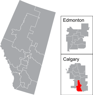
<span class="mw-page-title-main">Calgary Midnapore</span> Federal electoral district in Alberta, Canada

Calgary Midnapore is a federal electoral district in Alberta, Canada, that has been represented in the House of Commons of Canada since 2015. It has been represented by Stephanie Kusie since she won the 2017 by-election.

Saint Lucy is a constituency in the Saint Lucy parish of Barbados. It was established in 1645 as one of the original 11 constituencies. Since 2018, it has been represented in the House of Assembly of the Barbadian Parliament by Peter Phillips. Philips is a member of the BLP.

References

  1. "The History | BARBADOSPARLIAMENT.COM". www.barbadosparliament.com. Retrieved 24 November 2024.
  2. "Electoral and Boundaries Commission (Review of Boundaries) Order, 2002" (PDF). Electoral and Boundaries Commission. 10 July 2002. p. F14. Retrieved 24 November 2024.
  3. "Barbados General Election Results 1971". web.archive.org. 1 August 2021. Retrieved 24 November 2024.
  4. "Barbados General Election Results 1976". web.archive.org. 18 June 2021. Retrieved 24 November 2024.
  5. "Barbados General Election Results 1981". web.archive.org. 1 August 2021. Retrieved 24 November 2024.
  6. "Barbados General Election Results 1986". web.archive.org. 5 October 2021. Retrieved 24 November 2024.
  7. "Barbados By- Election Results - St. John 1987". web.archive.org. 5 October 2021. Retrieved 25 November 2024.
  8. "Barbados General Election Results 1991". web.archive.org. 5 October 2021. Retrieved 24 November 2024.
  9. "Barbados General Election Results 1994". web.archive.org. 5 October 2021. Retrieved 24 November 2024.
  10. "Barbados General Election Results 1999". web.archive.org. 5 October 2021. Retrieved 24 November 2024.
  11. "Barbados General Election Results 2003". web.archive.org. 5 October 2021. Retrieved 24 November 2024.
  12. "Barbados General Election Results 2008". web.archive.org. 5 October 2021. Retrieved 24 November 2024.
  13. "Barbados By- Election Results - St. John 2011". web.archive.org. 5 October 2021. Retrieved 25 November 2024.
  14. "Barbados By- Election Results - St. John 2011". web.archive.org. 5 October 2021. Retrieved 25 November 2024.
  15. "Barbados General Election Results 2018". web.archive.org. 5 October 2021. Retrieved 24 November 2024.
  16. "Elections Results". nationnews.com. 19 January 2022. Retrieved 24 November 2024.