Sainte-Luce, Quebec

Last updated
Sainte-Luce
Ste-Luce.jpg
Coast of Sainte-Luce
Sainte-Luce Quebec location diagram.png
Location within La Mitis RCM
Canada Eastern Quebec location map.png
Red pog.svg
Sainte-Luce
Location in eastern Quebec
Coordinates: 48°33′N68°23′W / 48.55°N 68.38°W / 48.55; -68.38 Coordinates: 48°33′N68°23′W / 48.55°N 68.38°W / 48.55; -68.38 [1]
CountryFlag of Canada (Pantone).svg  Canada
Province Flag of Quebec.svg  Quebec
Region Bas-Saint-Laurent
RCM La Mitis
ConstitutedAugust 29, 2001
Government
[2]
  MayorGaston Gaudreault
   Federal riding Avignon—La Mitis—Matane—Matapédia
   Prov. riding Matane-Matapédia
Area
  Total71.90 km2 (27.76 sq mi)
  Land72.59 km2 (28.03 sq mi)
 There is an apparent contradiction between two authoritative sources
Elevation
75 m (246 ft)
Population
 (2021) [3]
  Total2,845
  Density39.2/km2 (102/sq mi)
  Pop 2016-2021
Increase2.svg 1.6%
  Dwellings
1,462
Time zone UTC−5 (EST)
  Summer (DST) UTC−4 (EDT)
Postal code(s)
Area code(s) 418 and 581
Highways
Quebec Autoroute 20.svg A-20

Qc132.svg Route 132
Qc298.svg Route 298
Website www.sainteluce.ca

Sainte-Luce is a municipality in the La Mitis Regional County Municipality in the Bas-Saint-Laurent region of Quebec, Canada. The population in the Canada 2021 Census was 2,845. [2] [3]

Contents

History

The territory was known as of 1829 as the parish of Sainte-Luce, which was established in 1835. It became a municipality in 1855, but this same municipality had been created 1845 under the name of Lessard, for the name of the seigneurie which existed during the 16th century.

The church of Sainte-Luce QC SteLuce3 tango7174.jpg
The church of Sainte-Luce

The name of Sainte-Luce was given in honour of Luce-Gertrude Drapeau (1794–1880), wife of the local notary, Thomas Casault, one the persons that established the seigneurie when the parish was canonized. The patron saint was Saint Lucy.

In 1918, the municipality of the village of Luceville was created from the territory of Sainte-Luce. Because it had one of the nicest beaches in the area, it had the nickname of Sainte-Luce-sur-Mer. The name of Luceville now identifies with the former municipality of the same name.

On August 29, 2001 the village of Luceville merged with the parish municipality of Sainte-Luce to form the municipality of Sainte-Luce–Luceville; the name was changed to simply Sainte-Luce on April 27, 2002. [4]

See also

Related Research Articles

<span class="mw-page-title-main">Blainville, Quebec</span> City in Quebec, Canada

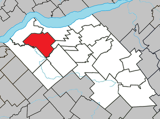
Blainville is a suburb of Montreal located on the North Shore in southwestern Quebec, Canada. Blainville forms part of the Thérèse-De Blainville Regional County Municipality within the Laurentides region of Quebec. The town sits at the foot of the Laurentian Mountains and is located 35 kilometres (22 mi) northwest of downtown Montreal.

<span class="mw-page-title-main">Boisbriand</span> City in Quebec, Canada

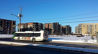
Boisbriand is an off-island suburb of Montreal, in southwestern Quebec, Canada, on the north shore of the Rivière des Mille Îles in the Thérèse-De Blainville Regional County Municipality.

<span class="mw-page-title-main">Sainte-Thérèse, Quebec</span> City in Quebec, Canada

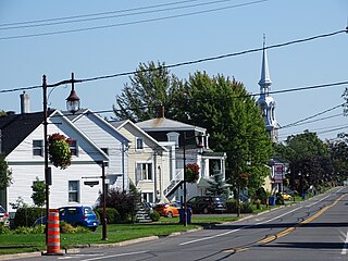
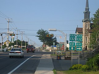
Sainte-Thérèse is an off-island suburb northwest of Montreal, in southwestern Quebec, Canada, in the Thérèse-De Blainville Regional County Municipality.

<span class="mw-page-title-main">Saint-Constant, Quebec</span> City in Quebec, Canada

Saint-Constant is a city in southwestern Quebec, Canada. It is located on the south shore of Montreal in the Roussillon Regional County Municipality of the Montérégie region. Its population, as of the Canada 2016 Census, numbered 27,359 residents.

<span class="mw-page-title-main">Lorraine, Quebec</span> City in Quebec, Canada

Lorraine is an affluent off-island suburb of Montreal, in southwestern Quebec, Canada on the north shore of the Rivière des Mille-Îles in the Thérèse-De Blainville Regional County Municipality. There are no industries and only a very limited commercial district ; almost all houses are of the detached type. Furthermore, a large portion of the town territory is set aside as wild forest ; some bike/ski trails run through it. The town is divided into two areas, Uptown and Downtown. These two areas are also delimited by Quebec freeway A-640, and are only joined together by the main street overpass.

<span class="mw-page-title-main">Papineauville, Quebec</span> Municipality in Quebec, Canada

Papineauville is a town and municipality in the Outaouais region of Quebec, Canada. It is the seat of the Papineau Regional County Municipality. In 2001 its population was 2247.

<span class="mw-page-title-main">Honfleur, Quebec</span> Municipality in Quebec, Canada

Honfleur is a municipality of approximately 850 people in the Bellechasse Regional County Municipality in the Chaudière-Appalaches region of Quebec. The Boyer River takes its source in the municipality.

<span class="mw-page-title-main">Sainte-Croix, Quebec</span> Municipality in Quebec, Canada

Sainte-Croix is a municipality in and the seat of the Municipalité régionale de comté de Lotbinière in Quebec, Canada. It is part of the Chaudière-Appalaches region and the population is 2,433 as of 2009. The new constitution dates from 2001, after the amalgamation of the parish and the village of Sainte-Croix.

<span class="mw-page-title-main">Saint-Flavien, Quebec</span> Municipality in Quebec, Canada

Saint-Flavien is a municipality in the Municipalité régionale de comté de Lotbinière in Quebec, Canada. It is part of the Chaudière-Appalaches region and the population is 1,594 as of 2009. It is named after archbishop Pierre-Flavien Turgeon.

<span class="mw-page-title-main">Saint-Édouard-de-Lotbinière, Quebec</span> Parish municipality in Quebec, Canada

Saint-Édouard-de-Lotbinière is a parish municipality in the Lotbinière Regional County Municipality in the Chaudière-Appalaches region of Quebec, Canada. Its population is 1,248 as of the Canada 2011 Census. It is named after Édouard Faucher, founder and first priest of the parish, and René-Louis Chartier de Lotbinière, first owner of the seigneurie in which Saint-Édouard lay.

<span class="mw-page-title-main">Saint-Narcisse-de-Beaurivage</span> Parish municipality in Quebec, Canada

Saint-Narcisse-de-Beaurivage is a parish municipality in the Lotbinière Regional County Municipality in the Chaudière-Appalaches region of Quebec, Canada. Its population is 1,091 as of the Canada 2011 Census. It was named after the Narcisse Dionne, an early benefactor of the parish. Beaurivage is associated to the seigneurie of Beaurivage, also known as Saint-Gilles.

<span class="mw-page-title-main">Bois-des-Filion</span> City in Quebec, Canada

Bois-des-Filion is an off-island suburb of Montreal, located in Quebec, Canada, to the north of Montreal.

<span class="mw-page-title-main">Saint-Philippe, Quebec</span> City in Quebec, Canada

Saint-Philippe is a city located in Roussillon Regional County Municipality in the Montérégie region of Quebec, Canada. It was established on July 1, 1855. The population as of the Canada 2021 Census was 7,597.

<span class="mw-page-title-main">Sainte-Marthe-sur-le-Lac</span> City in Quebec, Canada

Sainte-Marthe-sur-le-Lac is an off-island suburb of Montreal, in the Canadian province of Quebec, in the Deux-Montagnes Regional County Municipality, 40 km from Montreal. It is crossed from east to west by Route 344, commonly known as Oka Road. The town shares its borders with Deux-Montagnes to the east, Saint-Joseph-du-Lac to the west, the Lake of Two Mountains to the south, and Saint-Eustache to the north.

<span class="mw-page-title-main">Saint-Placide, Quebec</span> Municipality in Quebec, Canada

Saint-Placide is a municipality in the Laurentides region of Quebec, Canada, part of the Deux-Montagnes Regional County Municipality, along the north shore of the Ottawa River.

<span class="mw-page-title-main">Saint-Joseph-du-Lac</span> Municipality in Quebec, Canada

Saint-Joseph-du-Lac is a municipality in the Laurentides region of Quebec, Canada, part of the Deux-Montagnes Regional County Municipality.

<span class="mw-page-title-main">Sainte-Anne-du-Lac</span> Municipality in Quebec, Canada

Sainte-Anne-du-Lac is a municipality and village in the Laurentides region of Quebec, Canada, part of the Antoine-Labelle Regional County Municipality.

<span class="mw-page-title-main">Sainte-Marie, Quebec</span> City in Quebec, Canada

Sainte-Marie is a city in the province of Quebec, Canada. It is the seat of the Municipalité régionale de la Nouvelle-Beauce, in Chaudière-Appalaches. The population was 13,134 as of the Canada 2021 Census, and was 95.7% French-speaking as of 2021. It is located 59 kilometres (37 mi) south-east of Quebec City, on the Chaudière River.

<span class="mw-page-title-main">Saint-Donat, Bas-Saint-Laurent, Quebec</span> Parish municipality in Quebec, Canada

Saint-Donat is a parish municipality in La Mitis Regional County Municipality in the Bas-Saint-Laurent region of Quebec, Canada.
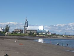
 Its population in the Canada 2011 Census was 890.

<span class="mw-page-title-main">Sainte-Rose-du-Nord, Quebec</span> Parish municipality in Quebec, Canada

Sainte-Rose-du-Nord is a village on the north shore of the Saguenay River in Quebec, Canada.

References

  1. "Reference number 368192 in Banque de noms de lieux du Québec". toponymie.gouv.qc.ca (in French). Commission de toponymie du Québec.
  2. 1 2 3 "Geographic code 09092 in the official Répertoire des municipalités". www.mamh.gouv.qc.ca (in French). Ministère des Affaires municipales et de l'Habitation.
  3. 1 2 3 https://www12.statcan.gc.ca/census-recensement/2021/dp-pd/prof/details/page.cfm?Lang=E&SearchText=Sainte%2Dluce&GENDERlist=1&STATISTIClist=1,4&DGUIDlist=2021A00052409092
  4. "Archived copy" (PDF). stat.gouv.qc.ca. Archived from the original (PDF) on 30 December 2006. Retrieved 30 June 2022.{{cite web}}: CS1 maint: archived copy as title (link)