Related Research Articles

West Cocalico Township is a township that is located in northeastern Lancaster County, Pennsylvania, United States. The population was 7,491 at the time of the 2020 census.
Khukha is a village in Jhelum District, Punjab, Pakistan. It is a Union Council, an administrative subdivision, of Jhelum Tehsil and is a "model" village. It lies 7 km west of Dina,1 km east of Gaggar Khurd, 5 km north of Rohtas and 10 km north east of Tilla Jogian. Neighbouring villages of khukha include Natain, Khojki and Mota Gharbi.
The Williams Lake First Nation is a First Nations government of the Secwepemc (Shuswap) Nation, located in the Cariboo region of the Central Interior region of the Canadian province of British Columbia, at the city of Williams Lake. It was created when the government of the then-Colony of British Columbia established an Indian reserve system in the 1860s. It is a member government of the Northern Shuswap Tribal Council. Its main Indian Reserve is Williams Lake Indian Reserve No. 1, a.k.a. "Sugarcane" or "The Cane" or "SCB".
The Tlʼetinqox-tʼin Government Office is a First Nations government located in the Chilcotin District in the western Central Interior region of the Canadian province of British Columbia. Governing a reserve communities near Alexis Creek known as Anaham Reserve First Nations or Anaham, it is a member of the Tsilhqotʼin Tribal Council aka known as the Tsilhqotʼin National Government. The main reserve is officially known as Anahim's Flat No. 1, and is more commonly as Anaham. Other reserves are Anahim's Meadow No. 2 and 2A, and Anahim Indian Reserves Nos. 3 through 18. Anaham, or Anahim and Alexis were chiefs of the Tsilhqotʼin during the Chilcotin War of 1864, although they and their people did not take part in the hostilities.

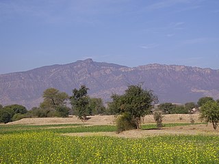
Dewal Manal is one of the 51 union councils of Abbottabad District in the Khyber-Pakhtunkhwa province of Pakistan.
Lakhala is a village of Abbottabad District in Khyber Pakhtunkhwa, Pakistan. It is at 34°11′0″N73°0′0″E in the west of the district. Its thana is Sherwan and Tehsil Lower Tanawaland district Abbottabad. Lakhala village is Khan property Mr Khanzada Muhammad Rajwali Khan Tanoli is King of This village He death 9 may 1922
Tajwal is one of the 51 union councils of Abbottabad District in Khyber-Pakhtunkhwa province of Pakistan.
Bagh is a union council of Abbottabad District in Khyber-Pakhtunkhwa province of Pakistan, it has two high schools GHS Bagh and GMS Kehial The main tribe of this area are the Jadun and the Dhund Abbasis.
Dab is a village and union council, an administrative subdivision, of Chakwal District in the Punjab Province of Pakistan, it is part of Chakwal Tehsil.
Mahant Darshan is a town and union council of Depalpur Tehsil in the Okara District of Punjab Province, Pakistan. The town is located at 30°13'60N 73°16'60E and has an altitude of 152 metres.
Samina sadaat is a town and union council of Dera Ghazi Khan District in the Punjab province of Pakistan probably its name is given on the basis of 2 historical figures as [(Suleman khan sameen)] and [(Syed Abdullah Shah)] as Shah Sahb came in Samina for the sake of dawah and Suleman khan sameen allotted him some land so could live here that is why that place is called Samina Sadat. The town is located on the bank of the Indus River.
Rustam is a 4th Tehsil in Mardan District of Khyber-Pakhtunkhwa. It is located at 34°21'0N 72°17'0E and has an altitude of 369m. Rustam is surrounded by the mountains of chengay baba, shabaz ghara, sar malang and Kashmir smasta. Rustam is famous for its agri products – fruits and vegetables. In education, the Rustam has recently moved forward with the establishments of private sector colleges such as Unicom College of Business Studies and Sudhum Children Academy and College. The Government High Schools for Boys and Girls are well established and many well known social contributors have taken their early education in these schools. Currently, A brand new building is under-construction for the Postgraduate Girls College.
Nagri Payeen or Nagri Tarli commonly known as Nagri Payeen is a village in Abbottabad District of Khyber Pakhtunkhwa province of Pakistan. It is part of the Union Council of Pakistan Union Council of Dewal Manal and is located at 34°1′20″N73°18′0″E with an altitude of 1712 metres . Famous Points: Barrian, Bagh, Balyasar, Garlani, Jalsiyan, Hellan, Mohari, Charrat, Katha, Nalla, Kanat, Graan, kathi, Taroli, Upri Pandi.
Makol or مکول is a village in Abbottabad District of Khyber Pakhtunkhwa province of Pakistan. The village Makol is divided into two parts. Makol Bala مکول بالا یا اپری مکول and Makol Payeen مکول پائیں‘ بنی مکول‘ ترلی مکول. Makol Bala is the part of Union Council Nagri Bala while Makol Payeen is part of the Union Council of Dewal Manal and is located at 34°1′30″N73°19′0″E with an altitude of 2064 metres . Makol Bala has three parts. Danna Makol ڈنہ مکول Makol Garan مکول گراں and Sadyalan ni Pandi صدیالاں نی پانڈی. Technically Chak Akhroota is also part of Makol Bala although locally its inhabitants belong to Makol Payeen and Tatreela. There are two primary schools. The major caste of Makool Tarli and Makool Bala is Karlal known as Sardar, Karlal (Sardar) tribes are the main stakeholder of Makool.
M'Clure Bay is a Peel Sound waterway in Qikiqtaaluk Region, Nunavut, Canada. It is located on the western side of Somerset Island, between Aston Bay and Birmingham Bay.
Tupla is a village in the Abbottabad District of the Khyber Pakhtunkhwa province of Pakistan. It is located at 34°0'0N 73°20'0E with an altitude of 1781 metres.
The Taku River Tlingit First Nation are the band government of the Inland Tlingit in far northern British Columbia, Canada and also in Yukon. They comprise two ḵwaan (tribes) of the Tlingit people, who are otherwise coastal, the Áa Tlein Ḵwáan of the Atlin Lake area and the Deisleen Ḵwáan of Teslin Lake, whose main focus is the Teslin Tlingit Council in Teslin, Yukon. Their band offices are in Atlin, British Columbia.
The Tseycum First Nation is a First Nations government located on Vancouver Island. In the 1850s they were signatories to the Douglas Treaties.
The District Council of Ridley-Truro was a local government area in South Australia from 1991 to 1997.
The District Council of Ridley was a local government area in South Australia from 1976 to 1991.
References
| | This Abbottabad District location article is a stub. You can help Wikipedia by expanding it. |