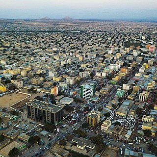
Hargeisa is the capital and largest city of the Republic of Somaliland, a de facto sovereign state in the Horn of Africa, still considered internationally to be part of Somalia. It is also the regional capital of the Maroodi Jeex region of Somaliland.

Gabiley, also known as Gebiley, is a city in the Maroodi Jeex region of Somaliland.

Rapu-Rapu, officially the Municipality of Rapu-Rapu, is a 3rd class municipality in the province of Albay in the Bicol Region of the Philippines. The population was 36,151 at the 2020 census.
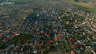
Ali Sabieh is the second largest city in Djibouti. It is situated about 98 kilometres Southwest of Djibouti City and 10 km (6 mi) north of the border with Ethiopia. It sprawls on a wide basin surrounded by granitic mountains on all sides. Ali Sabieh's mild climate makes it a popular tourist destination for Djiboutians. The famous landmark of Ali Sabieh mountain is located near the city.
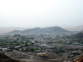
Borama is the largest city of the northwestern Awdal region of Somaliland. The commercial seat of the province, it is situated near the border with Ethiopia.

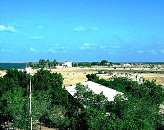
Arabsiyo is a town in the Gabiley district of Somaliland. The town is located about 30 km west of Hargeisa.

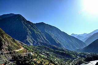
Besham is a city in the Shangla District of Khyber Pakhtunkhwa, Pakistan. Located on the right bank of the Indus River, Besham serves as a major junction on the Karakoram Highway, that connects Khyber Pakhtunkhwa and Punjab with Gilgit-Baltistan, and crosses over into China's Xinjiang. Besham is also the eastern terminus of the under-construction E90 expressway, which will connect the city westward with Khwazakhela in Swat District. Besham is located around 60 kilometres (40 mi) east of Swat, 250 kilometres (160 mi) north of Rawalpindi-Islamabad, and 270 kilometres (170 mi) northeast of the provincial capital, Peshawar, Pakistan.

Khôr ʽAngar is a town in the northern Obock Region of Djibouti. It is situated on the west coast of the Bab el Mandeb Strait. The town is served by Herkale Airport, a desert airstrip 7 kilometres (4 mi) northwest.
Loyada is a small town in Djibouti. Located in the Arta Region, it is the only official border crossing from Djibouti into Somaliland. It is situated on the west coast of Gulf of Aden, 25 kilometres (16 mi) from the capital, Djibouti.
Holhol is a town in the Ali Sabieh Region of Djibouti. It is located 44 kilometres south-west of the capital Djibouti City, at an altitude of 450 metres above sea level. The surrounding area is rich in livestock and fledgling agriculture. It is notable for being the birthplace of Cheik Osman Waiss a nationalist and anti-colonial where he began his movement.

The climate of Norway is more temperate than could be expected for such high latitudes. This is mainly due to the North Atlantic Current with its extension, the Norwegian Current, raising the air temperature; the prevailing southwesterlies bringing mild air onshore; and the general southwest–northeast orientation of the coast, which allows the westerlies to penetrate into the Arctic. The January average in Brønnøysund is 15.8C (28.6F) higher than the January average in Nome, Alaska, even though both towns are situated on the west coast of the continents at 65°N. In July the difference is reduced to 3.2C (5.8F). The January average of Yakutsk, in Siberia but slightly further south, is 42.3C (76.1F) lower than in Brønnøysund.
Ouroun is a small town and commune in the Cercle of Bougouni in the Sikasso Region of southern Mali. In 1998 the commune had a population of 3,947.

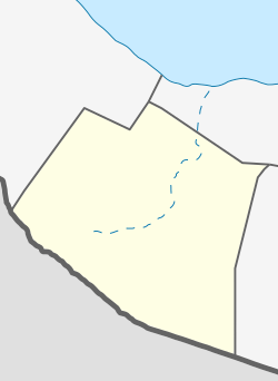
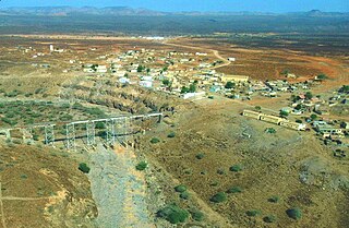
Salahley District is a District in the most Eastern part of the Maroodi Jeex Region in Somaliland. Its capital lies at Salahlay.
Weʽa or Wêʽa is a town in the Arta Region of Djibouti. It is located on the RN-1 National Highway, which connects it to Djibouti City, located some 37 kilometres to the east. Weʽa is the second largest city in the Arta Region after Arta and before Damerjog. It is the primary transportation hub in western Djibouti via highway. The town is situated in a small valley.
Chakrampally is a village located in Ranga Reddy district of Telangana, India. It falls under Mominpet mandal, It is 40 km (25 mi) from its headquarters, the capital of Telangana, Hyderabad. Cities near Chakrampally are: Sadasivpet, Vikarabad, and Sangareddy. Chakrampally has total 942 people in 456 hectares of region, where males are 462 and females are 480 with 199 houses (Eedula).

The Ogo Mountains, also known as the Galgodon Highlands, are a mountain range in the country of Somaliland. They cross the Sanaag and Togdheer regions. With a mean peak height of 2,450 m (8,040 ft), the ecology of this landform is semi-desert.
Meymunaq is a village in Sarajuy-ye Shomali Rural District, in the Central District of Maragheh County, East Azerbaijan Province, Iran. At the 2006 census, its population was 394, in 87 families.
Pattan is the capital of Lower Kohistan District in the Khyber Pakhtunkhwa province of Pakistan.
Darai Nur or Darra-i-Nur is a town in the Darai Nur District of Nangarhar Province, Afghanistan. It is located 45 km to the northeast of Jalalabad, the capital of Nangarhar. Darai Nur's residents speak a variant of Pashayi language, but are bilingual in Pashto.

Somaliland is an unrecognised sovereign state in the Horn of Africa, internationally considered to be part of Somalia.
Somaliland is located in the East African sub-continent between the equator and the Gulf of Aden. The country occupies an area of approximately 176,120 square kilometres (68,000 sq mi). The climate is mostly hot and desertlike; it is largely arid with some semi-arid regions.