Lae (German: Preußen-Reede, later Lehe) is the capital of Morobe Province and is the second-largest city in Papua New Guinea. It is located near the delta of the Markham River on the northern coast of Huon Gulf. It is at the start of the Highlands Highway, which is the main land transport corridor between the Highlands Region and the coast. Lae is the largest cargo port of the country and is the industrial hub of Papua New Guinea. The city is known as the Garden City and home of the Papua New Guinea University of Technology.
Kokoda is a station town in the Oro Province of Papua New Guinea. It is famous as the northern end of the Kokoda Track, site of the eponymous Kokoda Track campaign of World War II. In that campaign, it had strategic significance because it had the only airfield along the Track. In the decades preceding, it had been a foothills settlement near the gold fields.

Mount Hagen is the third largest city in Papua New Guinea, with a population of 46,250. It is the capital of the Western Highlands Province and is located in the large fertile Wahgi Valley in central mainland Papua New Guinea, at an elevation of 1,677 m (5,502 ft).
PNG Air is an airline based on the grounds of Jacksons International Airport, Port Moresby, Papua New Guinea. It operates scheduled domestic and international flights, as well as contract corporate charter work. Its main base is Jacksons International Airport.

Port Moresby International Airport, also known as Jacksons International Airport, is an international airport located eight kilometres outside Port Moresby in Papua New Guinea. It is the largest and busiest airport in Papua New Guinea, with an estimated 1.4 million passengers using the airport in 2015, and is the main hub for Air Niugini, the national airline of Papua New Guinea. The airport serves as the main hub for PNG Air and Travel Air. It replaced the original Port Moresby airport, in what is now the suburb of Waigani, whose airstrip remained until the 1990s but no trace of which remains, having been built over.
Awaba Airport is an airfield serving Awaba, in the Western Province of Papua New Guinea.
Balimo Airport is an airfield serving Balimo, in the Western Province of Papua New Guinea.
Buka Airport is an airport serving Buka Island in the Autonomous Region of Bougainville in Papua New Guinea.
Gasmata Airport is an airfield in Gasmata in the West New Britain Province of Papua New Guinea.
Jacquinot Bay Airport is an airport near Jacquinot Bay in the East New Britain Province on the island of New Britain in Papua New Guinea. The airstrip was liberated by the Australian Army in 1944, and an airstrip was built by 1945. There is no scheduled airline service.
Moro Airport is an airfield in Moro, in the Southern Highlands Province of Papua New Guinea.
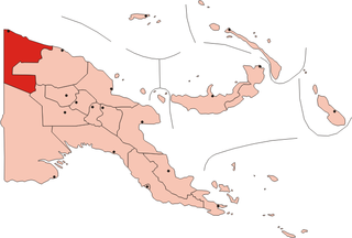
Aitape Airport is an airfield in Aitape, in the Sandaun Province of Papua New Guinea. There is another airstrip at Tadji about 10 km to the east, where most flights land.

Lae Airfield is a former World War II airfield and later, civilian airport located at Lae, Morobe Province, Papua New Guinea. The airport was closed in the 1980s, in favour of Lae Nadzab Airport, which was able to accommodate larger jet aircraft. The airport was also known as Lae Drome or Lae Aerodrome.
Bosset Airport is an airfield serving Bosset, a village in the Western province in Papua New Guinea. The airfield is located 289 nautical miles west of Port Moresby, the capital and largest city of Papua New Guinea.

Frieda River Airport is an airfield serving the Frieda River area in Papua New Guinea. It is located near the border between the provinces of West Sepik (Sandaun) and East Sepik. The area has a gold and copper mine known as the Frieda River Project. The airfield is located 428 nautical miles northwest of Port Moresby, the capital and largest city of Papua New Guinea.

HMAS Ladava is a former Royal Australian Navy (RAN) base that was located at Milne Bay in Papua New Guinea.
Efogi Airport is an airfield serving Efogi, in the Central Province of Papua New Guinea.
Samberigi Airport is an airfield serving Samberigi, in the Southern Highlands Province of Papua New Guinea.

Bulolo Airport is an airfield serving Bulolo, in the Morobe Province of Papua New Guinea.


