
London is an unincorporated community in Kimble County, Texas, United States. According to the Handbook of Texas, the community had an estimated population of 180 in 2000.
Vanderpool is a small unincorporated community in Bandera County in the U.S. state of Texas, in the Texas Hill Country, which is part of the Edwards Plateau. It lies 30 miles (48 km) west of Bandera. Hunting, ranching and tourism are chief contributors to the regional economy. Vanderpool had a population of 22 in 1990. It is considered part of the San Antonio Metropolitan Statistical Area. The area zip code is 78885. The town is named after the first postmaster, L.B. Vanderpool.
Nugent is an unincorporated community in Jones County, Texas, United States. According to the Handbook of Texas, the community had an estimated population of 41 in 2000. It is part of the Abilene, Texas Metropolitan Statistical Area.
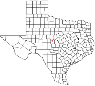
Lohn is an unincorporated community in McCulloch County, Texas, United States. According to the Handbook of Texas, the community had an estimated population of 149 in 2000.
Tarpley is an unincorporated community in Bandera County, Texas, United States. It is part of the San Antonio Metropolitan Statistical Area. The town is located about 12 miles southwest of Bandera. The zip code is 78883.
Islitas is a ghost town in southwestern Webb County, Texas, United States. It was established as a railroad stop and coal shipping center on the Rio Grande and Pecos Valley Railroad in 1882. In 1914 Islitas had its peak population of 300. After 1914 the local mines declined. In 1920 the last census report for the community showed 100 people.
Las Tiendas is a small unincorporated ranching community in northwestern Webb County, Texas, United States. The community's name is Spanish for "the shops" or "the tents".
Nye was a town two miles north of Laredo in southwestern Webb County, Texas, United States. It was named after Thomas C. Nye, a local planter who introduced Bermuda onions into the community in 1898. The area has been eventually absorbed by neighboring Laredo.
Pescadito was a town near Laredo in southwestern Webb County, Texas, United States. Pescadito was a stop on the Texas Mexican Railway in 1881. In 1930 it had a population of 25. The community's main business was mesquite wood for railroads until coal began to be used in 1946.
Callaghan is a ranching community in Webb County, Texas and was established in 1881. The community was named after a nearby ranch owned by Charles Callaghan and much later Joe B. Finley. The community was once a cattle shipping point on the International and Great Northern Railroad. Callaghan is served by the Callaghan Ranch Airport. Callaghan is fourteen miles north of Laredo, Texas.

Parkhill is an unincorporated community in Butte County, California. It lies at an elevation of 1942 feet. Parkhill is located at 39°43′21″N121°29′48″W.
Truscott is an unincorporated community in Knox County, Texas, United States. According to the Handbook of Texas, the community had an estimated population of 50.
Voca is an unincorporated community in McCulloch County, Texas, United States. According to the Handbook of Texas, the community had an estimated population of 56 in 2000.
Goldsboro is an unincorporated community that spans southeast Taylor County, northeast Runnels County, and northwest Coleman County, Texas, United States. According to the Handbook of Texas, the community had an estimated population of 30 in 2000. While Goldsboro received an influx of population from the nearby town of Tokeen when the railroad arrived, both communities are now considered rural remnants of the original towns. The geographical location is split between the Jim Ned and Coleman school districts. Ranching and farming are the primary sources of income other than serving as a bedroom community for Abilene, Texas.
Artesia Wells is an unincorporated community in La Salle County, Texas, United States. According to the Handbook of Texas, the community had an estimated population of 35 in 2000.

South Llano River State Park is located in the Hill Country of Texas and is managed by the Texas Parks and Wildlife Department. It lies in the valley of the Llano River. The park, which consists of 507 acres along the south bank of the Llano River, opened to the public in 1990.
Dent is an unincorporated community in Texas County, in the U.S. state of Missouri.
Callan is an unincorporated community in Menard County, Texas, United States.
Erna is an unincorporated community in Menard County, Texas, United States.
Glasgow is an unincorporated community in Thomas County, in the U.S. state of Georgia.


