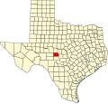
Hext, Texas

Last updated

Hext, Texas
USA Texas location map.svg
Red pog.svg
Hext, Texas
Location within the state of Texas
Usa edcp location map.svg
Red pog.svg
Hext, Texas
Hext, Texas (the United States)
Coordinates: 30°52′09″N99°31′43″W / 30.86917°N 99.52861°W / 30.86917; -99.52861
CountryUnited States
State Texas
County Menard
Population
 (2000)
  Total73
Time zone UTC-6 (Central (CST))
  Summer (DST) UTC-5 (CDT)
ZIP code
76848
Area code 325
FIPS code 48-33440 [1]
GNIS feature ID1379923 [2]

Hext is an unincorporated community in Menard County, Texas, United States. According to the Handbook of Texas , the community had an estimated population of 73 in 2000. [3]

Contents

Geography

Hext is situated at the intersection of State Highway 29 and FM 1221, approximately 16 miles east of Menard and 131 miles northwest of Austin in eastern Menard County. [4]

History

The community was first known as Maringo (or Marengo) when it was settled in the 1870s. When local residents attempted to establish a post office in 1895, they found that Maringo was already taken and decided on the name Hext in honor of Joseph Robert "Bob" Hext (1859–1941). Mr. Hext was one of the first settlers in the area. The post office was established in 1897, which made the name permanent. [4]

Hext reached its peak around 1914, when it had 125 residents, two general stores, a hotel, cotton gin, and a Church of Christ that had been organized in 1904. [3] A Baptist church was established in 1916. The community's population had declined to 40 by the mid-1920s, but rebounded to around 60 in the late 1940s. [3] By 1988, Hext reported 64 residents. That figure had grown slightly, to 73, by 2000. [3]

Although Hext is unincorporated, it continues to have a post office in operation with the zip code of 76848. [5] Several abandoned buildings remain in Hext, such as an old schoolhouse and church. [6]

Climate

Hext experiences a humid subtropical climate, with hot summers and a generally mild winter. Temperatures range from 95 °F (35 C) in the summer to 31 °F (-.06 C) during winter.

Climate data for Hext, Texas
MonthJanFebMarAprMayJunJulAugSepOctNovDecYear
Record high °F (°C)91
(33)
97
(36)
98
(37)
107
(42)
114
(46)
112
(44)
110
(43)
109
(43)
109
(43)
99
(37)
91
(33)
87
(31)
114
(46)
Average high °F (°C)60
(16)
66
(19)
73
(23)
81
(27)
87
(31)
91
(33)
95
(35)
94
(34)
88
(31)
80
(27)
69
(21)
61
(16)
79
(26)
Daily mean °F (°C)46
(8)
50
(10)
58
(14)
65
(18)
73
(23)
79
(26)
81
(27)
80
(27)
75
(24)
66
(19)
54
(12)
47
(8)
65
(18)
Average low °F (°C)31
(−1)
35
(2)
43
(6)
50
(10)
59
(15)
66
(19)
68
(20)
67
(19)
61
(16)
51
(11)
40
(4)
32
(0)
50
(10)
Record low °F (°C)−2
(−19)
−1
(−18)
7
(−14)
20
(−7)
27
(−3)
43
(6)
48
(9)
40
(4)
33
(1)
21
(−6)
9
(−13)
−6
(−21)
−6
(−21)
Average precipitation inches (mm).97
(25)
1.48
(38)
1.60
(41)
1.72
(44)
3.22
(82)
3.38
(86)
2.14
(54)
2.34
(59)
2.69
(68)
2.57
(65)
1.51
(38)
1.28
(33)
24.9
(633)
Source: The Weather Channel [7]

Education

Public education in the community of Hext is provided by the Menard Independent School District.

Related Research Articles

<span class="mw-page-title-main">London, Texas</span> Place in Texas, United States

London is an unincorporated community in northeast Kimble County, Texas, United States. According to the Handbook of Texas, the community had an estimated population of 180 in 2000.

Woden is an unincorporated community in Nacogdoches County, Texas, United States.

Veribest is an unincorporated community in Tom Green County, Texas, United States. According to the Handbook of Texas, the community had an estimated population of 40 in 2000. It is part of the San Angelo, Texas, Metropolitan Statistical Area.

<span class="mw-page-title-main">Gause, Texas</span> Census-designated place in Texas, United States

Gause is an unincorporated community and census-designated place in Milam County, Texas, United States. According to the Handbook of Texas, the community had an estimated population of 400 in 2000. It was first listed as a CDP in the 2020 census with a population of 275.

May is an unincorporated community in Brown County, Texas, United States. According to the Handbook of Texas, the community had an estimated population of 285 in 2000. May was designated a Recorded Texas Historic Landmark in 1981, with marker number 5377. In 2001, historical marker 12532 was added for May United Methodist Church, commemorating the church's presence in the community for over 100 years. The May Cemetery was designated a Historic Texas Cemetery in 2016.

Medina is an unincorporated community in Bandera County, Texas, United States. It is part of the San Antonio Metropolitan Statistical Area. Medina is famous for its apples. The community's population was estimated to be 515 in 2000.

Silver is an unincorporated community in northwestern Coke County, Texas, United States. Its elevation is 2,100 feet (640 m). Although Silver is unincorporated, it has a post office, with the ZIP code of 76949; the ZCTA for ZIP code 76949 had a population of 30 at the 2000 census. Founded in 1890, the post office was temporarily closed from 1907 to 1908.

<span class="mw-page-title-main">Kenney, Texas</span> Unincorporated community in Texas, United States

Kenney is an unincorporated community in northern Austin County, Texas, United States. According to the Handbook of Texas, the community had a population of 200 in 2000. It is located within the Greater Houston metropolitan area.

<span class="mw-page-title-main">Briggs, Texas</span>

Vancourt is an unincorporated community in eastern Tom Green County, Texas, United States. It lies along U.S. Route 87 east of the city of San Angelo, the county seat of Tom Green County. Its elevation is 1,867 feet (569 m). Although Vancourt is unincorporated, it has a post office, with the ZIP code of 76955; the ZCTA for ZIP Code 76955 had a population of 108 at the 2000 census.

Dodge is an unincorporated community in eastern Walker County, Texas, United States, on the northern edge of the Sam Houston National Forest. It lies along FM 405 east of the city of Huntsville, the county seat of Walker County. Its elevation is 400 feet (122 m). Although Dodge is unincorporated, it has a post office, with the ZIP code of 77334; the ZCTA for ZIP Code 77334 had a population of 184 at the 2000 census.

<span class="mw-page-title-main">Waring, Texas</span> Unincorporated community in Texas, United States

Waring is an unincorporated community in northwestern Kendall County, Texas, United States. It lies along local roads and the Guadalupe River, northwest of the city of Boerne, the county seat of Kendall County. Its elevation is 1,345 feet (410 m). Although Waring is unincorporated, it has a post office, with the ZIP code of 78074; the ZCTA for ZIP Code 78074 had a population of 59 at the 2000 census. The community is part of the San Antonio Metropolitan Statistical Area.

<span class="mw-page-title-main">Kendalia, Texas</span> Unincorporated community in Texas, United States

Kendalia is an unincorporated community in northeastern Kendall County, Texas, United States. It is part of the Texas-German belt.

Lelia Lake is an unincorporated community in central Donley County, Texas, United States. It lies along U.S. Route 287, southeast of the city of Clarendon, the county seat of Donley County. Its elevation is 2,592 feet (790 m). Although Lelia Lake is unincorporated, it has a post office, with the ZIP code of 79240; the ZCTA for ZIP code 79240 had a population of 101 at the 2000 census.

<span class="mw-page-title-main">DeBerry, Texas</span>

DeBerry is an unincorporated community in Panola County, Texas, United States. The community has an estimated population of 3,305.

<span class="mw-page-title-main">Dobbin, Texas</span>

Dobbin is an unincorporated community in Montgomery County, Texas, United States. According to the Handbook of Texas, the community had an estimated population of 170 in 2000, although some estimates place that figure at close to 300. Dobbin is part of the Houston–Sugar Land–Baytown Metropolitan Statistical Area.

Art is an unincorporated community in Mason County, Texas, United States. According to the Handbook of Texas, the highly-dispersed community had an estimated population of 18 in 2016.

South Bend is an unincorporated community in Young County, Texas, United States. According to the Handbook of Texas, the community had an estimated population of 140 in 2000.

Proctor is an unincorporated community and census-designated place (CDP) in Comanche County, Texas, United States. According to the Handbook of Texas, the community had an estimated population of 220 in 2000.

Fredonia is an unincorporated community in Mason County, Texas, United States. The community is located near the county line of Mason and San Saba counties, where State Highway 71 intersects with Ranch to Market Road 386. Fredonia has a post office with the ZIP code 76842.

References

  1. "U.S. Census website". United States Census Bureau . Retrieved January 31, 2008.
  2. "US Board on Geographic Names". United States Geological Survey. October 25, 2007. Retrieved January 31, 2008.
  3. 1 2 3 4 "Hext, Texas". The Handbook of Texas online. Retrieved June 9, 2009.
  4. 1 2 "Hext, Texas". History in a Pecan Shell. Texas Escapes Online Magazine. Retrieved June 9, 2009.
  5. Zip Code Lookup
  6. Hext at TexasEscapes
  7. "Monthly Averages for Hext, Texas". The Weather Channel. Archived from the original on October 23, 2012.