
The National Road was the first major improved highway in the United States built by the federal government. Built between 1811 and 1837, the 620-mile (1,000 km) road connected the Potomac and Ohio Rivers and was a main transport path to the West for thousands of settlers. When improved in the 1830s, it became the second U.S. road surfaced with the macadam process pioneered by Scotsman John Loudon McAdam.

The Blue Ridge Parkway is a National Parkway and All-American Road in the United States, noted for its scenic beauty. The parkway, which is America's longest linear park, runs for 469 miles (755 km) through 29 Virginia and North Carolina counties, linking Shenandoah National Park to Great Smoky Mountains National Park. It runs mostly along the spine of the Blue Ridge, a major mountain chain that is part of the Appalachian Mountains. Its southern terminus is at U.S. Route 441 (US 441) on the boundary between Great Smoky Mountains National Park and the Qualla Boundary of the Eastern Band of Cherokee Indians in North Carolina, from which it travels north to Shenandoah National Park in Virginia. The roadway continues through Shenandoah as Skyline Drive, a similar scenic road which is managed by a different National Park Service unit. Both Skyline Drive and the Virginia portion of the Blue Ridge Parkway are part of Virginia State Route 48 (SR 48), though this designation is not signed.

The Allegheny Mountain Range, informally the Alleghenies, is part of the vast Appalachian Mountain Range of the Eastern United States and Canada and posed a significant barrier to land travel in less developed eras. The Allegheny Mountains have a northeast–southwest orientation, running for about 400 miles (640 km) from north-central Pennsylvania, southward through western Maryland and eastern West Virginia.

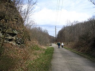
The Great Allegheny Passage (GAP) is a rail trail system in Maryland and Pennsylvania—the central trail of a network of long-distance hiker-biker trails throughout the Allegheny region of the Appalachian Mountains, connecting Washington, D.C. to Pittsburgh, Pennsylvania. It consists of several smaller trails including the Allegheny Highlands Trail of Maryland, the Allegheny Highlands Trail of Pennsylvania and the Youghiogheny River Trail.
Monsal Dale is a valley in Derbyshire, England, in the White Peak limestone area of the Peak District National Park. It is a Site of Special Scientific Interest (SSSI), a Special Area of Conservation (SAC) (1) and part of a Europe-wide network called Natura 2000.
The Montour Trail is a multi-use recreational rail trail near Pittsburgh, Pennsylvania. It was formerly the Montour Railroad.
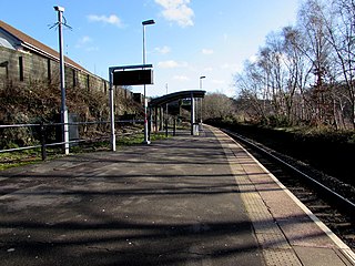
Quakers Yard railway station serves the village of Edwardsville in the community of Treharris, Merthyr Tydfil, Wales. It is located on the Merthyr Tydfil branch of the Merthyr Line. Passenger services are provided by Transport for Wales.

The Casselman River is a 56.5-mile-long (90.9 km) tributary of the Youghiogheny River in western Maryland and Pennsylvania in the United States. The Casselman River drains an area of 576 square miles.

Calstock railway station is an unstaffed railway station on the Tamar Valley Line serving the village of Calstock in Cornwall, United Kingdom. It is situated at grid reference SX 433 688 at the north end of Calstock Viaduct which carries the railway at high level over the River Tamar.
The Kiski Junction Railroad was a short-line railroad that operated in Western Pennsylvania near the city of Pittsburgh. The railroad was based in the small community of Schenley which is situated at the point where the Kiskiminetas River flows into the Allegheny River. The KJR functioned as both a freight hauler and a tourist railroad. The railroad suspended all rail operations after the 2016 season and was officially closed and abandoned in 2021.

The Three Rivers Heritage Trail is an urban rail trail paralleling the riverbanks in Pittsburgh, Pennsylvania and Allegheny County for about 33 miles (53 km), often on both sides of the rivers, and offering views of the city. The trail is promoted and maintained in part by the 'Friends of the Riverfront'. Their stated mission is to increase awareness and engagement with the region's rivers and riverfronts through activities and stewardship, and to extend the water and land trails on the major rivers within Allegheny County.
U.S. Route 40 Alternate is the U.S. Highway designation for a former segment of U.S. Route 40 (US 40) through Garrett and Allegany counties in Maryland. The highway begins at US 40 near exit 14 on Interstate 68 (I-68) and runs 31.80 miles (51.18 km) eastward to Cumberland, where it ends at exit 44 on I-68. Alt US 40 is maintained by the Maryland State Highway Administration (MDSHA).

Savage Mountain is an anticline extending from Bedford County, Pennsylvania southwest into Western Maryland. It is the western side of the Ridge-and-Valley Appalachians, and the eastern portion of the ridge forms the border of Garrett and Allegany Counties of Maryland.

The Herr's Island Railroad Bridge, also known as the West Penn Railroad Bridge, is a truss bridge across the Allegheny River in the United States between the Pittsburgh neighborhoods of Troy Hill and Herrs Island.
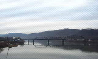
The Brilliant Branch Railroad Bridge is a truss bridge that carries Allegheny Valley Railroad's Brilliant Branch across the Allegheny River between the Pittsburgh neighborhood of Highland Park and the borough of Aspinwall, Pennsylvania.
The Allegheny River Valley Trail is a 5.6-mile (9.0 km) rail trail in Cattaraugus county in western New York. It was built on portions of the former Western New York and Pennsylvania Railway. It has two "loops" the main loop that crosses through Gargoyle Park, West State Street, Constitution Ave, as well as Saint Bonaventure University. There is a shorter alternative loop called the Saint Francis Loop which is 2.6 miles, loops around Saint Bonaventure's campus.

The Brilliant Branch, also known as the Brilliant Cutoff, is a railway line in Pittsburgh and Aspinwall, Pennsylvania. It connects the Pittsburgh Line to the Conemaugh Line and to Allegheny Valley Railroad's Allegheny Subdivision.

Fort Hill is an unincorporated community in Somerset County, Pennsylvania, United States. The community is located along the Casselman River 4.6 miles (7.4 km) east-northeast of Confluence. Fort Hill has a post office with ZIP code 15540, which opened on December 23, 1885.

