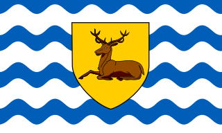
Hertfordshire is one of the home counties in southern England. It borders Bedfordshire and Cambridgeshire to the north, Essex to the east, Greater London to the south, and Buckinghamshire to the west. For government statistical purposes, it forms part of the East of England region.

Berkhamsted is a historic market town in Hertfordshire, England, in the Bulbourne valley, 26 miles (42 km) northwest of London. The town is a civil parish with a town council within the borough of Dacorum which is based in the neighbouring large new town of Hemel Hempstead. Berkhamsted and the adjoining village of Northchurch are together encircled by countryside, much of it in the Chiltern Hills, an Area of Outstanding Natural Beauty (AONB).
Royston is a town and civil parish in the District of North Hertfordshire and county of Hertfordshire in England.

Hitchin is a market town in the North Hertfordshire district in Hertfordshire, England, with an estimated population of 33,350.

Watford is a town and borough in Hertfordshire, England, 15 miles northwest of Central London, on the River Colne.

Harpenden is a town and civil parish in the City and District of St Albans in the county of Hertfordshire, England. The population of the built-up area was 30,240 in the 2011 census, whilst the population of the civil parish was 29,448. Harpenden is a commuter town, with a direct rail connection through Central London and property prices well over triple the national average.

Hertford is the county town of Hertfordshire, England, and is also a civil parish in the East Hertfordshire district of the county. The parish had a population of 26,783 at the 2011 census.

Sawbridgeworth is a town and civil parish in Hertfordshire, England, close to the border with Essex. It is 12 miles (19 km) east of Hertford and 9 miles (14 km) north of Epping. It is the northernmost part of the Greater London Built-up Area.

Markyate is a village and civil parish in north-west Hertfordshire, close to the border with Bedfordshire and Buckinghamshire.

Hinxworth is a village and civil parish in North Hertfordshire, England. It sits just off the Great North Road between Baldock and Biggleswade. It has a village hall, a park, a pub, a small church, a bus stop and a post box. The population at the 2011 Census was 313.

Darsham is a village in Suffolk, England. It is located approximately 4 miles (6 km) north east of Saxmundham. The village is bypassed by the A12 and is served by Darsham railway station, which is approximately one mile away from the village centre, on the Ipswich-Lowestoft East Suffolk Line.

Bramfield is a village and civil parish in the east of the English county of Suffolk, and in the East Suffolk district. It is 5 miles (8.0 km) south of the market town of Halesworth on the A144 road between Halesworth and the A12 road, one of the main arterial routes through the county. The village is 24 miles (39 km) north-east of the county town of Ipswich and 15 miles (24 km) south-west of the port of Lowestoft. The East Suffolk railway line between Lowestoft and Ipswich passes close to the west of the village with Halesworth railway station being the nearest station.

East Hertfordshire District Council is the local authority for the East Hertfordshire non-metropolitan district of England, the United Kingdom. East Hertfordshire covers most of the eastern third of Hertfordshire, in the East of England region. The council area includes the county town of Hertford, the district's largest town Bishop's Stortford, Ware, Sawbridgeworth, Buntingford and neighbouring villages.

Braughing is a village and civil parish, between the rivers Quin and Rib, in the non-metropolitan district of East Hertfordshire, part of the English county of Hertfordshire. Braughing gave its name to a county division in Hertfordshire, known as a "hundred". This was a rural district from 1935 to 1974. The population at the 2011 Census was 1,203. This includes Bozen Green, Braughing Friars and Brent Pelham.

Kelshall is a small village in North East Hertfordshire, England. It is near the town of Royston. It has a village hall and the local church is St Faith's. Kelshall is also the name of the civil parish. Kelshall also has a major road running along one of its boundaries. In the 1880s the church was described as being "ancient, plain, and good, with a tower; and contains a few brasses and monuments".

Sally Pearson, OAM is a retired Australian athlete. She is the 2011 and 2017 World champion and 2012 Olympic champion in the 100 metres hurdles. She also won a silver medal in the 100 m hurdles at the 2008 Summer Olympics and the 2013 World Championships.

Reed is a small village and civil parish in North Hertfordshire. It is situated on a chalk ridge, approximately 3 miles (4.8 km) south of the market town of Royston. The Prime Meridian passes just to the east of the village, between Reed and Barkway. The modern A10 road passes just to the west of the village. The population of the parish was 310 at the time of the 2011 census.
Hertingfordbury is a small village in Hertfordshire, England, close to the county town of Hertford. It was mentioned in the Domesday Book. Hertingfordbury is also the name of a neighbouring civil parish, which does not contain the village, which is actually within the local government area of Hertford Town Council. The population of the civil parish as of the 2011 census was 630.

Kensworth is a village and civil parish located in the Central Bedfordshire district of Bedfordshire, England. The parish is located on the edge of Dunstable Downs, and includes the hamlets of California and Kensworth Lynch.

Bramfield is a village and civil parish in the East Hertfordshire district, in the county of Hertfordshire, England. Nearby settlements include Hertford, Waterford and Stapleford. Bramfield has a church dedicated to St Andrew.
