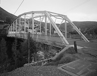
The San Francisco River is a 159-mile-long (256 km) river in the southwest United States, the largest tributary of the Upper Gila River. The river originates near Alpine, Arizona and flows into New Mexico before re-entering Arizona and joining the Gila downstream from Clifton, Arizona.

Entre Ríos is a central province of Argentina, located in the Mesopotamia region. It borders the provinces of Buenos Aires (south), Corrientes (north) and Santa Fe (west), and Uruguay in the east.

Jujuy is a province of Argentina, located in the extreme northwest of the country, at the borders with Chile and Bolivia. The only neighboring Argentine province is Salta to the east and south.

Santiago del Estero, also known simply as Santiago, is a province in the north of Argentina. Neighbouring provinces, clockwise from the north, are Salta, Chaco, Santa Fe, Córdoba, Catamarca and Tucumán.
The Salmita Mine was a gold producer in the Northwest Territories, Canada during 1983 to 1987. The deposit was first discovered in 1945 and underground exploration was carried out in 1951-1952. It was reactivated for exploration by Giant Yellowknife Mines Limited in 1975 and entered production in 1983. They used the old camp and milling plant of the abandoned Tundra Mine, located a few kilometres to the south. The mine produced 179,906 troy ounces (5596 kg) of gold from the milling of 238,177 tons of ore.
The Mojotoro River, or Lavayen River is a river in the province of Salta, Argentina. It is a tributary of the San Francisco River. It is the natural north border of the municipality of Salta, the provincial capital. Its catchment basin drains an area of 835 square kilometres (322 sq mi) and is in turn a part of the upper basin of the Bermejo River.

Chilliwack River Provincial Park is a provincial park in British Columbia, Canada, located on the north side of the Chilliwack River to the southeast of the City of Chilliwack in the province's Lower Mainland region.

Libertador General San Martín is a town in Jujuy Province, Argentina, and capital of the Ledesma Department, located on the National Route Nº34.

The Diamante River is a river in the Argentine province of Mendoza. It is born from glaciers on the Maipo, a volcano in the Andes range in the Argentine–Chilean border, and flows east until emptying in the Desaguadero River. Its drainage basin covers an area of 2,750 square kilometres (1,060 sq mi) in the central region of Mendoza.

The National University of the Littoral is a university in Argentina. It is based in Santa Fe, the capital of the province of the same name, and it has colleges and other academic facilities in Esperanza, Reconquista and Gálvez, also in Santa Fe Province.
Cajón del Maipo is a canyon located in the Andean southeastern portion of the Santiago Metropolitan Region, Chile. It encompasses the upper Maipo River basin, where the river has entrenched itself in a narrow valley. The zone features a series of confluent rivers such as El Volcán River, Yeso River and Colorado River, as well as other minor streams, including San Gabriel, Manzanito, Coyanco, El Sauce, El Manzano and San José. The main locality is San José de Maipo, capital of the commune that includes all of the Andean sector of the Metropolitan Region. The valley ends almost at the border with Argentina, where it is surrounded by some of the highest peaks in the region, including San José, Maipo, and Marmolejo, the most southerly mountain taller than 6,000 metres (20,000 ft) in the world. Several of the mountains are active volcanoes; San Jose was the most recent to erupt, in 1960.

The Iruya River is a river of Argentina. It is a tributary of the Pescado River.
The Lipeo River is a river of Argentina. It is a tributary of the Bermejo River.
The Pescado River is a river of Argentina. It is a tributary of the Bermejo River.
The Río Grande de Tarija is a river of Argentina and Bolivia. It is a tributary of the Bermejo River. It is also known as the Río Tarija and the Tarija River.

San Ramón is a small town in the Beni Department in Bolivia.

Aubrey Landing, Aubrey City or Aubrey is a ghost town at the mouth of the Bill Williams River in southern Mohave County, Arizona. The town was founded before 1865 and was abandoned sometime after 1886. Aubrey Landing was inundated when Lake Havasu was formed.
Whitewater Draw, originally Rio de Agua Prieta, [Spanish: river of dark water], is a tributary stream of the Rio de Agua Prieta in Cochise County, Arizona. It was called Blackwater Creek by Philip St. George Cooke when his command, the Mormon Battalion, camped at a spring on its course on December 5, 1846.