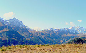
The Grimsel Pass is a mountain pass in Switzerland, crossing the Bernese Alps at an elevation of 2,164 metres (7,100 ft). The pass connects the Haslital, the upper valley of the river Aare, with the upper valley of the Rhône. In so doing, and as the Aare is a tributary of the Rhine, the pass crosses the continental divide between the North Sea and the Mediterranean Sea.

The Splügen Pass is an Alpine mountain pass of the Lepontine Alps. It connects the Swiss, Grisonian Splügen 5 kilometres (3.1 mi) to the north 675 metres (2,215 ft) below the pass with the Italian Chiavenna 21 kilometres (13 mi) to the south at the end of the Valle San Giacomo 1,789 metres (5,869 ft) below the pass.

The Grosse Scheidegg is a mountain pass in the Bernese Alps of Switzerland, The pass crosses the col between the Schwarzhorn and the Wetterhorn mountains at an elevation of 1,962 m (6,437 ft).

The Brünig Pass, at an altitude of 1,008 m (3,307 ft), connects the Bernese Oberland and central Switzerland, linking Meiringen in the canton of Bern and Lungern in the canton of Obwalden. It is on the watershed between the upper reaches of the Aare, which flows through Lake Brienz and Lake Thun, and the Sarner Aa, which flows into Lake Lucerne.

Lago di Poschiavo is a natural lake in the Val di Poschiavo in the Swiss canton of the Grisons.

Monte Ceneri is a mountain pass in the canton of Ticino in Switzerland. It connects the Magadino Plain and the Vedeggio Valley across the Lugano Prealps at an elevation of 554 metres (1,818 ft) above sea level. It provides the most direct route between the cities of Bellinzona and Lugano. Despite its name, Monte Ceneri is the lowest point on the crest between Monte Tamaro and the Camoghè.

Zürich Wiedikon railway station is a railway station on the Zürich S-Bahn system in Wiedikon in the western part of the Swiss city of Zürich. It is the only railway station in Switzerland where the ticket office building is located on a bridge above the tracks – in German, this is known as Reiterbahnhof.
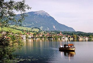
Lake Lauerz is a lake in the Canton of Schwyz, Switzerland.

Pic Chaussy is a mountain of the Vaud Alps, overlooking Les Diablerets to the south. On its northern side lies the Lac Lioson, whilst the Col des Mosses pass flanks its western side. To the east, a ridgeline connects to the peaks of the Châtillon and Le Tarent. Its summit reaches an altitude of 2,351 metres (7,713 ft).

Poschiavino is an 30-kilometre (19 mi) long river that rises in the Swiss canton of Graubünden and flows into the Italian province of Sondrio. The majority of the river is in Switzerland, with just 3 kilometres (1.9 mi) in Italy.

Monte Rogoria is a mountain of the Lugano Prealps, located on the border between Switzerland and Italy, north of Astano, at the foot of the Monte Lema. The summit and the majority of the mountain are in the Swiss canton of Ticino, whilst a part of the north-western flank lies in the Italian region of Lombardy. It has an elevation of 1,184 metres above sea level. The view from the summit of the mountain encompasses the Lake Maggiore, the Borromean Islands and the Monte Rosa massif. There is no official hiking trail leading to the summit itself, but there are trails to the mountain pass Forcola respectively Passo di Monte Faëta at an altitude of 1,117 metres located close to the summit plateau. Starting points are: Astano, Miglieglia and Dumenza.

The Stelvio Pass is a mountain pass in northern Italy bordering Switzerland at an elevation of 2,757 m (9,045 ft) above sea level. It is the highest paved mountain pass in the Eastern Alps, and the second highest in the Alps, 7 m (23 ft) below France's Col de l'Iseran.

The Val Colla is a valley and a quarter of the city of Lugano in the Swiss canton of Ticino, to the north-east of the city of Lugano. It includes the localities of Bogno, Valcolla, Certara, Cimadera, Sonvico, which are all part of the city of Lugano, and the municipality of Capriasca.

Giubiasco railway station is a railway station in the Swiss canton of Ticino and municipality of Bellinzona. The station is on the Swiss Federal Railways Gotthard railway, between Bellinzona and Lugano, and is a junction point with several other lines.

Airolo railway station is a railway station in the Swiss canton of Ticino and municipality of Airolo. The station is on the original line of the Swiss Federal Railways Gotthard railway, at the southern entrance to the Gotthard Tunnel. Most trains on the Gotthard route now use the Gotthard Base Tunnel and do not pass through Airolo station.

Ambrì-Piotta railway station is a railway station in the Swiss canton of Ticino and municipality of Quinto. It takes its name from the nearby communities of Ambrì and Piotta. The station is on the original line of the Swiss Federal Railways Gotthard railway, on the southern ramp up to the Gotthard Tunnel. Most trains on the Gotthard route now use the Gotthard Base Tunnel and do not pass through Ambrì-Piotta station.
The San Lucio Pass, located in the Lugano Prealps at an altitude of 1,541 metres (5,056 ft) above sea level, connects the Val Cavargna in the Italian province of Como with the Val Colla in the Swiss canton of Ticino. The pass is shared by the municipalities of Cavargna (Italy) and Bogno (Switzerland).
The San Jorio Pass, located between the Lepontine Alps and the Lugano Prealps at an altitude of 2,012 metres (6,601 ft) above sea level, connects Garzeno in the Italian province of Como with Carena in the Swiss canton of Ticino. It thus offers a route between the shores of Lake Como and the valley of the Ticino river around Bellinzona.

The Foo Pass is a mountain pass of the Glarus Alps, located on the border between the Swiss cantons of St. Gallen and Glarus, at an elevation of 2,223 m (7,293 ft). It crosses the col between the peaks of Foostock and Piz Sardona.

The Hauptstrasse 29 is a main road in the Swiss canton of Graubünden, with a total length of 51 km (32 mi). The road begins at a junction with Hauptstrasse 27 between Samedan and Pontresina, and passes Pontresina before climbing over the Bernina pass at a maximum elevation of 2,328 m (7,638 ft) above sea level. From the summit of the pass the road descends into the Val di Poschiavo and passes through San Carlo, Poschiavo, Le Prese and Brusio before reaching the border with Italy at Campocologno.