
Manhattan Beach is a city in southwestern Los Angeles County, California, United States, on the Pacific coast south of El Segundo, west of Hawthorne and Redondo Beach, and north of Hermosa Beach. As of the 2010 census, the population was 35,135.
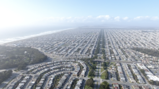
The Sunset District is a neighborhood located in the southwest quadrant of San Francisco, California, United States.
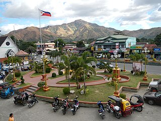
San Antonio, officially the Municipality of San Antonio, is a 2nd class municipality in the province of Zambales, Philippines. According to the 2020 census, it has a population of 37,450 people.

Fitzgerald Marine Reserve is a marine reserve in California on the Pacific Ocean, located just north of Pillar Point Harbor and Mavericks in the San Mateo County community of Moss Beach. Moss Beach is located approximately 20 miles (32 km) south of San Francisco and 50 miles (80 km) north of Santa Cruz. The reserve is a 32-acre (0.13 km2) holding which extends from Montara light station at the north to Pillar Point on the south. The reserve consists of a three-mile stretch of beach, tidepool habitat, marsh, erosive bluffs, clifftop trail and cypress and eucalyptus forests. The property is owned by the State of California and managed by San Mateo County as a county park and nature preserve. The reserve is administratively assigned to be part of the Monterey Bay National Marine Sanctuary. Adjacent to and possibly within the reserve is an endangered species of butterfly, the San Bruno elfin butterfly.
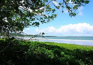
Borongan, officially the City of Borongan, is a 1st class component city and capital of the province of Eastern Samar, Philippines. According to the 2020 census, it has a population of 71,961 people.
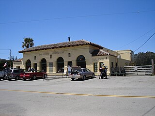
San Gregorio is an unincorporated community in San Mateo County, California, with a population of 214 people. It is located in the San Francisco Bay Area, south of Half Moon Bay. Just east of Highway 1, it is one mile (1.6 km) inland on Highway 84, from San Gregorio State Beach. It is also located 7 (11.4 km) north of Pescadero via Stage Road and 8 miles (13 km) west of La Honda via SR 84.

San Gregorio State Beach is a beach near San Gregorio, California, United States, south of Half Moon Bay. Part of the California State Park System, the beach lies just west of the intersection of California State Route 1 and State Route 84.
San Gregorio may refer to:

Emma Wood State Beach is a California State Beach in Ventura, California. It is located on the Santa Barbara Channel on the west side of the Ventura River estuary and south of the railroad tracks of the Coast Line and the US Highway 101 freeway.

Manchester State Park is a state park of California, United States. It includes 18,000 feet (5,500 m) of protected beachfront on the Pacific Ocean in Northern California on State Route 1, 7 miles (11 km) north of Point Arena. The park features sand dunes, flat grasslands and five miles of gentle, sandy beachfront. The park is noted for steelhead and salmon fishing in the park's two streams, Brush Creek and Alder Creek, as well as the driftwood that collects in the catch basin created by the gently curved coastline. The 5,272-acre (2,134 ha) site was established as a California state park in 1955 and takes its name from Manchester, California, seven miles north of Point Arena.
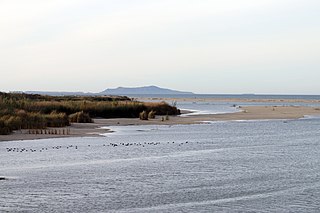
McGrath State Beach is a protected beach park located on the south bank of the mouth of Santa Clara River in the city of Oxnard, California. McGrath State Beach is one of the best bird-watching areas in California, with the lush riverbanks of the Santa Clara River and sand dunes along the shore. A nature trail leads to the Santa Clara Estuary Natural Preserve. Camping sites are available. Two miles of beach provide surfing and fishing opportunities. Just south of the station is the undeveloped Mandalay Beach Park which is about a mile downcoast beach walk from the park or a bike ride along Harbor Blvd. Located south of Ventura on Harbor Boulevard, the beach is on the Pacific Coast Bicycle Route and the California Coastal Trail.
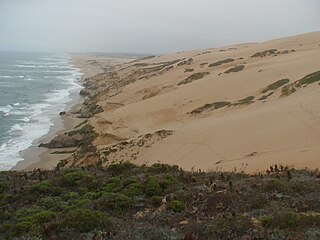
Guadalupe-Nipomo Dunes is the largest remaining dune system south of San Francisco and the second largest in the U.S. state of California. It encompasses an 18-mile (29 km) stretch of coastline on the Central Coast of California and extends from southern San Luis Obispo County to northern Santa Barbara County.
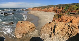
Pescadero State Beach is alongside State Route 1, located 14.5 miles south of Half Moon Bay and 1.5 miles west of the city of Pescadero in San Mateo County, California. The beach has a mile-long shoreline with sandy coves, rocky cliffs, tide pools, fishing spots and picnic facilities.

San Gregorio Creek is a river in San Mateo County, California. Its tributaries originate on the western ridges of the Santa Cruz Mountains whence it courses southwest through steep forested canyons. The San Gregorio Creek mainstem begins at the confluence of Alpine and La Honda Creeks, whence it flows 12 miles (19 km) through rolling grasslands and pasturelands until it meets the Pacific Ocean at San Gregorio State Beach. It traverses the small unincorporated communities of La Honda, San Gregorio, Redwood Terrace and Sky Londa.

The Agua Hedionda Lagoon is a lagoon in Carlsbad, California, that is fed by the Agua Hedionda Creek. Stewardship of much of the lagoon is held by the Encina Power Station and its owner NRG Energy. In November 2000 the Agua Hedionda Lagoon was designated as a critical habitat for the tidewater goby.

Pomponio State Beach is a state beach of California in the United States. It is located 12 miles (19 km) south of Half Moon Bay off California State Route 1.

The San Gregorio Fault is an active, 209 km (130 mi) long fault located off the coast of Northern California. The southern end of the fault is in southern Monterey Bay, and the northern end is about 20 km northwest of San Francisco, near Bolinas Bay, where the San Gregorio intersects the San Andreas Fault. Most of the San Gregorio fault trace is located offshore beneath the waters of Monterey Bay, Half Moon Bay, and the Pacific Ocean, though it cuts across land near Point Año Nuevo and Pillar Point. The San Gregorio Fault is part of a system of coastal faults which run roughly parallel to the San Andreas.
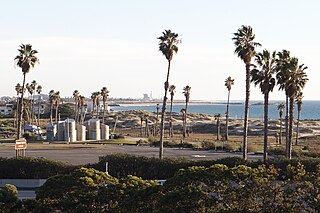
San Buenaventura State Beach is a beach located in Ventura, California. The primary entrance is located at 901 Pedro Street, off the 101 Freeway.

King Philip was a 19th-century clipper ship launched in 1856 and wrecked in 1878. The wreck of this ship is only rarely visible; very infrequently the timbers can be seen protruding from the sands of Ocean Beach, on the Pacific Ocean coast of San Francisco, California. The wreck is the "most complete remains of an American medium clipper." This is a shipwreck of one of many ships that were wrecked in and around San Francisco Bay.


