La Masica is a town, with a population of 5,975, and a municipality in the Honduran department of Atlántida. The largest town of the municipality is San Juan Pueblo, with a population of 8,983.
Santa Rita is a municipality in the Honduran department of Copán.

Texiguat is a municipality in the Honduran department of El Paraíso.
San José is a municipality in the Honduran department of La Paz.
Santiago de Puringla is a municipality in the Honduran department of La Paz. The municipality is situated on a plain bordered by the River Puringla. South of the municipality runs the River Lepasale.

Cololaca is a municipality in the Honduran department of Lempira.

Gualcince is a municipality in the Honduran department of Lempira.

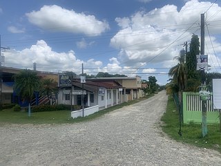
San Sebastián is a municipality in the Honduran department of Lempira.
Olanchito is a town with a population of 45,270, as of 2020, and a municipality in the Honduran department of Yoro. The municipality was founded in 1530 and today comprises 70 villages, over 300 hamlets, and around 100,000 inhabitants. It is located 107 miles (172 km) northeast of Tegucigalpa, the country's capital. Olanchito is in the Central Time Zone, with a UTC offset of -6 hours. The city is the birthplace of many figures of Honduran literature, such as Ramón Amaya Amador. Olanchito has his manuscripts, his collection of books, the table at which he wrote, and even his ashes. Known locally as the Civic City, Olanchito's main industry is agriculture.
Concepción is a municipality in the Honduran department of Ocotepeque.
La Encarnación is a municipality in the Honduran department of Ocotepeque.

Ocotepeque is a municipality in the Honduran department of Ocotepeque. The town of Nueva Ocotepeque is the municipal seat and the capital of the department.
San Fernando is a municipality in the Honduran department of Ocotepeque.
San Marcos is a town, with a population of 6,836, and a municipality in the Honduran department of Ocotepeque.
Sinuapa is a municipality in the Honduran department of Ocotepeque.

Abáigar is a town and municipality located in the province and autonomous community of Navarre, northern Spain.

Espera Feliz is a municipality in southeastern Minas Gerais state, Brazil. The altitude is 2,430 m above sea level. Located at 20°39′00″S41°54′25″W, its neighboring cities are Caiana to the south, Dores do Rio Preto to the east, Divino to the west, Alto Caparaó and Caparaó to the north and Carangola to the southwest.

San Vicente de Alcántara is a municipality in the province of Badajoz, Extremadura, Spain. It has a population of 5,788 and an area of 275 km².
Cottonwood Canyon is a canyon along the Fraser River in the North Cariboo region of the Central Interior of British Columbia, Canada. It is located west of the Cariboo Mountains on the Fraser River south of its confluence with the east-flowing West Road River and north of its confluence with the northwest-flowing Cottonwood River just northwest of the city of Quesnel, The first European explorer was Simon Fraser (explorer) who ran the rapids on the first of June, 1808. One of his canoes became stranded and had to be pulled out of the canyon with a rope. It was one of the obstacles for gold rush-era steamboats operating on the Fraser from Quesnel to Fort George and up the Nechako and Stuart Rivers to Stuart Lake.

