San Luis del Palmar Department

Last updated
San Luis del Palmar Department

Departamento San Luis del Palmar
Bandera de San Luis del Palmar.jpg
Flag
San Luis del Palmar Corrientes.PNG
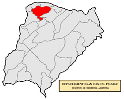
location of San Luis del Palmar Department in Corrientes Province
Coordinates: 27°31′S58°34′W / 27.517°S 58.567°W / -27.517; -58.567
Country Argentina
Seat San Luis del Palmar
Area
  Total2,551 km2 (985 sq mi)
Population
 (2001 census [INDEC])
  Total16,513
  Density6.5/km2 (17/sq mi)
Postal Code
W3403
Area Code03783

San Luis del Palmar Department is a department of Corrientes Province in Argentina.

The provincial subdivision has a population of about 16,513 inhabitants in an area of 2,551 km2 (985 sq mi), and its capital city is San Luis del Palmar, which is located around 1,050 km (650 mi) from Capital Federal.

Settlements


Related Research Articles

Corrientes Province Province of Argentina

Corrientes ; officially the Province of Corrientes is a province in northeast Argentina, in the Mesopotamia region. It is surrounded by : Paraguay, the province of Misiones, Brazil, Uruguay, and the provinces of Entre Rios, Santa Fe and Chaco.

Archipelago of San Andrés, Providencia and Santa Catalina Department in Insular Region, Colombia

The Archipelago of San Andrés, Providencia and Santa Catalina, or, in everyday language, San Andrés and Providencia, is one of the departments of Colombia. It consists of two island groups in the Caribbean Sea about 775 km (482 mi) northwest of mainland Colombia, and eight outlying banks and reefs. The largest island of the archipelago is called San Andrés and its capital is San Andrés. The other large islands are Providencia and Santa Catalina Islands which lie to the north-east of San Andrés; their capital is Santa Isabel.

Municipalities of San Luis Potosí

San Luis Potosí is a state in North Central Mexico that is divided into 58 municipalities. According to the 2020 Mexican Census, it is the nineteenth most populated state with 2,822,255 inhabitants and the 15th largest by land area spanning 61,138.0 square kilometres (23,605.5 sq mi).

Río Negro Department Department of Uruguay

Río Negro Department is a department of the northwestern region of Uruguay. It has an area of 9,282 km2 (3,584 sq mi) and a population of 54,765. Its capital is Fray Bentos. It borders Paysandú Department to the north, Tacuarembó Department to the east, Durazno Department to the southeast, Soriano Department to the south and has the Río Uruguay flowing at its west, separating it from Argentina.

Fray Bartolomé de las Casas Place in Alta Verapaz, Guatemala

Fray Bartolomé de las Casas is a municipality in the Guatemalan department of Alta Verapaz. It is situated at 170m above sea level. It contains 31,611 people. It covers a terrain of 1229km2. The annual festival is April 30-May 4. It is named after the 15th-century Spanish priest, bishop, and writer Bartolomé de Las Casas.

Municipalities of Colombia

The Municipalities of Colombia are decentralized subdivisions of the Republic of Colombia. Municipalities make up most of the departments of Colombia with 1,122 municipalities (municipios). Each one of them is led by a mayor (alcalde) elected by popular vote and represents the maximum executive government official at a municipality level under the mandate of the governor of their department which is a representative of all municipalities in the department; municipalities are grouped to form departments.

National Route 3 (Argentina)

Ruta Nacional 3 is an Argentine highway, stretching from the eastern side of the country in Buenos Aires, crossing the provinces of Buenos Aires, Río Negro, Chubut Province, Santa Cruz and Tierra del Fuego. Since its start at Avenida General Paz (A001) until the end, on the bridge over Lapataia River, it measures 3,045 kilometres (1,892 mi).

San Rafael, Mendoza City in Mendoza, Argentina

San Rafael is a city in the southern region of the Mendoza Province, Argentina. With more than 118,000 inhabitants, it is the largest city in and the seat of San Rafael Department.

Maipú Department, Mendoza Department in Argentina

Maipú Department is a department and municipality located in the north west of Mendoza Province in Argentina.

Santa Vitória do Palmar city in South, Brazil

Santa Vitória do Palmar is a Brazilian city and municipality. It is the southernmost municipality in Brazil, located in the state of Rio Grande do Sul. To the west of the municipality is the Lagoa Mirim and beyond that is Uruguay; to the east and southeast lies the Atlantic Ocean, and to the north is the city of Rio Grande. To the south, it borders the municipality of Chuí and Uruguay.

San Gil Municipality and town in Santander Department, Colombia

San Gil is a town municipality in the Department of Santander in northeastern Colombia, located roughly 300 km (192 mi) from Bogotá and 95 km from the department's capital, Bucaramanga. As of 2020, San Gil had a population of roughly 46,000 people within the total municipal area, making it the third largest urban area in the department, after Bucaramanga and Barrancabermeja. Founded in 1689, San Gil is over 300 years old. It was officially named the tourist capital of the region in 2004, thanks to its outdoor activity opportunities such as rafting, caving, kayaking and hiking.

San José del Palmar Municipality in Chocó Department, Colombia

San José del Palmar is a municipality and town in the Chocó Department, Colombia in the central part of the country, 240 km west of the capital Bogotá. San José del Palmar is 1,288 meters above sea level and the population is about 4,800.

San Luis del Palmar Town in Corrientes, Argentina

San Luis del Palmar is a town in Corrientes Province, Argentina. It is the head town of the San Luis del Palmar Department.

Siltepec Municipality in Chiapas, Mexico

Siltepec is a town and one of the 125 municipalities of Chiapas in southern Mexico.

Tezonapa Municipality in Veracruz, Mexico

Tezonapa is a municipality located in the high mountains region in the State of Veracruz, Mexico, about 219 km from state capital Xalapa. It covers an area of 351 square kilometres (136 sq mi). The law number 93 of December 22, 1960 San Agustín created Tezonapa's municipality with the congregations of the Josefinas, Prison, Tezonapa, Palmarito, etc.

Concarán Municipality and City in San Luis Province, Argentina

Concarán is the capital city of Chacabuco Department or County, in San Luis Province in central Argentina.

Museo Regional del Sureste de Petén

The Museo Regional del Sureste de Petén is an archaeological museum in the town of Dolores in the Petén Department of Guatemala. The museum is located 82 kilometres (51 mi) from Flores, the departmental capital, among the Maya Mountains in an area rich in archaeological sites. It is open daily from 8am to 5pm.

Chacabuco Department, San Luis Department in San Luis, Argentina

Chacabuco is a department of San Luis Province, Argentina.

Juan Martín de Pueyrredón Department Department in San Luis, Argentina

Juan Martín de Pueyrredón is a department of the province of San Luis, Argentina. Its headtown is the city of San Luis, which is also the largest and capital city of the province of San Luis.

Ferrocarril Económico Correntino

Ferrocarril Económico Correntino was the informal name for some former narrow gauge State-owned railway lines in Corrientes Province of Argentina that used a gauge of 600 mm.