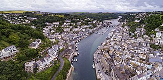
Looe is a coastal town and civil parish in south-east Cornwall, England, United Kingdom, with a population of 5,280 at the 2011 census.

The Liskeard and Looe Union Canal was a broad canal between Liskeard and Looe in Cornwall, United Kingdom. It was almost 6 miles (9.7 km) long and had 24 locks, and it opened progressively from 1827. The engineer was Robert Coad.

Liskeard is an ancient stannary and market town in south-east Cornwall, England, United Kingdom. It is situated approximately 20 miles (32 km) west of Plymouth, 14 miles (23 km) west of the Devon border, and 12 miles (20 km) east of Bodmin. The Bodmin Moor lies to the north-west of the town. The total population of the town at the 2011 census was 11,366

The Looe Valley Line is an 8+3⁄4-mile (14 km) community railway from Liskeard to Looe in Cornwall, England, that follows the valley of the East Looe River for much of its course. It is operated by Great Western Railway.

The River Looe is a river in south-east Cornwall, which flows into the English Channel at Looe. It has two main branches, the East Looe River and the West Looe River. The eastern branch has its source near St Cleer only 0.31 miles (0.5 km) away from the Golitha Falls on the River Fowey, and flows south, passing close to the western outskirts of Liskeard. The western branch has its source near Dobwalls.

Liskeard railway station serves the town of Liskeard in Cornwall, England. The station is approximately 18 miles (29 km) west of Plymouth on the Cornish Main Line and 264 miles 71 chains (426.3 km) from London Paddington via Box and Plymouth Millbay. It is the junction for the Looe Valley Line. The railway station is situated approximately 0.5 miles (0.80 km) south-west of Liskeard town centre.

Looe railway station serves the twin towns of East and West Looe, in Cornwall, England. The station is the terminus of the scenic Looe Valley Line 8.75 miles (14 km) south of Liskeard. It faces out across the estuary of the River Looe.
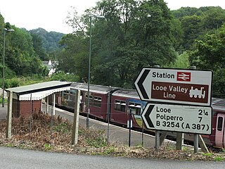
Sandplace railway station is an intermediate station on the scenic Looe Valley Line in Cornwall, England, United Kingdom. The station serves the hamlet of Sandplace and is 6.5 miles (10 km) south of Liskeard.
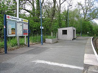
Causeland railway station is an intermediate station 5 miles (8.0 km) south of Liskeard on the scenic Looe Valley Line in Cornwall, United Kingdom, which serves the hamlet of Causeland.

St Keyne Wishing Well Halt railway station is an intermediate station on the scenic Looe Valley Line in Cornwall, England. It serves the village of St Keyne, and is adjacent to the Magnificent Music Machines museum of fairground organs and similar instruments.

Coombe Junction Halt railway station serves the villages of Coombe and Lamellion near Liskeard, Cornwall, England, UK. It is situated on the Looe Valley Line and operated by Great Western Railway. All trains on this line have to reverse at Coombe Junction, but very few continue the short distance into the platform to allow passengers to alight or join the train.

Moorswater is an industrial suburb of Liskeard in Cornwall, England, United Kingdom. It is situated approximately half-a-mile (0.8 km) west of Liskeard town centre.

The Liskeard and Caradon Railway was a mineral railway in Cornwall, in the United Kingdom, which opened in 1844. It was built to carry the ores of copper and tin, and also granite, from their sources on Caradon Hill down to Moorswater for onward transport to market by way of Looe Harbour and coastal shipping. At first this was on the Liskeard and Looe Union Canal and later on the parallel Liskeard and Looe Railway.
The Liskeard and Looe Railway was a railway originally built between Moorswater, in the valley west of Liskeard, and Looe, in Cornwall, England, UK, and later extended to Liskeard station on the Cornish Main Line railway. The first section was opened in 1860 and was owned by the Liskeard and Looe Union Canal Company, whose canal had earlier been built to convey sea sand and lime up the valley of the East Looe River, for the purpose of improving agricultural land.

Moorswater railway station was the centre of operations for the Liskeard and Caradon Railway and the Liskeard and Looe Railway. The two railways made an end on junction here. It was the site of the lines' engine shed, also a china clay works which is now used as a cement terminal.
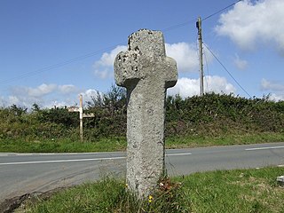
Dobwalls and Trewidland was a civil parish in south-east Cornwall, England, United Kingdom between 1974 and 2021.

Terras Bridge, also known as Terras Pill Bridge, is a road bridge near Morval in Cornwall, England. Built in c. 1825, the Grade II listed bridge crosses the tidal East Looe River, and is adjacent to the Liskeard and Looe Railway and the remains of the Liskeard and Looe Union Canal.
Presented below is an alphabetical index of articles related to Cornwall:
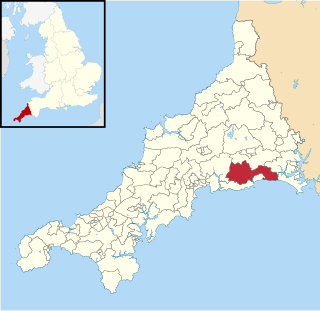
Trelawny was an electoral division of Cornwall in the United Kingdom which returned one member to sit on Cornwall Council between 2013 and 2021. It was abolished at the 2021 local elections, being split into four new divisions: Lostwithiel and Lanreath; Looe West, Pelynt, Lansallos and Lanteglos; Liskeard South and Dobwalls; and Looe East and Deviock.
The St Germans & Looe Railway was a proposed new railway in Cornwall by the Great Western Railway, providing a direct connection between St Germans and Looe. The railway was proposed in 1935 and authorised in 1936, and work commenced in 1937. By the time that war began in 1939 only a small amount of work had been completed, and it was abandoned. Had the railway been completed, it would have involved the construction of four stations, three tunnels and two viaducts.


