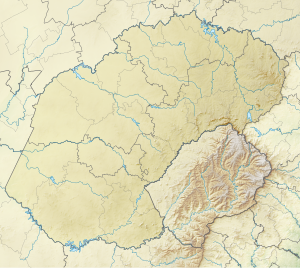
The Drakensberg is the eastern portion of the Great Escarpment, which encloses the central Southern African plateau. The Great Escarpment reaches its greatest elevation – 2,000 to 3,482 metres within the border region of South Africa and Lesotho.

The town of Hoopstad is situated at the intersection of the R34, R59 & R700 in the Free State Province. This area is considered to be the richest maize-producing district in South Africa. The town is located near the Bloemhof Dam which is situated on the Vaal River. The Sandveld Nature Reserve is positioned alongside the Bloemhof Dam. Hopetown and Hoopstad are two different towns and are often confused.

Bloemhof is an agricultural town of about 2,000 inhabitants situated on the banks of the Vaal River in North West Province of South Africa.

The Highveld is the portion of the South African inland plateau which has an altitude above roughly 1,500 m (4,900 ft), but below 2,100 m (6,900 ft), thus excluding the Lesotho mountain regions to the south-east of the Highveld. It is home to some of the country's most important commercial farming areas, as well as its largest concentration of metropolitan centres, especially the Gauteng conurbation, which accommodates one-third of South Africa's population.

The R34 is a long provincial route in South Africa that connects Vryburg with Richards Bay via Kroonstad and Newcastle. It passes through three provinces, North West, the Free State and KwaZulu-Natal.

The R40 is a provincial route in South Africa that connects the Eswatini border at Bulembu via Barberton, Mbombela, Bushbuckridge, Acornhoek and Hoedspruit with Phalaborwa. The route spans two provinces and passes through several private game reserves.

The Caledon River is a major river located in central South Africa. Its total length is 642 km (399 mi), rising in the Drakensberg Mountains on the Lesotho border, flowing southwestward and then westward before joining the Orange River near Bethulie in the southern Free State. The river was originally named Prinses Wilhelminas Rivier in 1777, by Colonel R J Gordon.

The wildlife of Botswana refers to the flora and fauna of this country. Botswana is around 90% covered in savanna, varying from shrub savanna in the southwest in the dry areas to tree savanna consisting of trees and grass in the wetter areas. Even under the hot conditions of the Kalahari Desert, many species survive; in fact the country has more than 2500 species of plants and 650 species of trees. Vegetation and its wild fruits are also extremely important to rural populations living in the desert and are the principal source of food, fuel and medicine for many inhabitants.

The wildlife of Zimbabwe occurs foremost in remote or rugged terrain, in national parks and private wildlife ranches, in miombo woodlands and thorny acacia or kopje. The prominent wild fauna includes African buffalo, African bush elephant, black rhinoceros, southern giraffe, African leopard, lion, plains zebra, and several antelope species.

Timbavati Private Nature Reserve is a nature reserve on the western edge of Kruger National Park in Mpumalanga Province, South Africa. It was established in 1956 by like-minded game farmers with the creation of the Timbavati Association. The association has 50 members and covers 53,392 ha. Timbavati Private Nature Reserve harbours many animals among which the Big Five as well as many antelope species.

The wildlife of Zambia refers to the natural flora and fauna of Zambia. This article provides an overview, and outline of the main wildlife areas or regions, and compact lists of animals focusing on prevalence and distribution in the country rather than on taxonomy. More specialized articles on particular groups are linked from here.

The wildlife of Togo is composed of the flora and fauna of Togo, a country in West Africa. Despite its small size the country has a diversity of habitats; there are only remnants of the once more extensive rain forests in the south, there is Sudanian savanna in the north-western part of the country and larger areas of Guinean forest–savanna mosaic in the centre and north-east. The climate is tropical with distinct wet and dry seasons. There are estimated to be over 3000 species of vascular plants in the country, and 196 species of mammals and 676 species of birds have been recorded there.
The North West Parks Board is a governmental organisation responsible for the management of protected areas and public nature reserves in North West Province, South Africa.

Oviston Nature Reserve is a protected area in the Eastern Cape Province, South Africa. The nature reserve is managed by Eastern Cape Parks. It is located on the southern shores of the Gariep Dam.
The Borakalalo Game Reserve is a protected area in North West Province, South Africa. It is located about 80 kilometres NNW of Pretoria and 60 km north of Brits. This majestic Nature reserve has unfortunately been hampered by numerous safety problems, especially affecting overnight visitors to the reserve. Also known as a fantastic birding destination with specials including African Finfoot, Meyer's Parrot and Grey-Headed Kingfisher.
Koppies Dam Nature Reserve is situated on the highveld of the Free State province of South Africa. The town of Koppies lies 55 km north of Kroonstad, just off the National road N1 and R82 between Kroonstad and Sasolburg. The nature reserve is 16 km east of the town, and is about 4719.65 ha in size. The Renoster and Elandspruit rivers are found within its borders and feed into the Koppies Dam.
Bloemhof Dam is a dam in South Africa. It was originally known as the Oppermansdrif Dam when under construction during the late 1960s. It is located at the confluence of the Vaal River and the Vet River, on the border between the North West and Free State provinces. The dam wall has a total length of 4,270 metres (14,010 ft) The reservoir is very shallow, and therefore needs a large area to mean anything for water storage. The area around the reservoir (dam), has been a protected area, but because it lies on the border between provinces, these became two separate nature reserves. On the North West Province side lies the Bloemhof Dam Nature Reserve, on the Free State side is the Sandveld Nature Reserve.


