
The Cape Cod Canal is an artificial waterway in Massachusetts connecting Cape Cod Bay in the north to Buzzards Bay in the south, and is part of the Atlantic Intracoastal Waterway. The approximately 17.4-mile (28.0 km) long canal traverses the neck of land joining Cape Cod to the state's mainland. It mostly follows tidal rivers widened to 480 feet (150 m) and deepened to 32 feet (9.8 m) at mean low water, shaving up to 135 miles (217 km) off the journey around the Cape for its approximately 14,000 annual users.

Sagamore is a census-designated place (CDP) in the town of Bourne in Barnstable County, Massachusetts, United States. The population was 3,623 at the 2010 census. "Sagamore" was one of the words used by northeastern Native Americans to designate an elected chief or leader.

Bourne is a town in Barnstable County, Massachusetts, United States. The population was 20,452 at the 2020 census.

Route 25 is a 10-mile-long (16 km) freeway located in Plymouth County and Barnstable County, Massachusetts, United States. The route is a nominally east–west highway, and less commonly known as the Blue Star Memorial Highway. An eastward continuation of Interstate 495, Route 25 provides freeway access to Cape Cod. The route's western terminus is at a trumpet interchange with I-495 and I-195 in West Wareham. The route has three numbered interchanges along its length before terminating at the northern end of the Bourne Bridge in Bourne; the mainline of Route 25 continues across the bridge and over the Cape Cod Canal as Massachusetts Route 28 south.

Massachusetts Route 6A is the state road for two sections formerly known as U.S. Route 6 (US 6) on Cape Cod. Most of Route 6A is also known as the Old King's Highway. Combining the 2 major sections, the highway is approximately 62 miles (100 km) long.

Route 3 is a state-numbered route in the U.S. state of Massachusetts, maintained by the Massachusetts Department of Transportation (MassDOT). Spanning approximately 56 miles (90 km) along a north–south axis, it is inventoried with U.S. Route 3 as a single route by the state. The state-numbered Route 3 travels from Bourne in the south to Cambridge in the north, while US 3 continues from Cambridge and crosses the New Hampshire state line in Tyngsborough. Mileposts on US 3 continue from those on the state-numbered Route 3.

The Bourne Bridge in Bourne, Massachusetts, carries Route 28 across the Cape Cod Canal, connecting Cape Cod with the rest of Massachusetts. It won the American Institute of Steel Construction's Class "A" Award of Merit as the "Most Beautiful Steel Bridge" in 1934. Most traffic approaching from the west follows Route 25 which ends at the interchange with US 6 and Route 28 just north of the bridge. The highway provides freeway connections from Interstate 495 and Interstate 195.
The Sagamore Bridge in Sagamore, Massachusetts carries Route 6 and the Claire Saltonstall Bikeway across the Cape Cod Canal, connecting Cape Cod with the mainland of Massachusetts. It is the more northeastern of two automobile canal crossings, the other being the Bourne Bridge. Most traffic approaching from the north follows Massachusetts Route 3 which ends at Route 6 just north of the bridge, and the bridge provides direct expressway connections from Boston and Interstate 93.

Route 28 is a 151.93-mile-long (244.51 km) nominally south–north state highway in the U.S. state of Massachusetts, running from the town of Eastham via Boston to the New Hampshire state line in Methuen. Following the route from its nominally southern end, Route 28 initially heads south to the town of Chatham then turns west to follow along the south shore of Cape Cod. In Falmouth, Route 28 turns north and continues through the western part of Plymouth County and the eastern part of Norfolk County; it then passes through downtown Boston before heading north via Lawrence to the New Hampshire state line, where it continues as New Hampshire Route 28.

Route 130 is a 11.90-mile-long (19.15 km) state highway in the U.S. state of Massachusetts. Its southern terminus is at Route 28 in Barnstable and the northern terminus is at Route 6A in Sandwich. Along the way it intersects U.S. Route 6 at exit 59 in Sandwich.

Route 3A is a 97-mile-long (156 km) state highway in eastern Massachusetts, which parallels Route 3 and U.S. Route 3 from Cedarville in southern Plymouth to Tyngsborough at the New Hampshire state line.

U.S. Route 6 (US 6) is a major east–west road in the U.S. state of Rhode Island. Nationally, the route continues west to Bishop, California, and east to Provincetown, Massachusetts. In western Rhode Island, it forms part of one of several routes between Hartford, Connecticut, and Providence and was planned to be replaced by Interstate 84 (I-84). The part of I-84 that was built, from I-295 to Olneyville, is now part of US 6. At Olneyville, US 6 joins Route 10 and heads east toward Downtown, Providence, where it turns south on I-95 and east on I-195. US 6 splits from I-195 in East Providence, crossing into Massachusetts on Warren Avenue. The whole route of US 6 is a state highway maintained by the Rhode Island Department of Transportation (RIDOT).
The LaSalle Expressway is a 2.62-mile-long (4.22 km) freeway in Niagara County, New York, in the United States. It begins near the North Grand Island Bridge at an interchange with Interstate 190 (I-190) in Niagara Falls and ends just south of the Niagara Falls International Airport at Williams Road (NY 952V) in Wheatfield. The LaSalle Expressway is part of New York State Route 951A (NY 951A), an unsigned reference route; the other, 0.42-mile (0.68 km) portion is located along Niagara Street between the Rainbow Bridge and Fifth Street in downtown Niagara Falls. Most of this portion, which is not connected to the LaSalle Expressway, is also part of the signed NY 384.

The Circumferential Highway is the common name for a freeway bypass around the city of Nashua in southern New Hampshire, most of which has not yet been built. The purpose of the highway is to provide easier access to the F.E. Everett Turnpike and U.S. Route 3 in Nashua. Most of the highway is planned to be built in Hudson, with small sections also built through the towns of Litchfield and Merrimack as well as the city of Nashua.
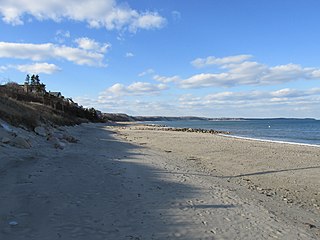
Sagamore Beach is a village on Cape Cod, in the town of Bourne, Massachusetts, United States. The northern half of the Sagamore census-designated place, Sagamore Beach faces Cape Cod Bay, and the Cape Cod Canal courses through it. Along with Buzzards Bay and Bournedale, it is one of three communities that comprise the county of Barnstable.
U.S. Route 6 (US 6) in Massachusetts is a 117.952-mile-long (189.825 km) portion of the cross-country route connecting Providence, Rhode Island, to Fall River, New Bedford, and Cape Cod. In the Fall River and New Bedford areas, US 6 parallels Interstate 195 (I-195). On Cape Cod, US 6 is a highway interconnecting the towns of the area. The freeway section in this area is also known as the Mid-Cape Highway. The highway is also alternatively signed as the "Grand Army of the Republic Highway".

The Claire Saltonstall Bikeway, also known as the Boston to Cape Cod Bikeway, is a 135-mile bikeway marked as Bike Route 1 that starts on the Charles River Bike Path near Boston University in Boston, Massachusetts and winds along Boston's Emerald Necklace, using mostly back roads and bike paths with occasional stretches of secondary highways. It ends in Provincetown, Massachusetts. The bikeway was named on July 17, 1978, in memory of Claire Saltonstall, the daughter of Senator William L. Saltonstall. Claire was killed by an automobile in 1974 while she was riding her bicycle. Senator Saltonstall was a sponsor of bicycle safety legislation and was instrumental in developing the bikeway. Dual signs were erected along the route shortly after the bikeway opened, one with a picture of a bicycle in a green background and the green number 1 below the picture, and another rectangular sign with the words Claire Saltonstall Bikeway below that. Few of the original signs survive today, however, and new signs were erected in the summer of 2018.

Route 147 is a 4.23-mile-long (6.81 km) east–west state highway in Massachusetts, serving the cities of Agawam and West Springfield. Its western terminus is at Mill Street and Springfield Street in Agawam, and its eastern terminus is at U.S. Route 5 in West Springfield. It follows the easternmost few miles of the former route of Route 57 before it was moved onto a freeway a mile south, the Henry E. Bodurtha Highway, completed in 1966.
Several special routes of U.S. Route 6 (US 6) exist. In order from west to east, these special routes are as follows.

